
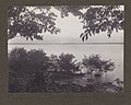
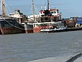
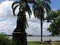
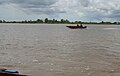
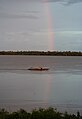
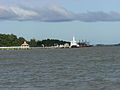
Category:Suriname River
Cymraeg: Afon fawr 480 km o hyd sy'n llifo trwy Suriname yn Ne America yw Afon Suriname. Gorwedd ei tharddleoedd yn Ucheldiroedd Guiana ar y ffin rhwng Mynyddoedd Wilhelmina a Mynyddoedd Eilerts de Haan (lle mae'n cael ei galw y Gran Rio). Llufa'r afon trwy Brokopondo, Berg en Dal, Klaaskreek a Nieuw-Lombé, Jodensavanne, Carolina, Ornamibo a Domburg, cyn cyrraedd y brifddinas Paramaribo a thref Meerzorg. yn Nieuw-Amsterdam mae Afon Commewijne yn ymuno ac yn fuan ar ôl hynny mae'n llifo i'r Cefnfor Iwerydd.
Deutsch: Der Suriname ( Sranan Tongo: Sranan-liba = Suriname-Fluss) ist ein Strom in der Republik Suriname (Südamerika), der durch das Brokopondostuwmeer (Stausee) in zwei Hälften geteilt ist.
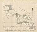
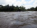
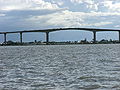
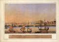
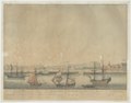
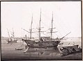
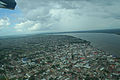
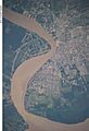
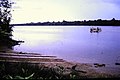
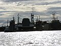
English: The Suriname River is 480 km long and flows through the country of Suriname. Its sources are located in the Guiana Highlands on the border between the Wilhelmina Mountains and the Eilerts de Haan Mountains (where it is known as the Gran Rio). The river flows below the reservoir along Brokopondo, Berg en Dal, the migrant communities Klaaskreek and Nieuw-Lombé, Jodensavanne, Carolina, Ornamibo and Domburg, before reaching the capital Paramaribo on the left bank and Meerzorg on the right bank. At Nieuw-Amsterdam it is joined by the Commewijne and immediately thereafter at the sandspit Braamspunt it flows into the Atlantic Ocean.
Español: El Surinam es un río de Surinam, país al que da nombre. Tiene 480 km de longitud y desemboca en el océano Atlántico en las inmediaciones de Paramaribo, capital del estado.
Français : Le fleuve Suriname est un fleuve de 480 km de long dans le centre et l’est du Suriname. Le fleuve prend sa source sur les hauteurs sous le nom de Gran Rio à la limite entre le massif Wilhelmina et le massif Eilerts de Haan. Le fleuve passe par le lac de retenue le long de Brokopondo, Berg en Dal, les villages de transmigration Klaaskreek et Nieuw-Lombè, Jodensavanne, Carolina, Ornamibo et Domburg, avant de laisser, sur la rive gauche, la capitale Paramaribo et Meerzorg, sur l’autre rive. À Nieuw-Amsterdam s’y joint le fleuve Commewijne et juste après le Suriname arrive dans la bande de sable Braamspunt et se déverse dans l’océan Atlantique.
Galego: O Surinam é un río de América do Sur, que percorre o país homónimo, ao que dá nome, durante 480 km e desembocar finalmente no Océano Atlántico.
Italiano: Il Suriname è un fiume del Suriname lungo 480 km che nasce presso il Juliana Top (1.230 m) e attraversa il paese in direzione da sud a est e sfocia a Paramaribo, dopo aver formato il grande lago artificiale di Brokopondo.
Lietuvių: Surinamas - upė centriniame Suriname. Prasideda Gvianos plokščiakalnyje, Vilhelminos ir Eilerts de Haan kalnų sandūroje. Aukštupyje, kur vadinama Gran Rio, slenkstėta. Teka šiaurės kryptimi. Prateka Bropkopondo tvenkinį. Ties Paramaribu įteka į Atlanto vandenyną. Surinamas - svarbi laivybinė upė, jungianti pakrantę su centriniais šalies rajonais. Gabenami boksitai, aliuminis, maisto produktai. Prie Surinamo upės įsikūrę miestai: Brokopondas, Paramaribas, Naujasis Amsterdamas.
Nederlands: De Suriname of voluit Surinamerivier is een 480 km lange rivier in het centrum en oosten van Suriname. De rivier ontspringt in de hooglanden onder de naam Gran Rio op de grens tussen het Wilhelminagebergte en het Eilerts de Haangebergte. De rivier stroomt beneden het stuwmeer langs Brokopondo, Berg en Dal, de transmigratie dorpen Klaaskreek en Nieuw-Lombé, Jodensavanne, Carolina, Ornamibo en Domburg, alvorens de hoofdstad Paramaribo op de linkeroever en Meerzorg aan de andere oever te passeren. Bij Nieuw-Amsterdam voegt zich de Commewijne bij de Suriname, en direct daarna mondt de Suriname bij de zandtong Braamspunt uit in de Atlantische Oceaan.
Polski: Surinam (w górnym biegu zwana Gran Rio) – rzeka w Surinamie o długości 500 km. Źródła w górach na Wyżynie Gujańskiej. W górnym biegu liczne bystrza i wodospady, w środkowym biegu sztuczny zbiornik Brokopondo. Uchodzi do Oceanu Atlantyckiego. Do miasta Paramaribo zdatna do żeglugi dla statków morskich. Największe mejscowości leżące na jej biegu to: Paramaribo, Nieuw Amsterdam, Brokopondo.
Русский: Река Сурина́м — одна из главных рек государства Суринам. Её исток располагается на Гвианском нагорье рядом с горами Вильгельмина. Длина реки составляет 480 км.
Kiswahili: Mto Surinam ni kati ya mito mikubwa nchini Surinam (Amerika Kusini). Bwawa la Brokopondostuwmeer inagawa mto katika sehemu mbili.
river in Suriname  Afon Swrinam yn Leonsberg, Paramaribo .jpg) | |||||
| Upload media | |||||
| Instance of | |||||
|---|---|---|---|---|---|
| Location | Suriname | ||||
| Length |
| ||||
| Mouth of the watercourse | |||||
| Tributary | |||||
| Lake on watercourse | |||||
 | |||||
Subcategories
This category has the following 5 subcategories, out of 5 total.
Media in category "Suriname River"
The following 200 files are in this category, out of 211 total.
(previous page) (next page)-
-
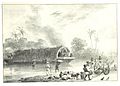
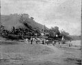
 SR197 (41) Gezicht op de Joden Savane aan de river Suriname.jpg 3,457 × 2,362; 5.7 MB
-
 SR209o (52) Een pont.jpg 2,318 × 1,669; 2.32 MB
-
 SR231u (80) Een indiansch vaartuig uit een stuk vervaardigt.jpg 2,401 × 1,652; 1.9 MB
-
 SR251o (96) Een cano van een vluchtenden neger.jpg 2,338 × 1,713; 2.67 MB
-
 Karte des Flusses Surinam.jpg 2,595 × 4,737; 5.08 MB
-
 Suriname, Rastpause, im oberen Surinam.jpg 1,853 × 1,055; 1.57 MB
-
 Suriname, Tafra Island.jpg 2,599 × 1,409; 2.02 MB
-

-
 Aanlegsteiger bij Koffiekamp, Bestanddeelnr 252-4353.jpg 2,622 × 2,620; 1.1 MB
-
 Afobaka dam II.JPG 3,264 × 2,448; 1.76 MB
-
 Afobaka dam III.JPG 3,264 × 2,448; 1.48 MB
-
 Afobaka dam.JPG 3,264 × 2,448; 938 KB
-
 Barges in Suriname river II (cropped).JPG 2,184 × 1,449; 402 KB
-
 Barges in Suriname river II.JPG 3,264 × 2,448; 900 KB
-
 Barges in Suriname river.JPG 3,264 × 2,448; 992 KB
-
 Boats along the coast of Suriname river.JPG 3,264 × 2,448; 1.29 MB
-
 Bouw kabelbrug over de Surinamerivier, NG-2009-132-16.jpg 4,580 × 3,552; 1.64 MB
-
 Bridge over Suriname river at Afobaka dam.JPG 3,264 × 2,448; 1.81 MB
-
 Broken down bridge over Suriname river between Carolina and Jodensavanne 2.JPG 3,264 × 2,448; 610 KB
-
 Broken down bridge over Suriname river between Carolina and Jodensavanne 3.JPG 3,264 × 2,448; 1.17 MB
-
 Broken down bridge over Suriname river between Carolina and Jodensavanne.JPG 3,264 × 2,448; 1.01 MB
-
 Brug aan de oever van de Surinamerivier, Bestanddeelnr 252-4394.jpg 2,643 × 2,599; 1.04 MB
-
 Canon at Fort Zeelandia.JPG 3,264 × 2,448; 894 KB
-
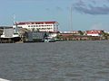
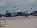
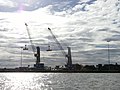 Cranes at Paramaribo harbor.JPG 3,264 × 2,448; 731 KB
-
De Goslar wordt uit de Surinamerivier verwijderd.webm 4 min 42 s, 1,280 × 720; 73.1 MB
-
 Dolfijnen bezichtigen.JPG 2,592 × 1,944; 1.34 MB
-

-

-
 Familie Brouwers op de Surinamerivier, NG-2009-39-80.jpg 6,566 × 2,796; 1.66 MB
-
 Former SDSM wharf II.JPG 3,264 × 2,448; 791 KB
-
 Former SDSM Wharf.JPG 3,264 × 2,448; 1,005 KB
-
 G.P.H. Zimmerman - Kaart van Suriname (1877).jpg 3,501 × 5,500; 1.67 MB
-
 Gezicht op de stad van af de rivier (titel op object), NG-1994-32-29.jpg 8,272 × 4,110; 3.05 MB
-
 Goslar and Paramaribo harbor.jpg 3,072 × 2,304; 759 KB
-
 Goslar I.JPG 3,264 × 2,448; 630 KB
-
 Goslar II.JPG 3,264 × 2,448; 805 KB
-
 Goslar III.JPG 3,264 × 2,448; 785 KB
-
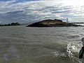 Goslar VII.JPG 3,264 × 2,448; 862 KB
-
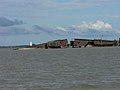
 Goslar wreck.jpg 2,875 × 2,156; 564 KB
-
 Halfsunken boat, Paramaribo.JPG 3,264 × 2,448; 1,018 KB
-
 Hardwood logs transported down Suriname river.jpg 564 × 592; 139 KB
-
 Houtvlot van Marrons op de Surinamerivier, NG-2009-39-15.jpg 6,572 × 2,820; 1.72 MB
-
 Jaw Jaw Rapids (14404472781).jpg 1,024 × 768; 143 KB
-
 Jodensavanna (2719401231).jpg 1,280 × 814; 1.34 MB
-
 Juju charm protecting dugout canoe on Suriname River bank, 1955.jpg 523 × 596; 234 KB
-
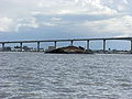
 Jules Wijdenbosch bridge II.JPG 3,264 × 2,448; 794 KB
-
 Jules Wijdenbosch bridge III.JPG 3,264 × 2,448; 708 KB
-
 Jules Wijdenbosch bridge IV.JPG 3,264 × 2,448; 895 KB
-
 Jules Wijdenbosch bridge.JPG 3,264 × 2,448; 928 KB
-
 Kaart van de Rivier de Suriname - door G.P.H. Zimmermann, 1877 - btv1b53242838j.jpg 8,412 × 12,600; 13.56 MB
-

-
 KITLV - 12669 - Bend of the Surinam River in Paramaribo - circa 1899.tif 1,764 × 1,177; 5.96 MB
-
 KITLV - 12683 - Bureau of Police at the Waterkant in Paramaribo - circa 1890.tif 2,395 × 1,824; 12.52 MB
-
-

-

-

-
-

-
 Lokale bevolking bij postboten en korjalen aan de Surinamerivier, RP-F-F01154-AK.jpg 5,950 × 4,362; 2.66 MB
-
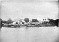
 Louise van Panhuys, haven van Parimaribo, 1816.jpg 1,164 × 780; 224 KB
-
 Louise van Panhuys, Surinamerivier met Engels koopvaardijschip, 1811.jpg 889 × 655; 133 KB
-

-
 Maroon village, Suriname River, 1955.jpg 652 × 444; 147 KB
-
 Motorized Canoe (14229423788).jpg 1,024 × 768; 143 KB
-
 Motorized Canoes (14407018475).jpg 1,024 × 768; 141 KB
-
 Nationale Assemblée, seen from Suriname river.JPG 3,264 × 2,448; 1.03 MB
-
 Nature view with Suriname river in the background - Suriname september 2024.jpg 780 × 1,040; 197 KB
-
 NL-HaNA 2.24.45 4 0022 1-groot.jpg 4,794 × 5,996; 1.86 MB
-

-
 Oranjestraat in Paramaribo en de Surinamerivier, NG-2009-130-2.jpg 4,956 × 3,600; 2.47 MB
-
 Overbridge (2719405019).jpg 1,280 × 814; 1.45 MB
-
 Overbridge (2719405427).jpg 834 × 1,242; 1.27 MB
-
 Overbridge (2719406539).jpg 1,280 × 801; 1.26 MB
-
 Overbridge (2720229460).jpg 1,280 × 781; 1.09 MB
-
 Overzicht Waterkant - 20652548 - RCE.jpg 3,198 × 3,191; 2.29 MB
-
 Paramaribo from the air.jpg 3,456 × 2,304; 4.71 MB
-
 Paramaribo in Suriname, gezien vanaf de boot, Bestanddeelnr 252-2147.jpg 2,640 × 2,587; 637 KB
-
 Paramaribo, Suriname (13905065262).jpg 4,608 × 3,456; 9.28 MB
-
 Paramaribo, Suriname (satellite view).jpg 2,048 × 1,280; 759 KB
-
 Paramaribo, Suriname.JPG 438 × 640; 84 KB
-
 Paramaribo, view from Suriname river.JPG 3,264 × 2,448; 948 KB
-
 Plantagewoning, galerij, gezicht op Surinamerivier - 20651954 - RCE.jpg 3,163 × 3,187; 1.09 MB
-
 Presidential palace seen from Suriname river.JPG 3,264 × 2,448; 810 KB
-
 Riviergezicht, NG-2009-127-9.jpg 2,886 × 2,312; 917 KB
-
 Saramacca (ship, 1982), 2022, 1.jpg 4,000 × 3,000; 2.53 MB
-
 Saramacca (ship, 1982), 2022, 2.jpg 4,000 × 3,000; 1.8 MB
-
 Ship in Suriname river in paramaribo.JPG 3,264 × 2,448; 893 KB
-
 Ships at Suriname river in Paramaribo.JPG 3,264 × 2,448; 884 KB
-
 Ships in Paramaribo Harbor.JPG 3,264 × 2,448; 928 KB
-
 Small boats on Suriname River.jpg 2,272 × 1,704; 693 KB
-
 Statue of Queen Wilhelmina and Suriname river.JPG 3,264 × 2,448; 1.17 MB
-
 Steps leading to Suriname river.JPG 3,264 × 2,448; 1.12 MB
-
 Suriname 2008 Carolina1.jpg 2,592 × 1,944; 488 KB
-
 Suriname and French Guiana captured by Envisat ESA208295.jpg 1,105 × 1,105; 381 KB
-
 Suriname and French Guiana captured by Envisat ESA208295.tiff 1,105 × 1,105; 3.14 MB
-
 Suriname River (2719236059).jpg 1,280 × 815; 1.22 MB
-
 Suriname River (2719988100).jpg 1,280 × 810; 1.11 MB
-
 Suriname River (2720059162).jpg 853 × 1,240; 962 KB
-
 Suriname River (32694060174).jpg 3,549 × 1,995; 1.12 MB
-
 Suriname River at Atlantic Ocean.jpg 4,258 × 4,261; 6.17 MB
-
 Suriname river at Berg en Dal.JPG 3,264 × 2,448; 677 KB
-
 Suriname river early in the morning.jpg 4,608 × 3,456; 2.84 MB
-
 Suriname river from the south.JPG 3,264 × 2,448; 734 KB
-
 Suriname river near Afobaka dam.JPG 3,264 × 2,448; 1.87 MB
-
 Suriname river near Babunhol.jpg 4,608 × 3,456; 2.74 MB
-
 Suriname river near Bergendal (33408953271).jpg 4,896 × 2,752; 2.35 MB
-
 Suriname River Nieuw Aurora Sipaliwini (32723202623).jpg 4,896 × 2,752; 2.04 MB
-
 Suriname river seen from Fort Zeelandia.JPG 3,264 × 2,448; 1.19 MB
-
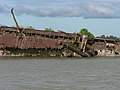
 Suriname river with Goslar wreck and Wijdenbosch bridge.JPG 3,264 × 2,448; 939 KB
-
 Suriname river with Paramaribo harbor and wreck of Goslar.JPG 3,264 × 2,448; 870 KB
-
 Suriname River.jpg 3,456 × 2,304; 4 MB
-
 Suriname rivier en het oerwoud bij Aurora.JPG 3,292 × 1,624; 782 KB
-

-

-
 SURINAME Rivier.jpg 2,560 × 1,440; 308 KB
-
 Surinamerivier, NG-2009-36-4.jpg 3,922 × 5,572; 3.11 MB
-
 Surinamerivier, NG-2009-36-5.jpg 3,946 × 5,694; 2.85 MB
-
 Theodoor Brouwers op de Surinamerivier, NG-2009-39-43.jpg 6,662 × 2,840; 1.46 MB
-

-

-

-

-

-

-

-

-
-

-

-

-
-
-

-

-

-

-

-

-
-

-
-

-
-

-

-
-

-

-
-

-
-

-

-

-

-
-

-

-

-

-
-

-

-

-
-

-
-

-

-
-
-

-
-
-

-
-

-

-

-
-

-

-
-
-
-

-
-

-
-

-
 Uitzicht over zee vanaf Fort Zeelandia in Paramaribo, Bestanddeelnr 252-6105.jpg 2,619 × 2,536; 1.21 MB
-
 Upper Suriname River (14245407318).jpg 1,024 × 768; 137 KB
-
 Upper Suriname River, Suriname (12076185395).jpg 4,592 × 3,448; 2.08 MB
-
 Upper Suriname River, Suriname (12077009236).jpg 4,042 × 3,035; 1.98 MB
-
 Upper Suriname River, Suriname (12077871503).jpg 3,000 × 4,496; 1.42 MB
-
 Upper-Suriname river (33496731746).jpg 4,792 × 2,694; 1.87 MB
-
 Veerverbinding Suriname rivier.jpg 1,086 × 723; 230 KB
-
 View at ships in Paramaribo harbor.JPG 3,264 × 2,448; 810 KB
.jpg)
_Gezicht_op_de_Joden_Savane_aan_de_river_Suriname.jpg)
_Een_pont.jpg)
_Een_indiansch_vaartuig_uit_een_stuk_vervaardigt.jpg)
_Een_cano_van_een_vluchtenden_neger.jpg)


.JPG)


,_NG-1994-32-29.jpg)


.jpg)
.jpg)


.jpg)
.jpg)


.jpg)
.jpg)
.jpg)
.jpg)


.jpg)
.jpg)


,_2022,_1.jpg)
,_2022,_2.jpg)


.jpg)
.jpg)
.jpg)
.jpg)


.jpg)
.jpg)


_aan_de_Suri.jpg)


.jpg)
.jpg)
.jpg)
.jpg)
.jpg)

