Category:Streets in Winchester
Jump to navigation
Jump to search
Subcategories
This category has the following 64 subcategories, out of 64 total.
A
- Airlie Lane, Winchester (1 F)
- Airlie Road, Winchester (10 F)
B
C
- Canon Street, Winchester (28 F)
- College Walk, Winchester (5 F)
- Cromwell Road, Winchester (24 F)
E
- Eastgate Street, Winchester (15 F)
G
H
J
K
- Kingsgate Road, Winchester (10 F)
L
M
- Market Lane, Winchester (7 F)
- Marston Gate, Winchester (4 F)
- Minster Lane, Winchester (9 F)
N
P
S
- St Thomas Street, Winchester (36 F)
- Sparkford Road, Winchester (13 F)
- Swan Lane, Winchester (6 F)
T
U
W
- Water Lane, Winchester (15 F)
Media in category "Streets in Winchester"
The following 200 files are in this category, out of 263 total.
(previous page) (next page)-
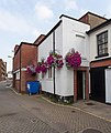
A colourful welcome - geograph.org.uk - 1530475.jpg 640 × 480; 81 KB
-
A white house in Hyde Abbey Road - geograph.org.uk - 1167627.jpg 480 × 640; 55 KB
-
Abbott's Barton, Winchester - geograph.org.uk - 27802.jpg 640 × 480; 87 KB
-
Access road off Barfield Close - geograph.org.uk - 879457.jpg 640 × 427; 116 KB
-
Albion Place - geograph.org.uk - 1530388.jpg 640 × 480; 83 KB
-
Alexandra Terrace - geograph.org.uk - 1164675.jpg 480 × 640; 57 KB
-
Alison Way - geograph.org.uk - 760863.jpg 640 × 480; 55 KB
-
An odd combination - geograph.org.uk - 1530327.jpg 640 × 480; 78 KB
-
Approaching a bend in Christchurch Road - geograph.org.uk - 2101856.jpg 640 × 480; 110 KB
-
Archway, The Broadway, Winchester - geograph.org.uk - 4435004.jpg 640 × 476; 180 KB
-
Argyll Court, St Cross Road - geograph.org.uk - 946195.jpg 559 × 640; 201 KB
-
Autumn in Sleepers Hill - geograph.org.uk - 1548539.jpg 480 × 640; 114 KB
-
Autumn in Sparkford Close - geograph.org.uk - 1548492.jpg 640 × 480; 91 KB
-
Avalon House, Chesil Street - geograph.org.uk - 4488381.jpg 640 × 427; 154 KB
-
Badger Farm Road (A3090) - geograph.org.uk - 1233726.jpg 450 × 640; 138 KB
-
Badger Farm Road - geograph.org.uk - 929628.jpg 640 × 455; 91 KB
-
Bar End Park and Ride phase 2, Winchester - geograph.org.uk - 879696.jpg 640 × 427; 137 KB
-
Barfield Close, Winchester - geograph.org.uk - 879476.jpg 640 × 427; 125 KB
-
Barnes Close, Winchester - geograph.org.uk - 4186499.jpg 800 × 600; 154 KB
-
Bartholomew Close, Hyde - geograph.org.uk - 1327332.jpg 428 × 640; 136 KB
-
Battery Hill in Winchester - geograph.org.uk - 1884798.jpg 1,500 × 1,000; 127 KB
-
Battery Hill, Stanmore,Winchester - geograph.org.uk - 66491.jpg 640 × 480; 40 KB
-
Beales in Winchester City Centre - geograph.org.uk - 1165716.jpg 640 × 480; 63 KB
-
Beaufort Road, Winchester - geograph.org.uk - 4187717.jpg 800 × 561; 179 KB
-
Beggars Lane, Winchester - geograph.org.uk - 4260596.jpg 717 × 800; 180 KB
-
Bend in Barfield Close, Winchester - geograph.org.uk - 879483.jpg 640 × 427; 121 KB
-
Bend in Chilbolton Avenue - geograph.org.uk - 3670812.jpg 640 × 447; 92 KB
-
Bend in Gordon Road - geograph.org.uk - 1167604.jpg 640 × 480; 65 KB
-
Brooks Centre Car Park Entrance - geograph.org.uk - 1194680.jpg 640 × 427; 94 KB
-
Burnett Close joins Stockbridge Road - geograph.org.uk - 3116188.jpg 640 × 427; 123 KB
-
Bus in Gladstone Street - geograph.org.uk - 2102126.jpg 640 × 480; 89 KB
-
Bus stop in The Valley - geograph.org.uk - 1549686.jpg 640 × 480; 55 KB
-
Chilbolton Avenue, Winchester - geograph.org.uk - 66486.jpg 640 × 480; 123 KB
-
Children Welcoming Home Hampshire Troops MOD 45149870.jpg 3,609 × 2,549; 4.93 MB
-
Children Welcoming Home Hampshire Troops MOD 45149871.jpg 4,224 × 2,660; 6.4 MB
-
Christchurch Road, Winchester - geograph.org.uk - 4186477.jpg 800 × 516; 150 KB
-
Clifton Hill - geograph.org.uk - 760850.jpg 640 × 480; 75 KB
-
Cripstead Lane - geograph.org.uk - 1227656.jpg 640 × 427; 225 KB
-
Cromwell Road, Stanmore, Winchester - geograph.org.uk - 4186203.jpg 800 × 617; 200 KB
-
Cross Keys Passage - geograph.org.uk - 4173327.jpg 537 × 640; 163 KB
-
Cross Keys Passage - geograph.org.uk - 4173332.jpg 427 × 640; 160 KB
-
Cross Keys Passage, Winchester - geograph.org.uk - 4389473.jpg 800 × 749; 172 KB
-
Cross Street - geograph.org.uk - 1162732.jpg 640 × 470; 65 KB
-
Crossroads on B3330, Winchester - geograph.org.uk - 879533.jpg 640 × 427; 130 KB
-
Crowder Terrace - geograph.org.uk - 760778.jpg 640 × 480; 66 KB
-
Culver Road - geograph.org.uk - 1164899.jpg 480 × 640; 52 KB
-
Cut through to the High Street - geograph.org.uk - 1162795.jpg 640 × 477; 77 KB
-
Cycling along Norman Road, Winchester - geograph.org.uk - 4186602.jpg 640 × 504; 100 KB
-
Domum Road, Winchester - geograph.org.uk - 1316474.jpg 640 × 480; 85 KB
-
Durngate Terrace, Winchester - geograph.org.uk - 1020504.jpg 640 × 425; 108 KB
-
East side of St Peter Street, Winchester - geograph.org.uk - 4303936.jpg 731 × 800; 128 KB
-
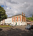
Eastgate House and roundabout, Winchester - geograph.org.uk - 869949.jpg 597 × 640; 148 KB
-
Edgar Road houses in Winchester - geograph.org.uk - 4185312.jpg 800 × 652; 162 KB
-
End of Sparkford Close - geograph.org.uk - 1548497.jpg 640 × 480; 76 KB
-
Entrance, Chantacre Business Park - geograph.org.uk - 4340612.jpg 640 × 480; 109 KB
-
Fiona Close - geograph.org.uk - 3626169.jpg 640 × 427; 84 KB
-
Friarsgate crosses Middle Brook Street - geograph.org.uk - 4176559.jpg 640 × 427; 221 KB
-
Friary Gardens - geograph.org.uk - 1548416.jpg 480 × 640; 54 KB
-
Fromond Road - geograph.org.uk - 4061668.jpg 640 × 427; 75 KB
-
Gates in Gordon Road - geograph.org.uk - 1167623.jpg 640 × 480; 56 KB
-
Gladstone Street - geograph.org.uk - 760875.jpg 640 × 480; 58 KB
-
Green Jacket Close, Stanmore, Winchester - geograph.org.uk - 4186217.jpg 800 × 524; 128 KB
-
Hillier Way, Abbotts Barton - geograph.org.uk - 982297.jpg 640 × 455; 115 KB
-
Houses - Winchester - geograph.org.uk - 921634.jpg 640 × 480; 81 KB
-
Hyde Abbey Road - geograph.org.uk - 1167594.jpg 640 × 480; 65 KB
-
Hyde Abbey Road, Winchester - geograph.org.uk - 980237.jpg 640 × 443; 103 KB
-
Hyde Close, Winchester - geograph.org.uk - 1326774.jpg 640 × 428; 119 KB
-
King Alfred Place, Hyde - geograph.org.uk - 1330650.jpg 640 × 480; 99 KB
-
Kings Avenue, Stanmore, Winchester - geograph.org.uk - 4186220.jpg 800 × 616; 136 KB
-
Kings Road, Winchester - geograph.org.uk - 864893.jpg 640 × 427; 128 KB
-
Layby on the A31 near Chilcomb - geograph.org.uk - 4166509.jpg 640 × 480; 308 KB
-
Little Minster Street - geograph.org.uk - 3852902.jpg 1,024 × 680; 201 KB
-
Little Minster Street, Winchester - geograph.org.uk - 3754651.jpg 4,000 × 2,666; 7.45 MB
-
Looking along Barf End Road, Winchester - geograph.org.uk - 879591.jpg 533 × 640; 118 KB
-
Looking down Chilbolton Avenue - geograph.org.uk - 3378640.jpg 800 × 531; 107 KB
-
Looking down Stanmore Lane, Winchester - geograph.org.uk - 864985.jpg 640 × 427; 107 KB
-
Looking down Stockbridge Road - geograph.org.uk - 3413604.jpg 640 × 425; 72 KB
-
Looking down Sussex Street - geograph.org.uk - 3856787.jpg 800 × 532; 188 KB
-
Looking down Teg Down Meads - geograph.org.uk - 3184386.jpg 640 × 427; 148 KB
-
Looking down Teg Down Meads - geograph.org.uk - 3184403.jpg 640 × 427; 132 KB
-
Looking down Teg Down Meads - geograph.org.uk - 3184517.jpg 640 × 427; 134 KB
-
Looking down Teg Down Meads - geograph.org.uk - 3184532.jpg 640 × 427; 123 KB
-
Looking eastwards in Norman Road - geograph.org.uk - 2094746.jpg 640 × 480; 57 KB
-
Looking north up Crowder Terrace - geograph.org.uk - 760847.jpg 640 × 480; 74 KB
-
Looking south on Bereweeke Avenue - geograph.org.uk - 3385331.jpg 800 × 600; 111 KB
-
Looking southwards down Edgar Road - geograph.org.uk - 2094780.jpg 480 × 640; 63 KB
-
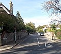
Looking southwards down Kingsgate Road - geograph.org.uk - 2094815.jpg 640 × 480; 100 KB
-
Looking up Battery Hill, Winchester - geograph.org.uk - 864899.jpg 427 × 640; 93 KB
-
Looking up Clifton Road - geograph.org.uk - 760773.jpg 640 × 480; 94 KB
-
Looking up East Hill, Winchester - geograph.org.uk - 879541.jpg 427 × 640; 164 KB
-
Looking up Stanmore Lane - geograph.org.uk - 3183490.jpg 640 × 427; 184 KB
-
Looking up Stanmore Lane, Winchester - geograph.org.uk - 864953.jpg 427 × 640; 107 KB
-
Looking up Stanmore Lane, Winchester - geograph.org.uk - 864967.jpg 508 × 640; 126 KB
-
Looking up Stanmore Lane, Winchester - geograph.org.uk - 864978.jpg 640 × 427; 134 KB
-
Looking up Teg Down Meads - geograph.org.uk - 3184401.jpg 640 × 427; 122 KB
-
Looking up Teg Down Meads - geograph.org.uk - 3184506.jpg 640 × 427; 163 KB
-
Looking up Teg Down Meads - geograph.org.uk - 3184526.jpg 640 × 427; 124 KB
-
Looking west along Stoney Lane - geograph.org.uk - 3385328.jpg 800 × 600; 152 KB
-
Lower Brook Street - geograph.org.uk - 1970611.jpg 2,560 × 1,920; 1.12 MB
-
Lower part of Teg down Meads - geograph.org.uk - 3184398.jpg 640 × 427; 177 KB
-
Matilda Place in Gordon Road - geograph.org.uk - 1167606.jpg 640 × 480; 80 KB
-
Mews Lane - geograph.org.uk - 760844.jpg 640 × 480; 66 KB
-
Mid section of Gordon Road - geograph.org.uk - 1167601.jpg 640 × 480; 94 KB
-
Mid section of Norman Road - geograph.org.uk - 2094756.jpg 640 × 480; 84 KB
-
Middle Brook Street - geograph.org.uk - 4173374.jpg 626 × 640; 200 KB
-
Middle Brook Street - geograph.org.uk - 4173376.jpg 607 × 640; 225 KB
-
Middle Brook Street - geograph.org.uk - 4176541.jpg 427 × 640; 137 KB
-
Middle Brook Street - geograph.org.uk - 4176546.jpg 640 × 427; 195 KB
-
Milky ghosts on a Winchester corner - geograph.org.uk - 4299537.jpg 800 × 753; 144 KB
-
Milland Road, Winchester - geograph.org.uk - 879502.jpg 640 × 427; 112 KB
-
Mini-roundabout on Station Hill - geograph.org.uk - 1167752.jpg 640 × 480; 74 KB
-
Modern style bus shelters - geograph.org.uk - 1530465.jpg 640 × 480; 100 KB
-
Monks Road, Hyde - geograph.org.uk - 1326903.jpg 640 × 428; 104 KB
-
Nickel Close, Winnall - geograph.org.uk - 1020395.jpg 640 × 455; 107 KB
-
Norman Road, Winchester - geograph.org.uk - 4186594.jpg 800 × 589; 160 KB
-
North along St Peter Street Winchester - geograph.org.uk - 4303937.jpg 800 × 696; 159 KB
-
Northern end of St James Terrace - geograph.org.uk - 760780.jpg 640 × 480; 125 KB
-
Northward view along Barfield Close, Winchester (June 2019).JPG 3,000 × 2,000; 2.57 MB
-
Northward view along Christchurch Road, Winchester (June 2019).JPG 2,000 × 2,800; 2.64 MB
-
Oliver's Battery Road North - geograph.org.uk - 929640.jpg 640 × 455; 87 KB
-
Parchment Street - geograph.org.uk - 4173534.jpg 640 × 629; 212 KB
-
Parchment Street, Winchester - geograph.org.uk - 4309827.jpg 800 × 600; 144 KB
-
Paternoster House - geograph.org.uk - 1546369.jpg 640 × 480; 99 KB
-
Peninsula Road - geograph.org.uk - 1548457.jpg 640 × 480; 58 KB
-
Postbox in Gordon Road - geograph.org.uk - 1167607.jpg 640 × 440; 77 KB
-
Ranelagh Road railway bridge, Winchester - geograph.org.uk - 4185332.jpg 800 × 690; 237 KB
-
Ranelagh Road, Winchester - geograph.org.uk - 4185305.jpg 800 × 715; 171 KB
-
Rear entrances to shops in King's Walk - geograph.org.uk - 4176584.jpg 640 × 427; 137 KB
-
Richard Moss House, Winchester - geograph.org.uk - 4299428.jpg 577 × 800; 110 KB
-
Romans Road, Winchester - geograph.org.uk - 4187726.jpg 800 × 643; 192 KB
-
Romsey Road, Winchester - geograph.org.uk - 3020852.jpg 1,600 × 1,200; 582 KB
-
Silver Hill, Winchester - geograph.org.uk - 4389444.jpg 800 × 600; 152 KB


