Category:Streets in Scotland
Jump to navigation
Jump to search
Wikimedia category | |||||
| Upload media | |||||
| Instance of | |||||
|---|---|---|---|---|---|
| Category combines topics | |||||
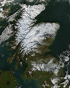
| Scotland | |||||
country in north-west Europe, part of the United Kingdom | |||||
| Instance of | |||||
| Part of | |||||
| Patron saint | |||||
| Location |
| ||||
| Capital | |||||
| Legislative body | |||||
| Executive body | |||||
| Official language | |||||
| Anthem |
| ||||
| Currency | |||||
| Head of state | |||||
| Head of government |
| ||||
| Highest point |
| ||||
| Population |
| ||||
| Area |
| ||||
| Replaces | |||||
| Top-level Internet domain |
| ||||
| Different from | |||||
| Partially coincident with |
| ||||
| official website | |||||
 | |||||
Constituent countries of the United Kingdom: England · Northern Ireland · Scotland · Wales – British Crown dependencies: Guernsey · Isle of Man · Jersey
British overseas territories: Bermuda · British Virgin Islands · Falkland Islands · Gibraltar · Montserrat
British overseas territories: Bermuda · British Virgin Islands · Falkland Islands · Gibraltar · Montserrat
Subcategories
This category has the following 39 subcategories, out of 39 total.
Media in category "Streets in Scotland"
The following 143 files are in this category, out of 143 total.
-
"Old" Currie - geograph.org.uk - 33413.jpg 640 × 480; 58 KB
-
'The Street' at Rora - geograph.org.uk - 351077.jpg 640 × 480; 76 KB
-
A Belhaven street - geograph.org.uk - 683644.jpg 640 × 480; 59 KB
-
A Multiplicity of Nelsons - geograph.org.uk - 1160913.jpg 640 × 427; 253 KB
-
Albion House Thornhill - panoramio.jpg 2,257 × 1,580; 486 KB
-
Aldour in Pitlochry.jpg 4,160 × 2,340; 4.15 MB
-
Arnprior - geograph.org.uk - 201931.jpg 640 × 480; 266 KB
-
Broad Street, Kirkwall - geograph.org.uk - 1446522.jpg 640 × 428; 93 KB
-
Bruce Street, Annan - geograph.org.uk - 1452567.jpg 640 × 480; 77 KB
-
Century Mag Ecclefechan.png 852 × 825; 613 KB
-
Chapel Street, Moffat. - geograph.org.uk - 1506910.jpg 480 × 640; 66 KB
-
Chapel Street, Moffat. - geograph.org.uk - 1506917.jpg 480 × 640; 58 KB
-
Charlestown - geograph.org.uk - 171188.jpg 640 × 480; 81 KB
-
Church Street - geograph.org.uk - 483660.jpg 640 × 427; 255 KB
-
Church Street - geograph.org.uk - 483666.jpg 640 × 427; 255 KB
-
County Hotel, Stornoway - geograph.org.uk - 2626523.jpg 2,560 × 1,920; 1.94 MB
-
Crosshill War Memorial - geograph.org.uk - 250280.jpg 640 × 466; 102 KB
-
Culross - geograph.org.uk - 1419749.jpg 640 × 480; 81 KB
-
Dalhowan Street, Crosshill - geograph.org.uk - 250301.jpg 640 × 480; 120 KB
-
East Church Street - geograph.org.uk - 483733.jpg 640 × 427; 256 KB
-
Falkland - geograph.org.uk - 97764.jpg 640 × 480; 82 KB
-
Fallin - Stirling Road.JPG 3,888 × 2,592; 4.56 MB
-
Flip side of the Alien Cow - geograph.org.uk - 178679.jpg 640 × 480; 80 KB
-
Fountain, Market St - geograph.org.uk - 392471.jpg 640 × 445; 107 KB
-
Francis Street, Stornoway - geograph.org.uk - 562641.jpg 545 × 640; 288 KB
-
Francis Street, Stornoway - geograph.org.uk - 927259.jpg 640 × 480; 66 KB
-
From Fassifern Road - geograph.org.uk - 185187.jpg 640 × 480; 117 KB
-
Front Road, St Margaret's Hope - geograph.org.uk - 488852.jpg 640 × 480; 100 KB
-
Gala Day - geograph.org.uk - 189140.jpg 640 × 480; 132 KB
-
Gifford, East Lothian, Scotland 1972.jpg 4,176 × 2,227; 6.43 MB
-
Girvan, Dalrymple Street, Mckechnie Institute And Reading Rooms.jpg 3,024 × 4,032; 4.14 MB
-
Grantown on Spey - geograph.org.uk - 11636.jpg 640 × 480; 84 KB
-
Grantown on Spey High Street - geograph.org.uk - 776220.jpg 640 × 359; 59 KB
-
Guardbridge - geograph.org.uk - 136863.jpg 640 × 480; 329 KB
-
Hazelrigg Avenue, Dumfries - geograph.org.uk - 397486.jpg 640 × 480; 89 KB
-
Henderson Street, Bridge of Allan - geograph.org.uk - 352339.jpg 640 × 480; 147 KB
-
High Street - geograph.org.uk - 464380.jpg 640 × 480; 73 KB
-
High Street Kirkcudbright - geograph.org.uk - 600156.jpg 640 × 480; 36 KB
-
Keith - geograph.org.uk - 523482.jpg 640 × 480; 76 KB
-
Khyber Pass, Stromness - geograph.org.uk - 14733.jpg 480 × 640; 81 KB
-
Kincardine - geograph.org.uk - 685557.jpg 480 × 640; 70 KB
-
Kinnedar Street , Lossiemouth - geograph.org.uk - 659296.jpg 640 × 480; 90 KB
-
Kinross High Street. - geograph.org.uk - 92123.jpg 640 × 480; 104 KB
-
Kirkhill Higland.jpg 640 × 480; 89 KB
-
Kirkmichael Road, Crosshill - geograph.org.uk - 250289.jpg 640 × 457; 116 KB
-
Land Street - geograph.org.uk - 394771.jpg 640 × 356; 194 KB
-
Land Street - geograph.org.uk - 394782.jpg 640 × 395; 215 KB
-
Lhanbryde - geograph.org.uk - 389307.jpg 640 × 380; 218 KB
-
M&Co, Cromwell Street - geograph.org.uk - 1826013.jpg 640 × 480; 95 KB
-
Main Street Campbeltown - geograph.org.uk - 429867.jpg 551 × 640; 92 KB
-
Main street Castlebay, looking west - geograph.org.uk - 557639.jpg 640 × 480; 81 KB
-
Main Street in Portmahomack - geograph.org.uk - 502434.jpg 640 × 480; 62 KB
-
Main Street Newmill - geograph.org.uk - 657273.jpg 640 × 480; 81 KB
-
Main Street Newmill - geograph.org.uk - 659494.jpg 640 × 480; 84 KB
-
Main Street Newmill - geograph.org.uk - 659501.jpg 640 × 480; 76 KB
-
Main Street, Dalry - geograph.org.uk - 463456.jpg 640 × 480; 75 KB
-
Main Street, Kirkwall - geograph.org.uk - 523087.jpg 433 × 640; 47 KB
-
Main Street, Leuchars - geograph.org.uk - 355751.jpg 640 × 424; 78 KB
-
Main Street, Newmill - geograph.org.uk - 315432.jpg 640 × 358; 187 KB
-
Main Street, Newmill - geograph.org.uk - 315442.jpg 640 × 346; 181 KB
-
Mansfield Road - geograph.org.uk - 601958.jpg 640 × 480; 91 KB
-
Maxwell Street - geograph.org.uk - 332231.jpg 640 × 413; 230 KB
-
Mid Street - geograph.org.uk - 394743.jpg 640 × 427; 248 KB
-
New Abbey - Main Street - geograph.org.uk - 663190.jpg 640 × 480; 73 KB
-
North Castle Street - geograph.org.uk - 1471167.jpg 464 × 617; 91 KB
-
Oldmeldrum residential street.jpg 640 × 439; 59 KB
-
Pipe band - geograph.org.uk - 283981.jpg 640 × 480; 118 KB
-
Pipe band in Albert St, Kirkwall - geograph.org.uk - 283982.jpg 640 × 480; 108 KB
-
Point Street - geograph.org.uk - 574619.jpg 640 × 480; 74 KB
-
Pub and Post Office at Tayinloan. - geograph.org.uk - 138826.jpg 640 × 480; 54 KB
-
Public path signs.jpg 1,024 × 768; 360 KB
-
Queen Street , Lossiemouth - geograph.org.uk - 659283.jpg 640 × 480; 84 KB
-
Reek - geograph.org.uk - 244370.jpg 428 × 640; 50 KB
-
Restaurant Castle Street - geograph.org.uk - 1465465.jpg 640 × 425; 68 KB
-
Rosebank.jpg 2,352 × 1,568; 1.13 MB
-
Sandend - geograph.org.uk - 378010.jpg 640 × 359; 180 KB
-
Scotland Street - geograph.org.uk - 1313420.jpg 640 × 429; 88 KB
-
Scotland Street, Stornoway - geograph.org.uk - 927230.jpg 640 × 480; 71 KB
-
Seaview Terrace, St Abbs - geograph.org.uk - 371188.jpg 480 × 640; 77 KB
-
Shawhead - geograph.org.uk - 383446.jpg 640 × 463; 101 KB
-
Snow scene - pedestrians only - geograph.org.uk - 136698.jpg 640 × 480; 108 KB
-
St Andrews Road, Lhanbryde - geograph.org.uk - 389302.jpg 640 × 366; 226 KB
-
Station Brae Lochgelly - geograph.org.uk - 161777.jpg 640 × 480; 93 KB
-
Street in Arbroath.jpg 1,256 × 1,644; 1.64 MB
-
Summer in Duffus.jpg 1,536 × 2,048; 252 KB
-
Tenements, Leith - geograph.org.uk - 6108.jpg 640 × 480; 113 KB
-
The Carrick Gazette - geograph.org.uk - 682634.jpg 640 × 477; 87 KB
-
The Drummond Arms, Crieff - geograph.org.uk - 435565.jpg 640 × 491; 95 KB
-
The Drummond Arms, Crieff - geograph.org.uk - 776646.jpg 640 × 480; 69 KB
-
The entrance to Culduthel park - geograph.org.uk - 354802.jpg 640 × 480; 108 KB
-
The Main Street, Gifford - geograph.org.uk - 472455.jpg 640 × 480; 71 KB
-
The Provost of Ceres - geograph.org.uk - 165870.jpg 426 × 640; 276 KB
-
Thornhill - geograph.org.uk - 376817.jpg 640 × 470; 102 KB
-
Village Street, New Abbey - geograph.org.uk - 397710.jpg 640 × 480; 111 KB
-
Wellmeadow, Blairgowrie - geograph.org.uk - 687569.jpg 640 × 426; 86 KB
-
West Barns - Dunbar - geograph.org.uk - 713338.jpg 640 × 480; 73 KB
-
Westburn Lane - geograph.org.uk - 1040497.jpg 640 × 426; 68 KB
-
Western Outskirts of Dervaig - geograph.org.uk - 183473.jpg 640 × 480; 101 KB
-
Whifflet - geograph.org.uk - 3572524.jpg 640 × 480; 76 KB
-
Wick, Bridge Street - geograph.org.uk - 245228.jpg 285 × 432; 16 KB
-
A view of Longniddry - geograph.org.uk - 817832.jpg 640 × 480; 84 KB
-
Arran Mall - geograph.org.uk - 1020610.jpg 640 × 468; 106 KB
-
Ayres Wynd - geograph.org.uk - 527551.jpg 640 × 480; 71 KB
-
Bayhead - geograph.org.uk - 574623.jpg 640 × 480; 65 KB
-
Bridge Street, East Linton - geograph.org.uk - 462100.jpg 640 × 480; 130 KB
-
Bungalowland - geograph.org.uk - 244262.jpg 640 × 480; 124 KB
-
Cafe Ballantrae - geograph.org.uk - 471093.jpg 640 × 472; 90 KB
-
Callanish Village - geograph.org.uk - 540505.jpg 640 × 410; 245 KB
-
Crown Hotel, Bridge Street, East Linton - geograph.org.uk - 462054.jpg 640 × 480; 121 KB
-
East Linton - geograph.org.uk - 697477.jpg 640 × 480; 63 KB
-
East Linton - geograph.org.uk - 713376.jpg 640 × 480; 83 KB
-
East Linton High Street - geograph.org.uk - 628967.jpg 640 × 427; 57 KB
-
Edinburgh Road - geograph.org.uk - 751635.jpg 640 × 480; 62 KB
-
Gullane - geograph.org.uk - 12791.jpg 640 × 480; 87 KB
-
Heavy traffic in Whitehall - geograph.org.uk - 241340.jpg 640 × 477; 149 KB
-
High Street, Dunbar - geograph.org.uk - 685243.jpg 640 × 480; 83 KB
-
High Street, East Linton - geograph.org.uk - 462043.jpg 640 × 480; 114 KB
-
King Street, Crosshill - geograph.org.uk - 683531.jpg 640 × 472; 55 KB
-
Kirkpatrick Street, Girvan - geograph.org.uk - 682612.jpg 640 × 467; 61 KB
-
Langriggs Haddington - geograph.org.uk - 597990.jpg 640 × 480; 89 KB
-
Leslie's Close - geograph.org.uk - 487795.jpg 480 × 640; 89 KB
-
Looking Down John Knox Street - geograph.org.uk - 241370.jpg 640 × 480; 137 KB
-
Main Street, Straiton - geograph.org.uk - 402106.jpg 640 × 480; 72 KB
-
Maybole High Street - geograph.org.uk - 241365.jpg 640 × 489; 140 KB
-
Maybole town - geograph.org.uk - 557445.jpg 640 × 480; 43 KB
-
Musselburgh High Street, East Lothian - geograph.org.uk - 659849.jpg 640 × 480; 60 KB
-
Pier Head and John Street - geograph.org.uk - 358254.jpg 640 × 480; 100 KB
-
Queensferry - geograph.org.uk - 15541.jpg 640 × 480; 74 KB
-
Red Brae, Maybole - geograph.org.uk - 241408.jpg 640 × 484; 127 KB
-
Shawbost Village - geograph.org.uk - 206722.jpg 640 × 480; 85 KB
-
Victoria Street, Stromness - geograph.org.uk - 358217.jpg 640 × 480; 122 KB
-
Victoria Street, Stromness - geograph.org.uk - 358238.jpg 640 × 480; 114 KB
-
Whitehall, Maybole - geograph.org.uk - 241336.jpg 640 × 470; 139 KB


