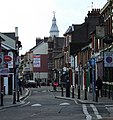
Category:Streets in Luton
Jump to navigation
Jump to search
Media in category "Streets in Luton"
The following 93 files are in this category, out of 93 total.
-
Airport Way - geograph.org.uk - 571979.jpg 640 × 480; 93 KB
-
Airport Way - geograph.org.uk - 571981.jpg 640 × 480; 84 KB
-
Brunel Road - geograph.org.uk - 483661.jpg 640 × 480; 48 KB
-
BuryPark.jpg 640 × 480; 90 KB
-
Bute Street Luton South 2023 (1).jpg 4,000 × 3,000; 1.39 MB
-
Bute Street Luton South 2023 (2).jpg 4,000 × 3,000; 1.18 MB
-
Capability green.jpg 640 × 480; 78 KB
-
Castle Street - geograph.org.uk - 944835.jpg 640 × 480; 93 KB
-
Chapel Viaduct (A505) & Days Hotel, Luton, England, 9 April 2009.jpg 3,264 × 2,448; 2.69 MB
-
Chaul End Lane Looking NW - geograph.org.uk - 402088.jpg 640 × 480; 123 KB
-
Chaul End Lane Looking SE - geograph.org.uk - 402096.jpg 640 × 480; 123 KB
-
Church Street - geograph.org.uk - 1076947.jpg 640 × 503; 66 KB
-
Elevated roadways - geograph.org.uk - 595658.jpg 640 × 480; 67 KB
-
Footbridge over the A505 - geograph.org.uk - 860233.jpg 640 × 480; 90 KB
-
George Street - geograph.org.uk - 1076937.jpg 516 × 640; 68 KB
-
George Street - geograph.org.uk - 1076940.jpg 640 × 480; 69 KB
-
George Street, Luton (2) - geograph.org.uk - 2739477.jpg 1,480 × 1,232; 352 KB
-
Gt Bramingham - geograph.org.uk - 391513.jpg 640 × 480; 142 KB
-
Guildford Street Luton South 2023 (1).jpg 4,000 × 3,000; 1.52 MB
-
Guildford Street Luton South 2023 (2).jpg 4,000 × 3,000; 1.09 MB
-
Guildford Street Luton South 2023 (3).jpg 4,000 × 3,000; 1.52 MB
-
Hedley Rise - geograph.org.uk - 1372855.jpg 640 × 480; 58 KB
-
High Town Road - geograph.org.uk - 1598570.jpg 640 × 480; 67 KB
-
High Town Road - geograph.org.uk - 1598582.jpg 601 × 640; 98 KB
-
Jubilee Street - geograph.org.uk - 1598553.jpg 640 × 480; 59 KB
-
Kimpton Road - geograph.org.uk - 572503.jpg 640 × 480; 71 KB
-
Lalleford Road - geograph.org.uk - 1374397.jpg 640 × 480; 62 KB
-
Lane at Gt Bramingham - geograph.org.uk - 391516.jpg 480 × 640; 154 KB
-
Lone pedestrian in John Street - geograph.org.uk - 2665814.jpg 640 × 480; 56 KB
-
Looking NNW along Chaul End Road - geograph.org.uk - 401461.jpg 640 × 480; 223 KB
-
Ludlow Avenue Estate - geograph.org.uk - 2816216.jpg 640 × 457; 131 KB
-
Luton Galaxy centre - geograph.org.uk - 1081397.jpg 640 × 479; 66 KB
-
Luton, Beech Road - geograph.org.uk - 192300.jpg 640 × 480; 93 KB
-
Luton, Cambridge Street - geograph.org.uk - 804340.jpg 640 × 480; 76 KB
-
Luton, Conway Road - geograph.org.uk - 193074.jpg 640 × 480; 114 KB
-
Luton, Hampton Road - geograph.org.uk - 191320.jpg 640 × 480; 124 KB
-
Luton, Hatters Way - geograph.org.uk - 193053.jpg 640 × 480; 111 KB
-
Luton, High Town Road - geograph.org.uk - 320761.jpg 640 × 480; 94 KB
-
Luton, North Street - geograph.org.uk - 91296.jpg 640 × 425; 78 KB
-
Luton, Saxon Road - geograph.org.uk - 193119.jpg 640 × 480; 86 KB
-
Manor Road - geograph.org.uk - 572554.jpg 640 × 480; 100 KB
-
Mid section of Church Street - geograph.org.uk - 2665351.jpg 640 × 480; 76 KB
-
Mid section of Farley Hill - geograph.org.uk - 2661495.jpg 640 × 480; 78 KB
-
Moreton Road North - geograph.org.uk - 1598495.jpg 640 × 480; 52 KB
-
New flyover - geograph.org.uk - 571986.jpg 640 × 480; 81 KB
-
Offices and flats on Old Bedford Road - geograph.org.uk - 1311464.jpg 480 × 640; 214 KB
-
Osborne Road - geograph.org.uk - 595640.jpg 480 × 640; 82 KB
-
Oxen Road - geograph.org.uk - 1598542.jpg 640 × 480; 55 KB
-
Park Street - geograph.org.uk - 1076944.jpg 640 × 480; 59 KB
-
Park Street West - geograph.org.uk - 944733.jpg 640 × 480; 86 KB
-
Park Viaduct - geograph.org.uk - 944736.jpg 640 × 529; 110 KB
-
Percival Road - geograph.org.uk - 1598465.jpg 640 × 480; 50 KB
-
Pinewood Close - geograph.org.uk - 391519.jpg 640 × 480; 158 KB
-
President Way - geograph.org.uk - 946358.jpg 640 × 480; 57 KB
-
Ridgway Road High Town 19 11 13 reg plates blanked.jpg 3,008 × 2,000; 1.4 MB
-
Roadworks on the A505 - geograph.org.uk - 860253.jpg 640 × 480; 104 KB
-
Roadworks on the A505 - geograph.org.uk - 860258.jpg 640 × 480; 95 KB
-
Shops on Old Bedford Road - geograph.org.uk - 1311427.jpg 640 × 468; 41 KB
-
St Dominic Sq Car park - geograph.org.uk - 483636.jpg 640 × 480; 50 KB
-
Stanley Street Luton - geograph.org.uk - 869189.jpg 640 × 480; 59 KB
-
The A505 - geograph.org.uk - 860220.jpg 640 × 480; 93 KB
-
The A505 - geograph.org.uk - 860277.jpg 640 × 480; 100 KB
-
Thistle Road - geograph.org.uk - 860649.jpg 640 × 480; 94 KB
-
Turners Road North - geograph.org.uk - 1598496.jpg 640 × 480; 68 KB
-
Turners Road South - geograph.org.uk - 1598503.jpg 640 × 480; 54 KB
-
Williton Road - geograph.org.uk - 1374456.jpg 640 × 480; 65 KB
-
Windmill Road - geograph.org.uk - 572512.jpg 640 × 480; 89 KB
-
Windmill Road - geograph.org.uk - 595675.jpg 640 × 480; 85 KB
-
Windmill Road - geograph.org.uk - 595678.jpg 640 × 480; 69 KB
-
Yeovil Road - geograph.org.uk - 1598483.jpg 640 × 480; 58 KB
-
York Street - geograph.org.uk - 1598574.jpg 640 × 480; 57 KB
-
A Row Of Shops - geograph.org.uk - 990116.jpg 640 × 414; 54 KB
-
Kimpton Road - geograph.org.uk - 572525.jpg 640 × 480; 93 KB
-
Luton, Buckingham Drive - geograph.org.uk - 295923.jpg 640 × 480; 89 KB
-
Road construction site - geograph.org.uk - 571971.jpg 640 × 480; 125 KB
-
Road construction site - geograph.org.uk - 571974.jpg 640 × 480; 102 KB


