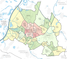
Category:Streets in Karlsruhe
Jump to navigation
Jump to search
Urban districts (cities): Baden-Baden · Freiburg · Heidelberg · Heilbronn · Karlsruhe · Mannheim · Pforzheim · Stuttgart · Ulm
Wikimedia category | |||||
| Upload media | |||||
| Instance of | |||||
|---|---|---|---|---|---|
| Category combines topics | |||||
| Karlsruhe | |||||
large city in Baden-Württemberg, Germany | |||||
| Instance of |
| ||||
| Part of |
| ||||
| Named after | |||||
| Location | |||||
| Located in or next to body of water | |||||
| Visitor center | |||||
| Head of government |
| ||||
| Inception |
| ||||
| Population |
| ||||
| Area |
| ||||
| Elevation above sea level |
| ||||
| Budget |
| ||||
| Different from | |||||
| official website | |||||
 | |||||
Deutsch: Innerortsstraßen in Karlsruhe
- “street” = Straße im Ort bzw. Innerortsstraße
- “road” = Straße allgemein, und hier speziell Außerortsstraße, siehe Category:Roads in Karlsruhe
- für Plätze siehe Category:Squares in Karlsruhe
Subcategories
This category has the following 7 subcategories, out of 7 total.
- Cycle streets in Karlsruhe (25 F)
L
Media in category "Streets in Karlsruhe"
The following 44 files are in this category, out of 44 total.
-
317 vbk.jpg 2,000 × 1,500; 362 KB
-
Der Karl Drais Weg quert die Stutenseer Allee - geo.hlipp.de - 18132.jpg 640 × 480; 104 KB
-
Die Friedrichstaler Allee quert die L604 - geo.hlipp.de - 18163.jpg 640 × 480; 115 KB
-
Die Grabener Allee kreuzt die L604 - geo.hlipp.de - 17739.jpg 640 × 480; 92 KB
-
Die Grabener Allee kreuzt die L604 - geo.hlipp.de - 18106.jpg 640 × 480; 107 KB
-
Die K9659, Ortsumgehung Durlach - geo.hlipp.de - 19292.jpg 640 × 480; 97 KB
-
Die L604 Richtung Waldstadt - geo.hlipp.de - 17968.jpg 640 × 480; 129 KB
-
Die Willy-Brandt-Allee beim Kanalweg - geo.hlipp.de - 19569.jpg 640 × 480; 88 KB
-
Ettlinger Allee - geo.hlipp.de - 1914.jpg 625 × 456; 73 KB
-
Fernwärme Karlsruhe Juli 2012.JPG 3,648 × 2,736; 4.11 MB
-
Grabener Allee - geo.hlipp.de - 17737.jpg 640 × 480; 103 KB
-
Grabener Allee - geo.hlipp.de - 17740.jpg 640 × 480; 118 KB
-
Grabener Allee - geo.hlipp.de - 18002.jpg 480 × 640; 127 KB
-
Grabener Allee - geo.hlipp.de - 18094.jpg 480 × 640; 124 KB
-
Grabener Allee - geo.hlipp.de - 18111.jpg 480 × 640; 127 KB
-
Grabener Allee am Hirschgraben - geo.hlipp.de - 17731.jpg 640 × 480; 115 KB
-
Karlsruhe tram 2019 3.jpg 3,648 × 2,736; 3.73 MB
-
Linkenheimer Allee - geo.hlipp.de - 17717.jpg 640 × 480; 128 KB
-
Linkenheimer Allee - geo.hlipp.de - 17718.jpg 640 × 480; 130 KB
-
Niederflurstrassenbahn Karlsruhe.jpg 3,336 × 2,024; 2.5 MB
-
Rotlichtviertelkarlsruhe2.png 1,200 × 1,600; 2.17 MB
-
Karlsruhe tram 2019 1.jpg 3,648 × 2,736; 3.31 MB
-
Street Art Karlsruhe Detail.jpg 1,700 × 1,440; 2.74 MB
-
Tram in Karlsruhe 199x 1.jpg 2,136 × 1,493; 383 KB
-
Karlsruhe tram 2019 2.jpg 3,648 × 2,736; 4.66 MB
-
Verfassungsgericht.JPG 1,188 × 942; 497 KB
-
Street Art Karlsruhe.jpg 2,229 × 3,685; 7.57 MB


