Category:Streets in Felixstowe
Jump to navigation
Jump to search
Subcategories
This category has the following 2 subcategories, out of 2 total.
B
F
- Falcon Street, Felixstowe (1 F)
Media in category "Streets in Felixstowe"
The following 24 files are in this category, out of 24 total.
-
 Berners Road - geograph.org.uk - 1045594.jpg 640 × 480; 74 KB
-
 Cliff Road - geograph.org.uk - 1326237.jpg 640 × 480; 51 KB
-
 Colneis Road, Felixstowe - geograph.org.uk - 4175050.jpg 640 × 480; 87 KB
-
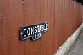 Constable Road sign, Felixstowe 2011.jpg 1,024 × 683; 282 KB
-
 Crescent Road, Felixstowe - geograph.org.uk - 5725548.jpg 1,280 × 851; 461 KB
-
 Felixstowe SalvationArmy SE.jpg 1,280 × 719; 517 KB
-
 Felixstowe, 2013.07.13 (6).jpg 2,592 × 1,944; 1.05 MB
-
 Grange Farm Avenue - geograph.org.uk - 1227487.jpg 640 × 480; 122 KB
-
 Hamilton Road - geograph.org.uk - 992377.jpg 640 × 480; 67 KB
-
 Leopold Road, Felixstowe 2012.jpg 1,024 × 683; 313 KB
-
 Looking along Cliff Road - geograph.org.uk - 1442479.jpg 640 × 480; 60 KB
-
 Looking down Bent Hill, Felixstowe, January 2023.jpg 5,184 × 3,456; 6.98 MB
-
 Lynwood Avenue - geograph.org.uk - 992381.jpg 640 × 480; 46 KB
-
 Mature Avenue - geograph.org.uk - 1324624.jpg 480 × 640; 108 KB
-
 Micklegate Road, Felixstowe.jpg 1,600 × 1,200; 620 KB
-
 Mill Road Felixstowe - geograph.org.uk - 1109522.jpg 640 × 480; 100 KB
-
 Orford Road, Felixstowe - geograph.org.uk - 1442161.jpg 640 × 461; 85 KB
-
 Orwell Road facing up to the town - geograph.org.uk - 829657.jpg 640 × 480; 50 KB
-
 Orwell Road, Felixstowe - geograph.org.uk - 1227559.jpg 640 × 480; 73 KB
-
 Quilter Road, Felixstowe 2011.jpg 1,024 × 683; 368 KB
-
 St Andrews Road - geograph.org.uk - 992400.jpg 640 × 480; 50 KB
-
 Undercliff Road west, Felixstowe - geograph.org.uk - 4169818.jpg 640 × 480; 89 KB
-
 Vicarage Road - geograph.org.uk - 1227508.jpg 640 × 480; 65 KB
-
 Walton Avenue - geograph.org.uk - 1227503.jpg 640 × 480; 88 KB


.jpg)


