Category:Stratton, Cornwall
Jump to navigation
Jump to search
town in Cornwall, England, UK | |||||
| Upload media | |||||
| Instance of | |||||
|---|---|---|---|---|---|
| Location | Bude-Stratton, Cornwall, South West England, England | ||||
| Diocese | |||||
 | |||||
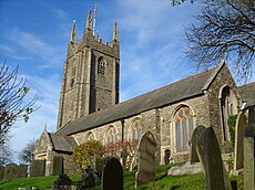
English: Stratton is a small town situated near the coastal resort of Bude in north Cornwall, UK. It was also the name of one of ten ancient administrative shires of Cornwall - see "Hundreds of Cornwall". A battle of the English civil war took place here on May 16 1643
Italiano: Stratton è una piccola città situata vicino alla località costiera di Bude, nella Cornovaglia settentrionale, nel Regno Unito. È anche il nome di una delle antiche contee amministrative della Cornovaglia. Una importante battaglia della Guerra civile inglese ebbe luogo qui il 16 maggio 1643.
Subcategories
This category has the following 3 subcategories, out of 3 total.
Media in category "Stratton, Cornwall"
The following 34 files are in this category, out of 34 total.
-
Battelfield stratton.JPG 3,264 × 2,448; 1.61 MB
-
Bridge Cottages Stratton - geograph.org.uk - 1801315.jpg 640 × 480; 68 KB
-
Burn Manor, Stratton - geograph.org.uk - 1348896.jpg 640 × 480; 124 KB
-
Church hall, Stratton - geograph.org.uk - 1388774.jpg 640 × 480; 98 KB
-
Church Street, Stratton - geograph.org.uk - 1390144.jpg 640 × 473; 117 KB
-
Former school, Stratton - geograph.org.uk - 1388796.jpg 640 × 480; 97 KB
-
Lane to Rhude Cross - geograph.org.uk - 3597225.jpg 3,468 × 2,232; 4.41 MB
-
Lane to Stratton near Marsh Farm - geograph.org.uk - 3598800.jpg 3,260 × 2,220; 5.47 MB
-
Maiden Street, Stratton - geograph.org.uk - 1390185.jpg 640 × 480; 93 KB
-
Old Post Office Hill, Stratton - geograph.org.uk - 1388803.jpg 640 × 476; 112 KB
-
Prustacott Farm - geograph.org.uk - 217971.jpg 640 × 426; 135 KB
-
Site of the Battle of Stratton - geograph.org.uk - 414526.jpg 640 × 426; 114 KB
-
Letter box, Maiden Street, Stratton - geograph.org.uk - 1390149.jpg 578 × 640; 141 KB
-
Stratton forestreet.JPG 3,264 × 2,448; 1.79 MB
-
Stratton oldcourt.JPG 3,264 × 2,448; 1.69 MB
-
The Gallery Tea Rooms, Stratton - geograph.org.uk - 414527.jpg 640 × 426; 108 KB
-
The King's Arms Stratton - geograph.org.uk - 1801338.jpg 640 × 480; 63 KB
-
The post office, Stratton - geograph.org.uk - 1390160.jpg 640 × 480; 115 KB
-
The Tree Inn, Stratton - geograph.org.uk - 1390177.jpg 640 × 471; 84 KB
-
Treeinn.jpg 1,024 × 768; 342 KB
-
Tudor Cottage Stratton - geograph.org.uk - 1801296.jpg 640 × 480; 73 KB
-
Union Hill, Stratton - geograph.org.uk - 1388766.jpg 640 × 480; 104 KB
-
Field entrance - geograph.org.uk - 217978.jpg 640 × 426; 107 KB
-
Field entrance near Stratton - geograph.org.uk - 410230.jpg 640 × 426; 117 KB
-
Stratton near Bude - geograph.org.uk - 410221.jpg 640 × 426; 121 KB
-
The A39 through Stratton - geograph.org.uk - 473646.jpg 640 × 426; 117 KB
-
Track to pumping station - geograph.org.uk - 405615.jpg 640 × 480; 292 KB
-
Trackway near Prustacott - geograph.org.uk - 217964.jpg 426 × 640; 111 KB
-
West Leigh, Leigh - geograph.org.uk - 410775.jpg 640 × 426; 103 KB


