Category:Stranraer to Ayr Line
Jump to navigation
Jump to search
Main Wikipedia article: Glasgow South Western Line.
English: A railway line in South West Scotland.
Subcategories
This category has the following 6 subcategories, out of 6 total.
B
- Burning Bridge (10 F)
D
- Dalrymple railway station (3 F)
H
- Holmhead Viaduct (3 F)
K
- Kinclair Viaduct (4 F)
S
- Stranraer Town railway station (18 F)
Media in category "Stranraer to Ayr Line"
The following 33 files are in this category, out of 33 total.
-
 Burning Bridge, staff access point. Stranraer to Ayr Line. South Ayrshire.jpg 4,896 × 2,752; 3.66 MB
-
 Burning Bridge, staff access stairway. Stranraer to Ayr Line. South Ayrshire.jpg 4,466 × 2,727; 3.5 MB
-
 Burning Bridge, view towards Girvan. Stranraer to Ayr Line. South Ayrshire.jpg 2,956 × 2,589; 2.49 MB
-
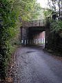 Railway bridge near Dailly - geograph.org.uk - 334590.jpg 480 × 640; 79 KB
-
 Deansmill. View towards Girvan. South Ayrshire.jpg 4,896 × 2,752; 5.74 MB
-
 Deansmill. View towards Maybole. South Ayrshire.jpg 4,896 × 2,752; 5.3 MB
-
 Dunragit level crossing and signalbox. Dumfries & Galloway.jpg 1,920 × 1,080; 673 KB
-
 Dunragit passing loop and signalbox. Dumfries & Galloway.jpg 1,920 × 1,080; 821 KB
-
 Dunragit signalbox and level crossing, Dumfries and Galloway, Scotland.jpg 1,920 × 1,080; 732 KB
-
 Entering Girvan - geograph.org.uk - 682574.jpg 640 × 497; 75 KB
-

-

-
 Graffiti on bridge, Burning Bridge, Stranraer to Ayr line.jpg 4,606 × 918; 1.27 MB
-
 Graffiti on parapet at Burning Bridge, Stranraer to Ayr Line.jpg 4,634 × 2,214; 3.72 MB
-
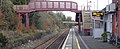
 Maybole Railway Station, Girvan Line. South Ayrshire. Old station buildings.jpg 4,148 × 2,515; 1.64 MB
-
 Maybole Railway Station, Girvan Line. South Ayrshire. Platform view east.jpg 4,896 × 2,752; 2.6 MB
-
 Maybole Railway Station, Girvan Line. South Ayrshire. Platform view to the east.jpg 4,650 × 1,913; 1.78 MB
-

-

-
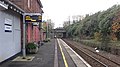 Maybole Railway Station, Girvan Line. South Ayrshire. Platform view west.jpg 4,896 × 2,752; 2.7 MB
-
 Maybole Railway Station, Girvan Line. South Ayrshire. View east and overbridge.jpg 4,896 × 2,752; 5.06 MB
-
 Maybole Railway Station, Girvan Line. South Ayrshire. View west.jpg 3,814 × 2,740; 1.96 MB
-
 New Railway Bridge at Girvan - geograph.org.uk - 2130089.jpg 640 × 455; 71 KB
-
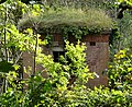 Platelayers Hut, Burning Bridge, Ayr to Stranraer line. South Ayrshire.jpg 3,306 × 2,704; 2.84 MB
-
 Railway Bridge Near Pinwherry - geograph.org.uk - 217857.jpg 480 × 640; 191 KB
-
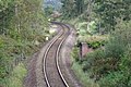 Railway line from the Burning Bridge, Stranraer to Ayr Line.jpg 3,416 × 2,282; 1.96 MB
-
 The Girvan Train - geograph.org.uk - 239160.jpg 640 × 480; 141 KB
-
 The Girvan Train - geograph.org.uk - 422632.jpg 640 × 470; 103 KB
-
 The Site of Crosshill Station - geograph.org.uk - 261899.jpg 640 × 480; 209 KB
-
 Townend of Maybole. View towards Ayr. South Ayrshire.jpg 2,655 × 2,623; 1.95 MB
-
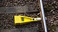 Train alarm for temporary speed restriction. Burning Bridge. South Ayrshire.jpg 4,896 × 2,752; 3.86 MB
-
 Train and Platelayers Hut, Burning Bridge, Ayr to Stranraer line. South Ayrshire.jpg 3,535 × 2,176; 1.97 MB
-
 Train to Ayr from Burning Bridge, South Ayrshire.jpg 4,151 × 2,214; 3.2 MB


