Category:Stourton with Gasper
Jump to navigation
Jump to search

civil parish in Wiltshire, England | |||||
| Upload media | |||||
| Instance of | |||||
|---|---|---|---|---|---|
| Location | Wiltshire, South West England, England | ||||
| Population |
| ||||
 | |||||
Subcategories
This category has the following 3 subcategories, out of 3 total.
G
- Gasper, Wiltshire (2 F)
S
Media in category "Stourton with Gasper"
The following 200 files are in this category, out of 740 total.
(previous page) (next page)-
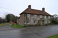 'Old Hunting Lodge' (66 Stourton Lane), Kilmington Common (geograph 7097037).jpg 3,776 × 2,520; 1.82 MB
-
 A frothy rainfall - geograph.org.uk - 6408375.jpg 2,472 × 3,296; 1.78 MB
-
 Alfred's Tower left, Stourton right - geograph.org.uk - 1882152.jpg 2,272 × 1,704; 3.02 MB
-
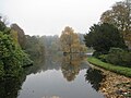
 Another view east across the lake, Stourhead - geograph.org.uk - 5956240.jpg 1,024 × 552; 215 KB
-
 Apollo Head - geograph.org.uk - 2911359.jpg 4,288 × 3,216; 2.31 MB
-
 Apollo, Stourhead - geograph.org.uk - 2911333.jpg 4,288 × 3,216; 1.98 MB
-
 Are we safe^ - geograph.org.uk - 2837887.jpg 800 × 574; 262 KB
-
 Arm of Garden Lake, Stourhead - geograph.org.uk - 5201648.jpg 3,072 × 2,048; 1.43 MB
-
 Autumn at Stourhead - geograph.org.uk - 4824866.jpg 640 × 480; 70 KB
-
 Bayley's Coppice - geograph.org.uk - 2837872.jpg 800 × 649; 201 KB
-
 Bells Lane - geograph.org.uk - 5439337.jpg 640 × 427; 417 KB
-
 Beware of low flying trees^ - geograph.org.uk - 2837865.jpg 600 × 800; 110 KB
-
 Bluebells , Garden Lake - geograph.org.uk - 3976439.jpg 2,201 × 976; 841 KB
-
 Boundary sign in Stourton - geograph.org.uk - 5091807.jpg 640 × 480; 123 KB
-
 Bridge and church at Stourhead - geograph.org.uk - 6698041.jpg 1,024 × 576; 206 KB
-
 Bridge over High Street, Stourton - geograph.org.uk - 5334620.jpg 640 × 480; 188 KB
-
 Bristol Cross - geograph.org.uk - 6698088.jpg 1,024 × 576; 183 KB
-
 Bristol Cross and Cottage, Stourhead Gardens - geograph.org.uk - 2954247.jpg 4,745 × 1,520; 2.19 MB
-
 Bristol Cross and Stourton church - geograph.org.uk - 5605037.jpg 768 × 1,024; 187 KB
-
 Bristol Cross, Stourhead - geograph.org.uk - 2998853.jpg 1,200 × 1,600; 454 KB
-
 Bristol Cross, Stourton - geograph.org.uk - 2911258.jpg 3,216 × 4,288; 3.03 MB
-

-
 Bristol High Cross, Stourton - geograph.org.uk - 5310767.jpg 1,600 × 1,422; 523 KB
-
 B^B on Stourhead Estate - geograph.org.uk - 2998953.jpg 1,600 × 1,200; 631 KB
-
 Cascade and Water Wheel, Stourhead Gardens - geograph.org.uk - 2954321.jpg 2,336 × 1,288; 1.07 MB
-
 Cascade, Stourhead - geograph.org.uk - 2911413.jpg 3,216 × 4,288; 3.65 MB
-
 Ceres, Pantheon - geograph.org.uk - 2911440.jpg 3,216 × 4,288; 2.94 MB
-

-
 Christmas at Stourhead - geograph.org.uk - 6364033.jpg 1,024 × 768; 93 KB
-
 Church Hill Stourton - geograph.org.uk - 5376122.jpg 3,560 × 2,670; 5.71 MB
-
 Church of St Peter, Stourhead - geograph.org.uk - 6698036.jpg 1,024 × 576; 176 KB
-
 Clock Gate, Stourhead - geograph.org.uk - 2997223.jpg 1,600 × 1,200; 524 KB
-
 Clocktower Gateway (North Side) - geograph.org.uk - 5439119.jpg 640 × 481; 606 KB
-
 Clocktower Gateway (South Side) - geograph.org.uk - 5439115.jpg 640 × 427; 502 KB
-
 Cormorants in a tree top - geograph.org.uk - 5605661.jpg 1,024 × 768; 219 KB
-
 Cottage, New Lake - geograph.org.uk - 1963453.jpg 1,056 × 1,509; 361 KB
-
 Cottage, Stourton - geograph.org.uk - 2997249.jpg 1,600 × 1,200; 522 KB
-
 Cottages at Stourton - geograph.org.uk - 5439288.jpg 640 × 427; 575 KB
-
 Cottages at Stourton, Wiltshire - geograph.org.uk - 4727368.jpg 4,000 × 3,000; 5.14 MB
-
 Cottages, Stourhead - geograph.org.uk - 5202482.jpg 3,054 × 2,018; 1.29 MB
-
 Cottages, Stourhead - geograph.org.uk - 5202494.jpg 3,072 × 2,048; 1.6 MB
-
 Courtyard, Stourhead - geograph.org.uk - 5954652.jpg 1,024 × 779; 354 KB
-
 Cross Dyke, White Sheet Hill - geograph.org.uk - 2429843.jpg 640 × 480; 71 KB
-
 Dam at Stourhead - geograph.org.uk - 5202438.jpg 3,072 × 2,048; 1.81 MB
-
 Defibrillator Box - geograph.org.uk - 5439336.jpg 481 × 640; 366 KB
-
 Defibrillator Box on Bells Lane - geograph.org.uk - 5439332.jpg 640 × 481; 674 KB
-
 Detail of St Peter's Pump, Stourhead - geograph.org.uk - 5605651.jpg 768 × 1,024; 167 KB
-
 Diana's Basin, Stourhead - geograph.org.uk - 2997291.jpg 1,600 × 1,200; 547 KB
-
 Dorset Horn sheep - geograph.org.uk - 5605812.jpg 1,024 × 768; 343 KB
-
 Dorset Horn sheep - geograph.org.uk - 5605814.jpg 1,024 × 768; 347 KB
-
 Driveway, Stourhead - geograph.org.uk - 5201237.jpg 3,072 × 2,048; 1.99 MB
-
 Ebenezer's Bike, Stourhead - geograph.org.uk - 5310525.jpg 4,169 × 3,000; 4.68 MB
-
 Edge of the Forest - geograph.org.uk - 417376.jpg 640 × 480; 96 KB
-
 Entering Stourton Village - geograph.org.uk - 4045263.jpg 640 × 396; 61 KB
-
 Entrance gateway to Stourhead House - geograph.org.uk - 4953197.jpg 1,600 × 1,196; 644 KB
-
 Estate Office, Stourton - geograph.org.uk - 5605048.jpg 1,024 × 768; 328 KB
-
 Exmoor Horn - geograph.org.uk - 2912056.jpg 4,288 × 3,216; 3.61 MB
-
 Exmoor Horn Sheep - geograph.org.uk - 2912061.jpg 4,288 × 3,216; 3.67 MB
-
 Farm in Stour Valley, Gasper - geograph.org.uk - 4704847.jpg 1,600 × 1,200; 476 KB
-
 Farm Shop at Stourhead - geograph.org.uk - 2516679.jpg 800 × 600; 432 KB
-
 Farmstead - geograph.org.uk - 3782933.jpg 1,600 × 1,200; 630 KB
-
 Field above top pond, Six Wells Bottom - geograph.org.uk - 6171565.jpg 1,024 × 683; 290 KB
-
 Field by car park, Stourhead - geograph.org.uk - 5202660.jpg 3,072 × 2,048; 1.34 MB
-
 Field by car park, Stourhead - geograph.org.uk - 5202666.jpg 3,072 × 2,048; 1.68 MB
-
 Field by car park, Stourhead - geograph.org.uk - 5202673.jpg 3,056 × 1,958; 1.44 MB
-
 Field edge track at Stourton - geograph.org.uk - 6171678.jpg 1,024 × 683; 276 KB
-
 Field edge view at Stourton - geograph.org.uk - 6171558.jpg 1,024 × 683; 230 KB
-
 Field near Stourhead - geograph.org.uk - 2901680.jpg 1,024 × 768; 200 KB
-
 Figures by the lake at Stourhead - geograph.org.uk - 2675554.jpg 640 × 480; 127 KB
-
 Fir Walk and the Obelisk - geograph.org.uk - 5604301.jpg 768 × 1,024; 312 KB
-
 Fir walk, Stourhead Gardens - geograph.org.uk - 5604307.jpg 768 × 1,024; 363 KB
-
 Fir, Stourhead - geograph.org.uk - 5201498.jpg 2,559 × 1,766; 1.38 MB
-
 First signs of autumn at Stourhead - geograph.org.uk - 4724674.jpg 3,956 × 2,940; 6.96 MB
-

-
 Flush bracket, White Sheet Hill trig point - geograph.org.uk - 5378045.jpg 954 × 1,600; 524 KB
-
 Footbridge in High Street - geograph.org.uk - 5090559.jpg 640 × 480; 85 KB
-
 Footbridge over Stourton High Street - geograph.org.uk - 5439106.jpg 640 × 481; 641 KB
-
 Footbridge over the Stour - geograph.org.uk - 6408378.jpg 3,296 × 2,472; 1.95 MB
-
 Footpath alongside Stourhead car park - geograph.org.uk - 3422680.jpg 3,264 × 2,448; 1.61 MB
-
 Footpath at west side of Garden Lake - geograph.org.uk - 4045369.jpg 480 × 640; 124 KB
-
 Footpath near Gothic Cottage - geograph.org.uk - 4045390.jpg 480 × 640; 111 KB
-
 Forest Track - geograph.org.uk - 2901735.jpg 1,024 × 768; 306 KB
-
 Garden Lake - geograph.org.uk - 2911432.jpg 4,288 × 3,216; 3.53 MB
-
 Garden Lake - geograph.org.uk - 3395804.jpg 640 × 424; 219 KB
-
 Garden Lake - geograph.org.uk - 3395869.jpg 424 × 640; 329 KB
-
 Garden Lake - geograph.org.uk - 3397017.jpg 424 × 640; 376 KB
-
 Garden Lake and geese, Stourhead - geograph.org.uk - 4723108.jpg 4,000 × 3,000; 6.19 MB
-
 Garden Lake viewed from within the Grotto - geograph.org.uk - 5603877.jpg 1,024 × 768; 144 KB
-
 Garden Lake, Stourhead - geograph.org.uk - 2997270.jpg 1,600 × 1,200; 395 KB
-
 Garden Lake, Stourhead - geograph.org.uk - 5049475.jpg 2,337 × 1,600; 861 KB
-
 Garden Lake, Stourhead Gardens - geograph.org.uk - 5603737.jpg 1,024 × 768; 319 KB
-
 Garden Lake, Stourhead Gardens - geograph.org.uk - 5603856.jpg 1,024 × 768; 268 KB
-
 Garden Lake, Stourhead Gardens - geograph.org.uk - 5603861.jpg 1,024 × 768; 277 KB
-
 Garden Lake, Stourhead Gardens - geograph.org.uk - 5629537.jpg 1,600 × 1,074; 270 KB
-
 Garden walls, Stourhead - geograph.org.uk - 5201093.jpg 3,072 × 2,048; 1.52 MB
-
 Gardens and lake at Stourhead - geograph.org.uk - 2998626.jpg 1,600 × 1,200; 495 KB
-
 Gateway and Lodge at Stourhead Estate - geograph.org.uk - 5439104.jpg 640 × 480; 455 KB
-
 Goddess in the Pantheon, Stourhead - geograph.org.uk - 2911468.jpg 3,216 × 4,288; 1.9 MB
-
 Gothic Cottage, Stourhead - geograph.org.uk - 4723132.jpg 4,000 × 3,000; 6 MB
-
 Gothic Cottage, Stourhead - geograph.org.uk - 5201526.jpg 3,072 × 2,048; 1.17 MB
-
 Gothic Cottage, Stourhead Gardens - geograph.org.uk - 5603910.jpg 768 × 1,024; 437 KB
-
 Granary Block, Stourhead - geograph.org.uk - 2912192.jpg 4,288 × 3,216; 3.66 MB
-
 Grand Entrance, Stourhead - geograph.org.uk - 2912176.jpg 4,288 × 3,216; 3.4 MB
-
 Grotto View , Stourhead - geograph.org.uk - 3976430.jpg 2,848 × 2,134; 1.09 MB
-
 Hercules in the Grotto - geograph.org.uk - 2911997.jpg 3,216 × 4,288; 2.11 MB
-
 Hercules, Pantheon - geograph.org.uk - 2911460.jpg 3,216 × 4,288; 3.16 MB
-
 Hiding in the trees. The Temple of Apollo, Stourhead - geograph.org.uk - 4722042.jpg 3,980 × 2,642; 6.23 MB
-
 High Street, Stourton - geograph.org.uk - 2911181.jpg 4,288 × 3,216; 3.72 MB
-
 High Street, Stourton - geograph.org.uk - 3397027.jpg 640 × 424; 292 KB
-
 Hoare Monument (geograph 6698024).jpg 1,024 × 576; 185 KB
-
 Holiday cottages, Stourhead - geograph.org.uk - 5605053.jpg 1,024 × 768; 292 KB
-
 House in High Street, Stourton - geograph.org.uk - 6171561.jpg 1,024 × 683; 187 KB
-
 Illuminated entrance to a grotto, Stourhead - geograph.org.uk - 4726206.jpg 4,000 × 3,000; 4.15 MB
-
 Inside St Peter, Stourton (i) - geograph.org.uk - 5092032.jpg 480 × 640; 65 KB
-
 Inside St Peter, Stourton (ii) - geograph.org.uk - 5092033.jpg 480 × 640; 60 KB
-
 Inside St Peter, Stourton (iii) - geograph.org.uk - 5092034.jpg 640 × 480; 78 KB
-
 Inside the Gothic Cottage, Stourhead - geograph.org.uk - 4723120.jpg 4,000 × 3,000; 4.22 MB
-
 Interior of the "Gothic Cottage", Stourhead Estate - geograph.org.uk - 4723134.jpg 4,000 × 3,000; 3.86 MB
-
 Iron Bridge, Stourhead Gardens (geograph 5604361).jpg 1,024 × 768; 335 KB
-
 Junction on Sand Walk, Stourhead - geograph.org.uk - 5201299.jpg 3,072 × 2,048; 1.88 MB
-
 King Alfred's Tower - geograph.org.uk - 3153801.jpg 600 × 800; 174 KB
-
 Lake and Gardens, Stourhead - geograph.org.uk - 2997281.jpg 1,600 × 1,200; 565 KB
-

-
 Lake ^ Palladian Bridge, Stourhead Gardens - geograph.org.uk - 2997263.jpg 1,600 × 1,200; 434 KB
-
 Lake, Stourhead - geograph.org.uk - 6241923.jpg 1,280 × 720; 1.04 MB
-
 Lakeside Path, Stourhead Estate - geograph.org.uk - 4726162.jpg 3,920 × 2,892; 4.55 MB
-
 Lakeside scene at Stourhead, Wiltshire - geograph.org.uk - 4726157.jpg 4,000 × 3,000; 4.83 MB
-
 Lane through Castle Wood - geograph.org.uk - 5334499.jpg 640 × 480; 204 KB
-
 Lily Pond - geograph.org.uk - 5201434.jpg 3,072 × 2,048; 1.48 MB
-
 Lily Pond, Stourhead - geograph.org.uk - 2912027.jpg 4,288 × 3,216; 3.24 MB
-
 Lily Pond, Stourhead - geograph.org.uk - 5605418.jpg 1,024 × 768; 278 KB
-
 Lily pond, Stourhead - geograph.org.uk - 5956025.jpg 1,024 × 669; 253 KB
-

-
 Long lens shot through the trees of The Pantheon, Stourhead - geograph.org.uk - 4722045.jpg 3,950 × 2,596; 5.72 MB
-
 Looking down from White Sheet Downs - geograph.org.uk - 5377974.jpg 1,600 × 1,200; 403 KB
-
 Low Water in the Lake - geograph.org.uk - 5310990.jpg 4,500 × 3,000; 5.12 MB
-
 Maple and another tree, Stourhead - geograph.org.uk - 5956041.jpg 1,024 × 695; 448 KB
-
 Maple, Stourhead - geograph.org.uk - 5955128.jpg 1,024 × 640; 425 KB
-
 Maple, Stourhead - geograph.org.uk - 5956028.jpg 1,024 × 669; 425 KB
-
 Meadow by Tucking Mill Hanging - geograph.org.uk - 5201596.jpg 3,072 × 2,048; 1.24 MB
-
 Memorial plaque on Obelisk, Stourhead Gardens - geograph.org.uk - 5604249.jpg 768 × 1,024; 249 KB
-
 Metal sun disc - geograph.org.uk - 5604241.jpg 1,024 × 768; 122 KB
-
 Mill Lane - geograph.org.uk - 5334518.jpg 640 × 480; 171 KB
-
 Millwheel in Stourhead Gardens - geograph.org.uk - 5604863.jpg 1,024 × 768; 356 KB
-
 Molehills, Sunny Hanging - geograph.org.uk - 2306065.jpg 640 × 480; 83 KB
-
 Muddy area at top end of Garden Lake - geograph.org.uk - 4045366.jpg 640 × 480; 94 KB
-
 New Lake - geograph.org.uk - 5334531.jpg 640 × 480; 124 KB
-
 New planting, Bayley's Coppice - geograph.org.uk - 2837657.jpg 640 × 481; 81 KB
-
 Obelisk, Stourhead Gardens - geograph.org.uk - 5604229.jpg 768 × 1,024; 177 KB
-
 Obelisk, Stourhead Gardens - geograph.org.uk - 5604238.jpg 768 × 1,024; 179 KB
-
 Ordnance Survey Cut Bench Mark - geograph.org.uk - 4203553.jpg 2,592 × 1,944; 1.04 MB
-
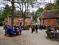
 Outdoor tables, Spread Eagle, Stourhead - geograph.org.uk - 5202617.jpg 3,072 × 2,048; 1.18 MB
-
 Overlooking Garden Lake - geograph.org.uk - 4045371.jpg 640 × 443; 105 KB
-
 Pair of mallard, Stourhead - geograph.org.uk - 5957041.jpg 1,024 × 768; 228 KB
-
 Palladian bridge and lake, Stourhead Gardens - geograph.org.uk - 4952610.jpg 1,600 × 1,200; 710 KB
-
 Palladian Bridge from Watch Cottage - geograph.org.uk - 2911490.jpg 4,288 × 3,216; 3.48 MB
-
 Palladian Bridge, Stourhead - geograph.org.uk - 2998479.jpg 1,600 × 1,200; 667 KB
-
 Palladian Bridge, Stourhead - geograph.org.uk - 2998511.jpg 1,600 × 1,200; 607 KB
-
 Palladian Bridge, Stourhead - geograph.org.uk - 5202451.jpg 3,072 × 2,048; 1.72 MB
-
 Palladian Bridge, Stourhead Gardens - geograph.org.uk - 5605029.jpg 1,024 × 768; 263 KB
-
 Panorama view of Stourhead Gardens - geograph.org.uk - 5603698.jpg 1,024 × 282; 105 KB
-
 Pantheon, Stourhead - geograph.org.uk - 2911422.jpg 4,288 × 3,216; 3.49 MB
-
 Pantheon, Stourhead Gardens - geograph.org.uk - 5604398.jpg 768 × 1,024; 247 KB
-
 Paragliding on White Sheet Hill - geograph.org.uk - 951721.jpg 640 × 472; 54 KB
-
 Parkland at Stourhead - geograph.org.uk - 4953175.jpg 1,600 × 1,196; 328 KB
-
 Path and trees, Stourhead - geograph.org.uk - 5605424.jpg 800 × 600; 235 KB
-
 Path down White Sheet Downs - geograph.org.uk - 5378168.jpg 1,600 × 1,200; 356 KB
-
 Path in Stourhead Gardens - geograph.org.uk - 5604324.jpg 768 × 1,024; 435 KB
-
 Path near Stourhead - geograph.org.uk - 2901763.jpg 1,024 × 768; 229 KB
-
 Path through wall, Stourhead - geograph.org.uk - 5201135.jpg 2,048 × 3,072; 1.15 MB
-
 Path to St Peter Stourton - geograph.org.uk - 5376118.jpg 3,560 × 2,670; 5.93 MB
-
 Path, Stourhead - geograph.org.uk - 5201289.jpg 3,072 × 2,048; 1.66 MB
-
 Path, Stourhead - geograph.org.uk - 5201427.jpg 3,072 × 2,048; 1.97 MB
-
 Path, Stourhead - geograph.org.uk - 5201457.jpg 2,048 × 3,072; 1.55 MB
-
 Path, Stourhead - geograph.org.uk - 5202653.jpg 2,048 × 3,072; 1.35 MB
-
 Pelargonium House at Stourhead - geograph.org.uk - 2516402.jpg 800 × 600; 444 KB
-
 Pelargonium House, Stourhead - geograph.org.uk - 5201120.jpg 3,072 × 2,048; 1.36 MB
-

-
 Plaster panel, Pantheon, Stourhead - geograph.org.uk - 5201588.jpg 2,048 × 1,536; 650 KB
-
 Pond, Stourhead - geograph.org.uk - 5201464.jpg 1,421 × 916; 535 KB
-
 Red leaves, Stourhead - geograph.org.uk - 5957036.jpg 1,024 × 768; 222 KB
-
 Redwood, Stourhead - geograph.org.uk - 5201452.jpg 2,048 × 3,072; 1.78 MB
-

-
 Reflections of the cows - geograph.org.uk - 1882132.jpg 1,517 × 1,136; 702 KB
-

-
 Rhododendron Flower, Stourhead - geograph.org.uk - 2912023.jpg 4,288 × 3,216; 3.24 MB
-
 Rhododendrons, Stourhead House - geograph.org.uk - 2912187.jpg 4,288 × 3,216; 3.44 MB
-
 River god in a grotto, Stourhead - geograph.org.uk - 5956154.jpg 1,024 × 768; 241 KB
-
 Rock Arch - geograph.org.uk - 3782944.jpg 1,600 × 1,155; 582 KB
-
 Romantic Landscape, Stourhead - geograph.org.uk - 2910914.jpg 4,288 × 3,216; 3.5 MB
-
 Roof dome, Temple of Apollo, Stourhead - geograph.org.uk - 5957045.jpg 1,024 × 1,024; 96 KB
-
 Sheep and lambs - geograph.org.uk - 5377085.jpg 1,600 × 1,223; 318 KB
-
 Signs of Life in the Walled Garden - geograph.org.uk - 5310542.jpg 1,600 × 1,133; 722 KB
-
 Six Wells Bottom - geograph.org.uk - 5201475.jpg 1,309 × 1,613; 524 KB
-
 Six Wells Bottom, Stourhead - geograph.org.uk - 5605621.jpg 1,024 × 768; 279 KB
-
 Six Wells Bottom, Stourhead - geograph.org.uk - 5605657.jpg 1,024 × 768; 308 KB
-
 Skylight, the Pantheon, Stourhead - geograph.org.uk - 5957025.jpg 1,024 × 1,002; 124 KB
-
 Sleeping Nymph - geograph.org.uk - 2912003.jpg 4,288 × 3,216; 1.91 MB
-
 South from White Sheet Hill - geograph.org.uk - 951738.jpg 640 × 460; 55 KB
-
 Spread Eagle and yard buildings, Stourhead - geograph.org.uk - 5202556.jpg 1,930 × 2,464; 659 KB
,_Kilmington_Common_(geograph_7097037).jpg)


_-_geograph.org.uk_-_5439119.jpg)
_-_geograph.org.uk_-_5439115.jpg)


.jpg)


_-_geograph.org.uk_-_5092032.jpg)
_-_geograph.org.uk_-_5092033.jpg)
_-_geograph.org.uk_-_5092034.jpg)


.jpg)


