Category:State legislative district maps of Wisconsin
Jump to navigation
Jump to search
States of the United States: California · Colorado · Delaware · Florida · Georgia · Idaho · Iowa · Kansas · Kentucky · Louisiana · Massachusetts · Michigan · Minnesota · Mississippi · Nevada · New Hampshire · New Jersey · New York · Oregon · Pennsylvania · Tennessee · Utah · Virginia · Washington · West Virginia · Wisconsin
Subcategories
This category has the following 2 subcategories, out of 2 total.
Media in category "State legislative district maps of Wisconsin"
The following 2 files are in this category, out of 2 total.
-
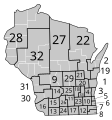
 1861 wi act 216 senate districts (1866 county borders).svg 245 × 262; 55 KB
-
 1866 wi act 101 senate districts.svg 245 × 262; 54 KB
.svg)
