Category:St Paul's Walden
Jump to navigation
Jump to search
English: St Paul's Walden is a village about five miles south of Hitchin in Hertfordshire, England. The parish of St Paul's Walden also includes the village of Whitwell. St Paul's Walden has two fine 18th-century mansions, both standing in parks of great beauty: Stagenhoe and St Paul's Walden Bury, which some say was the birthplace of Queen Elizabeth The Queen Mother.
village in Hertfordshire, England, UK  | |||||
| Upload media | |||||
| Instance of | |||||
|---|---|---|---|---|---|
| Location | North Hertfordshire, Hertfordshire, East of England, England | ||||
| Population |
| ||||
 | |||||
Subcategories
This category has the following 6 subcategories, out of 6 total.
Media in category "St Paul's Walden"
The following 143 files are in this category, out of 143 total.
-
 0748 Passing Minden Farm, Preston - geograph.org.uk - 1832530.jpg 1,024 × 768; 113 KB
-
 0749 King's Walden Church and Deer Park - geograph.org.uk - 1832534.jpg 1,024 × 768; 121 KB
-
 Art class, St Paul's Walden - geograph.org.uk - 3088585.jpg 2,048 × 1,360; 1.08 MB
-
 B 651 Hitchin Road and Whitwell Water Tower - geograph.org.uk - 2997272.jpg 2,560 × 1,920; 1.1 MB
-
 B651 Hitchin Road - geograph.org.uk - 6825831.jpg 1,024 × 684; 401 KB
-
 B651 Horn Hill, Whitwell - geograph.org.uk - 6825866.jpg 1,024 × 684; 277 KB
-
 Barn at Law Hall Farm - geograph.org.uk - 4649552.jpg 640 × 480; 120 KB
-
 Bendish and Pickering's Farm - geograph.org.uk - 4283398.jpg 3,264 × 2,448; 3.84 MB
-
 Blocked field entrance - geograph.org.uk - 6830943.jpg 1,024 × 768; 609 KB
-
 Bridge over the River Mimram, Whitwell - geograph.org.uk - 6195680.jpg 2,000 × 1,500; 1.28 MB
-
 Bullocks Hill - geograph.org.uk - 5392218.jpg 640 × 480; 199 KB
-
 Cattle and hedge row flowers - geograph.org.uk - 3532939.jpg 4,320 × 3,240; 4.58 MB
-
 Church Lane and crop, St Paul's Walden - geograph.org.uk - 6194660.jpg 2,000 × 1,500; 997 KB
-
 Church Lane, St Paul's Walden - geograph.org.uk - 6194673.jpg 2,000 × 1,500; 1.4 MB
-

-
 Codicote Road - geograph.org.uk - 3859891.jpg 640 × 480; 67 KB
-
 Codicote Road - geograph.org.uk - 3859898.jpg 640 × 480; 95 KB
-
 Codicote Road at the junction of High Street, Whitwell - geograph.org.uk - 5998957.jpg 2,048 × 1,536; 1.39 MB
-
 Codicote Road, Whitwell - geograph.org.uk - 5636237.jpg 2,304 × 1,728; 1.04 MB
-

-
 Cottages in Whitwell - geograph.org.uk - 3859877.jpg 640 × 449; 57 KB
-
 Cows chewing the cud near to Whitwell - geograph.org.uk - 4501919.jpg 4,320 × 3,240; 4.77 MB
-
 Cressman's Corner, Whitwell - geograph.org.uk - 5635069.jpg 2,304 × 1,728; 805 KB
-
 Crop field towards Lygrave Wood - geograph.org.uk - 3859895.jpg 640 × 480; 77 KB
-
 Driveway to Stagenhoe, St Paul's Walden - geograph.org.uk - 5119094.jpg 2,010 × 1,494; 978 KB
-
 Dropping down into Whitwell - geograph.org.uk - 3859875.jpg 640 × 435; 50 KB
-
 Easthall Farm - geograph.org.uk - 4283816.jpg 3,264 × 2,448; 3.6 MB
-
 Entering Whitwell - geograph.org.uk - 3859890.jpg 640 × 454; 75 KB
-
 Entrance to Stagenhoe, St Paul's Walden - geograph.org.uk - 5119105.jpg 2,048 × 1,536; 1.01 MB
-
 Entrance to the gas valve compound - geograph.org.uk - 3434009.jpg 4,320 × 3,240; 3.62 MB
-
 Entrance to the Stagenhoe Cat Hotel - geograph.org.uk - 6194708.jpg 2,000 × 1,500; 1.28 MB
-
 Entries in the Scarecrow competition, Whitwell - geograph.org.uk - 6195660.jpg 2,000 × 1,500; 1.23 MB
-
 Farmland towards Thieving Grove - geograph.org.uk - 3859865.jpg 640 × 480; 70 KB
-
 Field in Whiteway Bottom - geograph.org.uk - 5298846.jpg 2,304 × 1,728; 842 KB
-
 Flint Cottages, St Paul's Walden - geograph.org.uk - 5119289.jpg 2,000 × 1,500; 979 KB
-
 Footpath across a meadow, St Paul's Walden - geograph.org.uk - 6196099.jpg 2,000 × 1,500; 925 KB
-
 Footpath alongside Pinfold Wood, St Paul's Walden - geograph.org.uk - 5119309.jpg 2,048 × 1,536; 1.01 MB
-
 Footpath entering Hitch Wood, St Paul's Walden - geograph.org.uk - 5119341.jpg 1,500 × 2,000; 1.34 MB
-
 Footpath from Pinfold Wood to Hitch Wood, St Paul's Walden - geograph.org.uk - 5119335.jpg 2,048 × 1,536; 1.19 MB
-
 Ford and footbridge on Church Lane, St Paul's Walden - geograph.org.uk - 6194664.jpg 2,000 × 1,500; 1.48 MB
-
 Ford at Whitwell - geograph.org.uk - 3458816.jpg 3,872 × 2,592; 2.41 MB
-
 Former Baptist Church, Whitwell - geograph.org.uk - 6348555.jpg 2,448 × 3,264; 2.39 MB
-
 Frogmore from the air - geograph.org.uk - 2964091.jpg 640 × 480; 150 KB
-
 GOC Kimpton 046 Hoo End Farm barn (5722822500).jpg 4,288 × 3,216; 4.15 MB
-
 GOC St Paul's Walden 001 Garden House, St Paul's Walden (8731623524).jpg 4,288 × 3,216; 4.11 MB
-
 Grazing near Whitwell - geograph.org.uk - 3859887.jpg 640 × 480; 73 KB
-
 Grazing, The Holt - geograph.org.uk - 3859858.jpg 640 × 480; 61 KB
-
 Hertfordshire fieldscape - geograph.org.uk - 5548107.jpg 3,264 × 2,448; 3.55 MB
-
 Hertfordshire fieldscape - geograph.org.uk - 5844941.jpg 3,264 × 2,448; 2.9 MB
-
 High Street Whitwell showing the Bull pub - geograph.org.uk - 3434023.jpg 4,320 × 3,240; 3.54 MB
-
 High Street, Whitwell (B651) - geograph.org.uk - 3859878.jpg 640 × 480; 61 KB
-
 High Street, Whitwell, St Paul's Walden - geograph.org.uk - 6195614.jpg 2,000 × 1,292; 631 KB
-
 Hollybush Lane, Bendish - geograph.org.uk - 3457347.jpg 4,320 × 3,240; 5.4 MB
-
 House and walled garden, St Pauls Walden (geograph 4471330).jpg 4,320 × 3,240; 6.08 MB
-
 House on Horn Hill, Whitwell - geograph.org.uk - 5998991.jpg 2,048 × 1,536; 1.49 MB
-
 Houses on Hill View, Whitwell - geograph.org.uk - 3859874.jpg 640 × 480; 51 KB
-
 Houses on Horn Hill, Whitwell - geograph.org.uk - 5998994.jpg 1,960 × 1,412; 1.12 MB
-

-

-

-
 Junction on High Street Whitwell - geograph.org.uk - 5636253.jpg 2,270 × 1,682; 886 KB
-
 King's Walden from the air - geograph.org.uk - 5550401.jpg 3,264 × 2,448; 2.92 MB
-
 Kingswalden Park from the air - geograph.org.uk - 2709110.jpg 640 × 480; 105 KB
-
 Kingswalden Park from the air - geograph.org.uk - 3312058.jpg 640 × 480; 136 KB
-
 Kingswalden Park from the air - geograph.org.uk - 3378867.jpg 640 × 458; 141 KB
-
 KX200 Telephone Kiosk in Whitwell, Herts - geograph.org.uk - 5396855.jpg 2,592 × 1,944; 1.35 MB
-
 Lane heading north - geograph.org.uk - 3859864.jpg 640 × 480; 51 KB
-
 Lane heading north east,The Holt - geograph.org.uk - 3859861.jpg 640 × 480; 103 KB
-
 Lane heading north west - geograph.org.uk - 3859850.jpg 640 × 480; 47 KB
-
 Lane near Stagenhoe Bottom farm - geograph.org.uk - 3434005.jpg 4,320 × 3,240; 5.13 MB
-
 Lane towards Lilley Bottom - geograph.org.uk - 4649525.jpg 640 × 480; 159 KB
-
 Lane towards Whitwell - geograph.org.uk - 3859866.jpg 640 × 480; 86 KB
-
 Lilley Bottom Road - geograph.org.uk - 6825871.jpg 1,024 × 684; 459 KB
-
 Lilley Bottom Road - geograph.org.uk - 6832296.jpg 1,024 × 684; 275 KB
-
 Lilley Bottom Road at Stagenhoe - geograph.org.uk - 6194680.jpg 2,000 × 1,500; 1.15 MB
-
 Lilley Bottom Road at Stagenhoe, St Paul's Walden - geograph.org.uk - 6194694.jpg 2,000 × 1,498; 1.16 MB
-
 Lilley Bottom Road, St Paul's Walden - geograph.org.uk - 6194624.jpg 2,000 × 1,500; 840 KB
-
 Lilley Bottom Road, Whitwell - geograph.org.uk - 5635070.jpg 2,304 × 1,728; 1.3 MB
-
 Lilley Bottom Road, Whitwell - geograph.org.uk - 6825868.jpg 1,024 × 684; 353 KB
-
 Little Easthall Farm Triangulation Pillar - geograph.org.uk - 561486.jpg 640 × 480; 111 KB
-
 Long Lane, a public highway - geograph.org.uk - 6830941.jpg 1,024 × 768; 669 KB
-
 Looking down Nortonstreet Lane, Whitwell - geograph.org.uk - 6195724.jpg 2,000 × 1,500; 1.04 MB
-
 Looking towards Lilley Bottom Road - geograph.org.uk - 388027.jpg 640 × 480; 102 KB
-
 Looking up Nortonstreet Lane, Whitwell - geograph.org.uk - 6195726.jpg 2,000 × 1,500; 1.5 MB
-
 Memorial to Lady Elizabeth Bowes-Lyon, St Paul's Walden - geograph.org.uk - 5119231.jpg 1,705 × 2,000; 975 KB
-

-
 New Cottages, St Paul's Walden - geograph.org.uk - 5119161.jpg 2,000 × 1,500; 1.08 MB
-
 Nortonstreet Lane entering woodland, St Paul's Walden - geograph.org.uk - 6196151.jpg 2,000 × 1,500; 1.32 MB
-
 Nortonstreet Lane, Whitwell - geograph.org.uk - 6195718.jpg 2,000 × 1,500; 1.39 MB
-
 OS Flush Bracket S8440 Whitwell, former Baptist Church - geograph.org.uk - 6348554.jpg 1,132 × 1,726; 1.67 MB
-

-
 Permissive bridleway next to Hitch Wood - geograph.org.uk - 5119345.jpg 2,000 × 1,500; 1.12 MB
-
 Permissive path alongside the B651, St Paul's Walden - geograph.org.uk - 6196106.jpg 2,000 × 1,500; 1.05 MB
-
 Private road in Whitwell - geograph.org.uk - 5636229.jpg 2,260 × 1,668; 1.27 MB
-
 Public byway to Lilley Bottom Road - geograph.org.uk - 6830940.jpg 1,024 × 768; 649 KB
-
 Road signpost at Easthall - geograph.org.uk - 45699.jpg 640 × 480; 29 KB
-
 Small house on Codicote Road, Whitwell - geograph.org.uk - 5636230.jpg 1,666 × 2,258; 823 KB
-
 Small house on Codicote Road, Whitwell - geograph.org.uk - 5636231.jpg 1,728 × 2,304; 855 KB
-
 St Paul's Walden - geograph.org.uk - 561576.jpg 640 × 480; 117 KB
-
 St Paul's Walden, The Strathmore Arms - geograph.org.uk - 561499.jpg 640 × 480; 104 KB
-
 St Pauls Walden from the air (geograph 4550005).jpg 3,264 × 2,448; 3.85 MB
-
 Stackyard with machinery at Easthall - geograph.org.uk - 45702.jpg 640 × 480; 24 KB
-
 Stagenhoe at St Paul's Walden - geograph.org.uk - 45370.jpg 640 × 480; 26 KB
-
 Stagenhoe, Hertfordshire.jpg 2,983 × 2,129; 2.3 MB
-
 Telephone Exchange, Whitwell, Herts - geograph.org.uk - 5396863.jpg 2,592 × 1,944; 1.34 MB
-
 The B651, Whitwell - geograph.org.uk - 5636254.jpg 2,304 × 1,728; 873 KB
-
 The Bull Inn, Whitwell - geograph.org.uk - 3859883.jpg 640 × 480; 53 KB
-

-

-
 The Hertfordshire Way on the driveway to The Bury - geograph.org.uk - 6195705.jpg 2,000 × 1,500; 1.31 MB
-

-
 The Hoo, not the Who - geograph.org.uk - 2913844.jpg 640 × 480; 94 KB
-
 The lane to Bendish, King's Walden - geograph.org.uk - 6194620.jpg 2,000 × 1,500; 849 KB
-
 The Lime Avenue, The Bury Estate, St Paul's Walden - geograph.org.uk - 6196116.jpg 2,000 × 1,468; 1.19 MB
-
 The Lime Avenue, The Bury Estate, St Paul's Walden - geograph.org.uk - 6196147.jpg 2,000 × 1,500; 1.2 MB
-
 The Maiden's Head pub, Whitwell - geograph.org.uk - 3859882.jpg 640 × 480; 71 KB
-
 The River Mimram, Whitwell - geograph.org.uk - 6195688.jpg 2,000 × 1,500; 1.33 MB
-
 The silos at Easthall Farm - geograph.org.uk - 1264774.jpg 640 × 467; 97 KB
-
 The Strathmore Arms, St Paul's Walden - geograph.org.uk - 5998944.jpg 1,972 × 1,430; 886 KB
-
 The Strathmore Arms, St.Pauls Walden (geograph 2997288).jpg 2,560 × 1,920; 1.14 MB
-
 Track and field in Whiteway Bottom - geograph.org.uk - 5298987.jpg 2,304 × 1,728; 806 KB
-
 Track to New Cottages, St Paul's Walden - geograph.org.uk - 5119127.jpg 1,531 × 2,000; 1.11 MB
-
 Track to New Cottages, St Paul's Walden - geograph.org.uk - 5119136.jpg 2,000 × 1,482; 905 KB
-
 Tree in field - geograph.org.uk - 5392203.jpg 640 × 480; 149 KB
-
 Tree Shadow - Hitch Wood.jpg 3,425 × 3,425; 8.48 MB
-
 Tyres put for a purpose. Easthall - geograph.org.uk - 45708.jpg 640 × 480; 31 KB
-
 Victorian wall post box, St Pauls Walden (geograph 3088578).jpg 1,210 × 1,790; 895 KB
-
 Village green, Bendish - geograph.org.uk - 3457356.jpg 4,320 × 3,240; 4.14 MB
-
 Village pond, Bendish, St Paul's Walden - geograph.org.uk - 6194617.jpg 2,000 × 1,500; 1.07 MB
-
 Walk Wood at The Bury - geograph.org.uk - 4283798.jpg 3,264 × 2,448; 3.74 MB
-
 Walled Garden - Michael's Hope - geograph.org.uk - 185593.jpg 640 × 532; 134 KB
-
 Water cress beds at Nine Wells farm - geograph.org.uk - 3434016.jpg 4,320 × 3,240; 4.38 MB
-
 Water meadow by the River Mimram, Whitwell - geograph.org.uk - 5634532.jpg 2,304 × 1,728; 949 KB
-
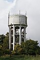 Water Tower, Horn Hill, Whitwell - geograph.org.uk - 5566639.jpg 1,065 × 1,600; 479 KB
-
 Water Tower, Whitwell - geograph.org.uk - 3859870.jpg 640 × 480; 72 KB
-
 Watercress beds, Whitwell - geograph.org.uk - 3086837.jpg 2,048 × 1,360; 928 KB
-
 Watercress beds, Whitwell - geograph.org.uk - 3087103.jpg 2,048 × 1,360; 1.86 MB
-
 Whitwell and the valley of the River Mimram - geograph.org.uk - 4283667.jpg 3,264 × 2,448; 3.83 MB
-
 Whitwell from the air - geograph.org.uk - 3453291.jpg 640 × 480; 126 KB
-
 Whitwell from the air - geograph.org.uk - 5844937.jpg 3,264 × 2,448; 2.54 MB
-
 Whitwell Post Office and stores - geograph.org.uk - 3859879.jpg 640 × 480; 72 KB
-
 Whitwell water tower - geograph.org.uk - 5999001.jpg 2,048 × 1,536; 1,014 KB
-
 Whitwell water tower - geograph.org.uk - 6825855.jpg 768 × 1,024; 593 KB


.jpg)
.jpg)


_-_geograph.org.uk_-_3859878.jpg)


.jpg)


.jpg)


.jpg)


.jpg)


