Category:St Fagans
Jump to navigation
Jump to search
community in the west of the city of Cardiff, Wales  St Mary's Church, St Fagans. .svg) | |||||
| Upload media | |||||
| Instance of | |||||
|---|---|---|---|---|---|
| Location | Cardiff, Wales | ||||
| Population |
| ||||
 | |||||
Cymraeg: Mae Sain Ffagan yn bentref ar gyrion Caerdydd, prifddinas Cymru. Rhed Afon Elai trwy'r pentref. Yn y castell a'i barcdir ceir Amgueddfa Werin Cymru. Daw'r enw o enw'r sant chwedlonol Ffagan, sy'n ymddangos yng ngwaith Sieffre o Fynwy.
Mae'r Categori yma yn ymwneud â phentref Sain Ffagan yn unig, ac nid Amgueddfa Werin Cymru.
Mae'r Categori yma yn ymwneud â phentref Sain Ffagan yn unig, ac nid Amgueddfa Werin Cymru.
Subcategories
This category has the following 7 subcategories, out of 7 total.
2
- August 2019 in St Fagans (34 F)
L
M
N
O
- St Fagans Old Rectory (1 F)
P
- Plasdwr (14 F)
S
- St Fagans level crossing (6 F)
Media in category "St Fagans"
The following 200 files are in this category, out of 249 total.
(previous page) (next page)-
 2010 Wales Cardiff Community St Fagans map.svg 512 × 546; 341 KB
-
 2024 Wales Cardiff Community St Fagans map.svg 512 × 546; 319 KB
-
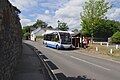 320 Bus at St Fagans.jpg 1,200 × 800; 226 KB
-

-
 A4232 crossing the Cardiff-Swansea railway - geograph.org.uk - 5888194.jpg 1,024 × 775; 125 KB
-
 A4232 east of Sant-y-Nyll - geograph.org.uk - 5888203.jpg 1,024 × 756; 121 KB
-
 A4232 heads south from the M4 - geograph.org.uk - 5249050.jpg 640 × 513; 52 KB
-
 A4232 Link Road - geograph.org.uk - 4833493.jpg 5,472 × 3,648; 7.76 MB
-
 A4232 south of M4 junction 33 - geograph.org.uk - 3126133.jpg 640 × 392; 47 KB
-
 A4232 west of St Fagans - geograph.org.uk - 5888199.jpg 1,024 × 743; 108 KB
-
 Abernodwydd Farmhouse, St Fagans Museum, Cardiff - geograph.org.uk - 5897421.jpg 3,912 × 2,715; 4.25 MB
-
-
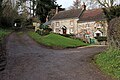
 Access road to St Fagans Museum - geograph.org.uk - 3126143.jpg 640 × 426; 38 KB
-

-
 Advance sign for junction 33 of M4 westbound - geograph.org.uk - 5819818.jpg 1,600 × 1,067; 745 KB
-
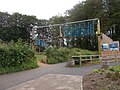 Adventure Playground - St Fagan's Museum - geograph.org.uk - 6199789.jpg 1,024 × 768; 260 KB
-

-
 Battle Field (50682218642).jpg 4,032 × 1,960; 4.13 MB
-
 Beech Avenue (50682147056).jpg 4,032 × 1,960; 3.79 MB
-
 Bridleway sign near Radyr, Cardiff - geograph.org.uk - 4373705.jpg 800 × 762; 161 KB
-

-
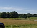
 Cardiff , Grassy Field - geograph.org.uk - 6115646.jpg 6,000 × 4,000; 5.33 MB
-
 Cardiff , The A4232 - geograph.org.uk - 6115647.jpg 6,000 × 4,000; 6.48 MB
-
 Cardiff , The A4232 - geograph.org.uk - 6115648.jpg 6,000 × 4,000; 6.55 MB
-
 Cardiff , The A4232 - geograph.org.uk - 6115649.jpg 6,000 × 4,000; 7.47 MB
-
 Cardiff , The A4232 - geograph.org.uk - 6115650.jpg 6,000 × 4,000; 7.47 MB
-
 Cardiff , The A4232 - geograph.org.uk - 6115651.jpg 6,000 × 4,000; 6.71 MB
-
 Cardiff , The M4 Motorway - geograph.org.uk - 3926541.jpg 4,288 × 2,848; 4.92 MB
-
 Cardiff , The M4 Motorway - geograph.org.uk - 3926542.jpg 4,288 × 2,848; 4.22 MB
-
 Cardiff , The M4 Motorway - geograph.org.uk - 3928392.jpg 4,288 × 2,848; 4.95 MB
-
 Cardiff , The M4 Motorway - geograph.org.uk - 3928395.jpg 4,288 × 2,848; 6.11 MB
-
 Cardiff UK community map (St Fagans).svg 1,187 × 1,266; 438 KB
-
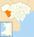
 Cardiff ward location - Creigiau St Fagans.png 800 × 571; 176 KB
-
 Cart shed, St Fagans National History Museum - geograph.org.uk - 5493692.jpg 5,179 × 3,451; 5.42 MB
-

-
 Castle Hill Court, St Fagans - geograph.org.uk - 3910750.jpg 800 × 553; 127 KB
-
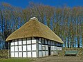
 Cilewent Farmhouse, Museum of Welsh Life, St Fagans - geograph.org.uk - 5370958.jpg 4,000 × 3,000; 6.38 MB
-
 Cistern, St Fagans Castle, Cardiff - geograph.org.uk - 5897590.jpg 3,344 × 2,806; 3.93 MB
-
 Civil War battlefield - geograph.org.uk - 6188749.jpg 2,048 × 1,536; 1,019 KB
-
-

-
 Cottages on Castle Hill - geograph.org.uk - 4833698.jpg 5,472 × 3,648; 7.72 MB
-
 Crofft-y-geneau Road looking south - geograph.org.uk - 2223023.jpg 640 × 480; 64 KB
-
 Derelict outbuildings, Michaelston-super-Ely - geograph.org.uk - 2362451.jpg 4,000 × 3,000; 2.86 MB
-
 Derwen Bakehouse - St Fagan's Museum - geograph.org.uk - 6199303.jpg 1,024 × 778; 222 KB
-

-
 Distorted boundary sign, St Fagans - geograph.org.uk - 3886407.jpg 800 × 627; 213 KB
-
 Disused Railway Bridge - geograph.org.uk - 4833507.jpg 5,472 × 3,648; 6.28 MB
-

-
 Disused Railway Embankment - geograph.org.uk - 4833599.jpg 5,472 × 3,648; 6.41 MB
-
 Driveway to Slanwood Boarding Kennels - geograph.org.uk - 2082019.jpg 2,816 × 2,112; 1.82 MB
-
 Driveway to Tregyrnog - geograph.org.uk - 4833500.jpg 5,472 × 3,648; 7.05 MB
-
 Duke of Gloucester near St. Fagans - geograph.org.uk - 1923756.jpg 640 × 480; 92 KB
-
 Dutch garden, St Fagans Castle - geograph.org.uk - 5936859.jpg 5,179 × 3,451; 5.73 MB
-
 East along the Ely Trail, St Fagans - geograph.org.uk - 3910737.jpg 800 × 703; 179 KB
-
 East Gate, St Fagans Castle, Cardiff - geograph.org.uk - 5897599.jpg 3,103 × 2,595; 2.63 MB
-
 Eastern boundary of St Fagans - geograph.org.uk - 3787516.jpg 800 × 613; 153 KB
-
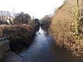
 Ely downstream from St Fagans Bridge - geograph.org.uk - 3911719.jpg 800 × 600; 213 KB
-
 Ely River - geograph.org.uk - 4833695.jpg 5,472 × 3,648; 7.79 MB
-
 Ely Trail St Fagans.JPG 2,058 × 1,452; 1.01 MB
-
 Ely Trail, Cardiff - geograph.org.uk - 1923760.jpg 640 × 480; 70 KB
-
 Ely Trail, St Fagans, Cardiff.jpg 1,000 × 750; 236 KB
-
 Ely upstream from St Fagans Bridge - geograph.org.uk - 3911706.jpg 800 × 600; 169 KB
-
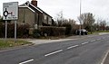
 End of the 40 zone near Radyr, Cardiff - geograph.org.uk - 4373808.jpg 800 × 591; 123 KB
-
 Entering Cardiff at junction 33 on the M4 - geograph.org.uk - 4321726.jpg 1,600 × 1,200; 1.06 MB
-
 Entrance to Penhefyd Farm, St Fagans - geograph.org.uk - 3886411.jpg 798 × 800; 267 KB
-
 Farm track across two bridges - geograph.org.uk - 4145502.jpg 4,000 × 3,000; 4.82 MB
-
 Farmland, St Fagans, Cardiff - geograph.org.uk - 4591623.jpg 800 × 612; 142 KB
-

-
 Fields on the edge of Pentrebane, Cardiff - geograph.org.uk - 2084968.jpg 2,816 × 2,112; 1.62 MB
-

-
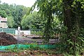
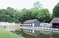 Fish Rearing Pool, St Fagans Museum, Cardiff - geograph.org.uk - 5897492.jpg 2,846 × 1,817; 1.28 MB
-
 Footbridge, Gweithdy, St Fagans National History Museum - geograph.org.uk - 5491655.jpg 5,184 × 3,456; 5.36 MB
-
 Footpath near St. Fagans - geograph.org.uk - 2082024.jpg 2,112 × 2,816; 2.72 MB
-
 Footpath, Michaelston-super-Ely - geograph.org.uk - 2362478.jpg 4,000 × 3,000; 3.96 MB
-
 Forecourt, St Fagans Museum, Cardiff - geograph.org.uk - 5897610.jpg 3,787 × 2,985; 3.48 MB
-

-
 Former railway bridge on A4119 - geograph.org.uk - 2081997.jpg 2,816 × 2,112; 2.48 MB
-

-

-
 Gardens at St Fagan's Castle - geograph.org.uk - 6449050.jpg 1,800 × 1,199; 578 KB
-

-
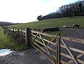
 Gateway and track to Stockland Farm - geograph.org.uk - 1516427.jpg 640 × 480; 79 KB
-
 Gorse Mill, St Fagans National History Museum - geograph.org.uk - 5689445.jpg 1,024 × 768; 1.41 MB
-
 Grade II listed Hill Cottage, St Fagans - geograph.org.uk - 3910679.jpg 800 × 521; 129 KB
-

-

-
 Greenhouses St Fagans - geograph.org.uk - 4854420.jpg 640 × 428; 107 KB
-
 Gwalia Stores and Photographer's Shop, St. Fagans - geograph.org.uk - 5269944.jpg 1,600 × 1,200; 414 KB
-
 Gweithdy, St Fagans National History Museum - geograph.org.uk - 5689397.jpg 1,024 × 768; 1.03 MB
-
 GWR Swansea to Cardiff line - geograph.org.uk - 4835020.jpg 3,648 × 5,472; 6.68 MB
-
 Hayshed, St Fagans National History Museum - geograph.org.uk - 5693527.jpg 1,024 × 768; 1.14 MB
-
 Hendre-wen barn (2), St Fagans N H Museum - geograph.org.uk - 5936736.jpg 5,184 × 3,456; 5.17 MB
-
 Hendre-wen barn, St Fagans National History Museum - geograph.org.uk - 5936722.jpg 5,184 × 3,456; 5.85 MB
-

-
 Inside Maestir School at St Fagan's Museum - geograph.org.uk - 6199292.jpg 1,024 × 825; 128 KB
-

-
 Kennixton Farmhouse, St Fagans Museum, Cardiff - geograph.org.uk - 5897458.jpg 2,616 × 2,394; 1.94 MB
-
 Kiln, St Fagans National History Museum - geograph.org.uk - 5936396.jpg 5,179 × 3,451; 4.7 MB
-

-

-
 Level crossing warning sign, St Fagans - geograph.org.uk - 3910709.jpg 800 × 718; 156 KB
-

-

-

-
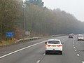
 M4 approaching J33 - geograph.org.uk - 3683067.jpg 640 × 430; 39 KB
-
 M4 at Junction 33 - geograph.org.uk - 3683069.jpg 640 × 430; 37 KB
-
 M4 at Junction 33 - geograph.org.uk - 4138284.jpg 800 × 493; 53 KB
-
 M4 eastbound at Junction 33 - geograph.org.uk - 3274069.jpg 640 × 481; 46 KB
-
 M4 eastbound at junction 33 - geograph.org.uk - 4321736.jpg 1,600 × 1,200; 1,018 KB
-
 M4 eastbound towards junction 32 - geograph.org.uk - 4321773.jpg 1,600 × 1,221; 904 KB
-
 M4 Motorway Junction 33 - geograph.org.uk - 2455861.jpg 640 × 480; 85 KB
-
 M4 near Jct 33 - geograph.org.uk - 2441641.jpg 2,816 × 2,112; 1.78 MB
-
 M4 passes under Llantrisant Road - geograph.org.uk - 3274076.jpg 640 × 480; 47 KB
-
 M4, J33 overbridges - geograph.org.uk - 3683070.jpg 640 × 430; 33 KB
-
 M4, westbound - geograph.org.uk - 3683059.jpg 640 × 430; 42 KB
-
 M4, westbound - geograph.org.uk - 3683064.jpg 640 × 430; 39 KB
-
-
 Maes-y-llech Farm near Radyr, Cardiff - geograph.org.uk - 4373852.jpg 800 × 574; 123 KB
-
 Medieval House, St Fagans Museum, Cardiff - geograph.org.uk - 5896862.jpg 4,012 × 3,009; 3.16 MB
-
 Mews, St Fagans Castle, Cardiff - geograph.org.uk - 5897614.jpg 3,963 × 2,972; 2.81 MB
-

-
 Miners' Institute, St Fagans Museum, Cardiff - geograph.org.uk - 5896607.jpg 3,567 × 2,765; 3.16 MB
-
 Miners' Institute, St Fagans Museum, Cardiff - geograph.org.uk - 5896633.jpg 3,776 × 3,024; 1.99 MB
-
 Miners' Institute, St Fagans Museum, Cardiff - geograph.org.uk - 5896689.jpg 3,369 × 2,907; 1.71 MB
-
 Minor Road - geograph.org.uk - 5411254.jpg 3,264 × 2,448; 1.28 MB
-
 Minor road to Radyr, Cardiff - geograph.org.uk - 4373819.jpg 800 × 504; 102 KB
-
 Missing railway bridge near St. Fagans - geograph.org.uk - 2082029.jpg 2,816 × 2,112; 2.3 MB
-
 Nant Y Drope, Cardiff - geograph.org.uk - 2162579.jpg 640 × 480; 69 KB
-
 Nantwallter Cottage, St Fagans Museum, Cardiff - geograph.org.uk - 5897410.jpg 3,885 × 2,913; 4.37 MB
-

-
 North across St Fagans Bridge, St Fagans - geograph.org.uk - 3911685.jpg 800 × 581; 194 KB
-
 North West of St Fagans National History Museum - geograph.org.uk - 4605101.jpg 3,072 × 2,304; 1.95 MB
-

-

-
 Ordnance Survey Cut Mark - geograph.org.uk - 5947750.jpg 787 × 1,024; 171 KB
-
 Ordnance Survey Cut Mark - geograph.org.uk - 5947754.jpg 1,024 × 682; 282 KB
-
 Ordnance Survey Flush Bracket (G3713) - geograph.org.uk - 5947759.jpg 936 × 1,024; 218 KB
-
 Ordnance Survey Flush Bracket (S9120) - geograph.org.uk - 6308248.jpg 807 × 1,024; 271 KB
-
 Path to Plymouth Great Wood, Cardiff - geograph.org.uk - 3911016.jpg 800 × 600; 190 KB
-

-

-
 Pentrebane Road - geograph.org.uk - 4833677.jpg 5,472 × 3,648; 5.02 MB
-
 Persondy Lane, Michaelston-super-Ely - geograph.org.uk - 2362491.jpg 4,000 × 3,000; 2.9 MB
-
 Pigsty, St Fagans National Museum, Cardiff - geograph.org.uk - 5896540.jpg 2,822 × 2,850; 2.2 MB
-
 Police layby on the M4 eastbound, east of junction 33 - geograph.org.uk - 4321771.jpg 1,600 × 1,200; 1.1 MB
-
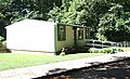 Prefab house, St Fagans Museum, Cardiff - geograph.org.uk - 5896735.jpg 3,517 × 2,126; 2.27 MB
-

-
 Rail over Rail - geograph.org.uk - 2581658.jpg 2,560 × 1,920; 963 KB
-
 Rear of Gwalia Stores, St Fagans National History Museum - geograph.org.uk - 5490687.jpg 5,184 × 3,456; 4.99 MB
-
 Rebuilding The Vulcan Hotel - geograph.org.uk - 6233281.jpg 5,048 × 3,366; 4.8 MB
-
 Reconstructed boundary wall, Llys Llwelyn - geograph.org.uk - 6233163.jpg 5,179 × 3,451; 5.22 MB
-
 River Ely at St. Fagan's - geograph.org.uk - 1951390.jpg 480 × 640; 101 KB
-
 Riverside Cottage, St Fagans - geograph.org.uk - 3910771.jpg 679 × 800; 203 KB
-
 Road bridge on A4119 - geograph.org.uk - 5943882.jpg 2,448 × 3,264; 3.06 MB
-
 Road bridge over Barry Railway - geograph.org.uk - 1935040.jpg 3,648 × 2,736; 4.17 MB
-
 Road bridge over Taff Vale Railway - geograph.org.uk - 2581633.jpg 2,560 × 1,920; 861 KB
-
 Road north from St Fagans - geograph.org.uk - 3886409.jpg 800 × 645; 166 KB
-

-
 Roadworks on the A4119 - geograph.org.uk - 5755886.jpg 3,264 × 2,448; 2.98 MB
-
 Rosery, St Fagans Castle - geograph.org.uk - 5936873.jpg 5,048 × 3,366; 5.3 MB
-
 Roundabout and Housing - geograph.org.uk - 5411276.jpg 2,907 × 2,180; 1.47 MB
-
 Route Map (50681377728).jpg 4,752 × 3,168; 5.66 MB
-
 Route of dismantled railway west of Cardiff - geograph.org.uk - 2082014.jpg 2,112 × 2,816; 2.5 MB
-
 Row of 3 cottages, St Fagans - geograph.org.uk - 3886438.jpg 800 × 529; 126 KB
-

-

-
 Sain Ffagan - St Fagans - geograph.org.uk - 4388311.jpg 640 × 480; 99 KB
-
 Site of Battle of St.Fagans - geograph.org.uk - 4833514.jpg 5,472 × 3,648; 4.66 MB
-
 Site of the Battle of St Fagans - geograph.org.uk - 2395992.jpg 640 × 480; 78 KB
-
-
 Slip road from M4 J33 onto A4232 southbound - geograph.org.uk - 5819824.jpg 1,600 × 961; 526 KB
-
-
 St Fagan's Castle (4785956).jpg 1,157 × 678; 206 KB
-
 St Fagan's Castle - geograph.org.uk - 6449048.jpg 1,800 × 1,200; 333 KB
-
 St Fagan's Castle - geograph.org.uk - 6614310.jpg 5,152 × 3,161; 5.44 MB
-
 St Fagan's Castle - Kitchen - geograph.org.uk - 6614326.jpg 3,864 × 5,152; 5.43 MB
-
 St Fagans - Abernodwydd Farmhouse - geograph.org.uk - 6615946.jpg 4,670 × 3,406; 7.32 MB
-
 St Fagans - Formal Gardens - geograph.org.uk - 6614156.jpg 5,152 × 3,864; 7.06 MB
-
 St Fagans - Gwalia Stores - geograph.org.uk - 6615898.jpg 4,480 × 3,548; 7.77 MB
-
 St Fagans - Kennixton Farmhouse - geograph.org.uk - 6615747.jpg 4,717 × 3,003; 5.45 MB
-
 St Fagans - Maestir School - geograph.org.uk - 6615931.jpg 5,152 × 3,595; 5.62 MB
-
 St Fagans - Modern Sculpture - geograph.org.uk - 6615736.jpg 3,454 × 3,359; 5.83 MB
-
 St Fagans - Museum Gardens - geograph.org.uk - 6614161.jpg 5,152 × 3,864; 5.96 MB
-
 St Fagans - Noah's Ark - geograph.org.uk - 6615830.jpg 4,986 × 3,445; 6.62 MB
-
 St Fagans - Nostalgia - geograph.org.uk - 6615915.jpg 5,152 × 3,864; 6.66 MB
-
 St Fagans - Oakdale Library - geograph.org.uk - 6615893.jpg 5,152 × 3,864; 5.47 MB
-
 St Fagans - Oakdale Workmen's Institute - geograph.org.uk - 6615882.jpg 4,496 × 3,738; 7.03 MB
-
 St Fagans - Parish Church - geograph.org.uk - 6614340.jpg 4,307 × 3,066; 7.35 MB
-
 St Fagans - Penfold Post Box - geograph.org.uk - 6614145.jpg 2,576 × 4,782; 5.76 MB
-
 St Fagans - St Teilo's Church - geograph.org.uk - 6615807.jpg 4,725 × 2,916; 6.68 MB
-
 St Fagans - St Teilo's Church - geograph.org.uk - 6615819.jpg 5,152 × 3,864; 6.83 MB
-
 St Fagans - St Teilo's Font - geograph.org.uk - 6615865.jpg 3,526 × 4,614; 5.7 MB
-
 St Fagans - St Teilo's Font Cover - geograph.org.uk - 6615839.jpg 4,678 × 2,995; 5.15 MB
-
 St Fagans - Tollhouse - geograph.org.uk - 6615937.jpg 5,002 × 3,461; 7.01 MB
-
 St Fagans - Wild Flowers - geograph.org.uk - 6615712.jpg 2,552 × 2,205; 2.99 MB
-
 St Fagans and around, August 2019 12.jpg 4,032 × 3,024; 3.07 MB
-
 St Fagans Castle Gardens - geograph.org.uk - 6614300.jpg 5,152 × 3,864; 7.27 MB
-
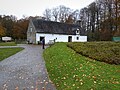
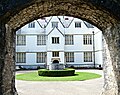
 St Fagans Castle, St Fagans Museum, Cardiff - geograph.org.uk - 5897563.jpg 3,621 × 2,795; 2.04 MB
-
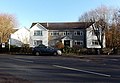
 St Fagans Cricket ^ Bowls Club - geograph.org.uk - 3886410.jpg 800 × 511; 144 KB


.jpg)
.jpg)


,_St_Fagans_N_H_Museum_-_geograph.org.uk_-_5936736.jpg)


_-_geograph.org.uk_-_5947759.jpg)
_-_geograph.org.uk_-_6308248.jpg)


.jpg)


.jpg)


