Category:St Enoder's Church, St Enoder
Jump to navigation
Jump to search
| Object location | | View all coordinates using: OpenStreetMap |
|---|
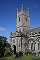
church in Cornwall, England, UK  | |||||
| Upload media | |||||
| Instance of | |||||
|---|---|---|---|---|---|
| Dedicated to |
| ||||
| Location | St Enoder, Cornwall, South West England, England | ||||
| Diocese | |||||
| Heritage designation |
| ||||
| Inception |
| ||||
| Religion or worldview | |||||
| official website | |||||
 | |||||
Subcategories
This category has only the following subcategory.
S
Media in category "St Enoder's Church, St Enoder"
The following 4 files are in this category, out of 4 total.
-
 Cross In Churchyard.jpg 3,987 × 5,981; 10.58 MB
-
 St Enoder Church - another view - geograph.org.uk - 229674.jpg 640 × 427; 130 KB
-
 St Enoder Church - geograph.org.uk - 229670.jpg 427 × 640; 92 KB
-
 St Enoder's Parish Church - geograph.org.uk - 2859225.jpg 640 × 426; 109 KB


