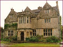
Category:St Catherine, Somerset
Jump to navigation
Jump to search
English: St Catherine is a small village and civil parish in the Bath and North East Somerset unitary authority, Somerset, England.
village and civil parish in Somerset, England, UK | |||||
| Upload media | |||||
| Instance of | |||||
|---|---|---|---|---|---|
| Location | Bath and North East Somerset, Somerset, South West England, England | ||||
| Population |
| ||||
 | |||||
Subcategories
This category has the following 4 subcategories, out of 4 total.
Media in category "St Catherine, Somerset"
The following 65 files are in this category, out of 65 total.
-
A gate with stile - geograph.org.uk - 4649824.jpg 2,304 × 1,704; 1.71 MB
-
A line of three - geograph.org.uk - 4655070.jpg 2,304 × 1,704; 1.81 MB
-
A small window in St Catherine's - geograph.org.uk - 5163982.jpg 1,704 × 2,304; 1.98 MB
-
A stile that has gone out of fashion - geograph.org.uk - 4649834.jpg 2,304 × 1,704; 1.75 MB
-
Ayford Bridge - geograph.org.uk - 2071250.jpg 2,272 × 1,704; 2.89 MB
-
Ayford Farm - geograph.org.uk - 440685.jpg 640 × 460; 97 KB
-
Byway adjoining Downedge - geograph.org.uk - 470358.jpg 480 × 640; 108 KB
-
Down to ground level - geograph.org.uk - 4655032.jpg 2,304 × 1,704; 1.7 MB
-
Downland above St Catherine's valley - geograph.org.uk - 4705560.jpg 3,128 × 2,346; 1.19 MB
-
Edge of the runway - geograph.org.uk - 4651155.jpg 2,304 × 1,704; 1.67 MB
-
Fewells and Dicknick Woods - geograph.org.uk - 5163962.jpg 2,304 × 1,704; 1.59 MB
-
Field of barley, St Catherine - geograph.org.uk - 479030.jpg 640 × 480; 148 KB
-
Flowers where there used to be flyers - geograph.org.uk - 4655037.jpg 2,304 × 1,704; 1.54 MB
-
Flying to the horizon - geograph.org.uk - 4652512.jpg 2,304 × 1,704; 1.65 MB
-
Following an old line - geograph.org.uk - 4654108.jpg 2,304 × 1,704; 1.42 MB
-
Footpaths across the old airfield - geograph.org.uk - 4652498.jpg 1,704 × 2,304; 1.63 MB
-
General purpose barn near The Hermitage - geograph.org.uk - 1608996.jpg 640 × 515; 323 KB
-
Grazing cattle, St Catherine - geograph.org.uk - 1755253.jpg 640 × 480; 146 KB
-
Is this St. Catherine's Court^ - geograph.org.uk - 1608970.jpg 640 × 462; 203 KB
-
Lane in St. Catherine's Valley - geograph.org.uk - 1608924.jpg 640 × 515; 227 KB
-
Lane through St.Catherine's Valley - geograph.org.uk - 1608978.jpg 640 × 455; 242 KB
-
Late autumn in St. Catherine's valley - geograph.org.uk - 1608986.jpg 640 × 505; 222 KB
-
Leaving a mark on the tower - geograph.org.uk - 5163979.jpg 1,704 × 2,304; 1.71 MB
-
Left out in the field - geograph.org.uk - 4649891.jpg 2,304 × 1,704; 1.7 MB
-
Leigh Lane in the rain - geograph.org.uk - 1591099.jpg 640 × 455; 292 KB
-
Lodge Farm, St Catharine's - geograph.org.uk - 315876.jpg 626 × 433; 134 KB
-
Longley Wood - geograph.org.uk - 440682.jpg 640 × 459; 69 KB
-
Oldhouse Farm, St.Catherine's Valley - geograph.org.uk - 871491.jpg 640 × 435; 86 KB
-
Parish notice board and EIIR postbox - geograph.org.uk - 1608933.jpg 640 × 505; 226 KB
-
Path to the valley - geograph.org.uk - 5163964.jpg 2,304 × 1,704; 2.1 MB
-
Perimeter track of Charmy Down airfield (disused) - geograph.org.uk - 4705563.jpg 3,128 × 2,346; 1.31 MB
-
Pillboxes on Charmy Airfield - geograph.org.uk - 1811115.jpg 1,872 × 1,244; 316 KB
-
Poppies by the mast - geograph.org.uk - 4649898.jpg 1,704 × 2,304; 1.75 MB
-
Radford Farm, St.Catherine's Valley - geograph.org.uk - 875626.jpg 640 × 427; 96 KB
-
Rotor Radar Station - geograph.org.uk - 1811252.jpg 1,600 × 1,063; 447 KB
-
Scarlet sentry - geograph.org.uk - 4651171.jpg 1,704 × 2,304; 1.19 MB
-
St Catharine's valley - geograph.org.uk - 315874.jpg 640 × 434; 50 KB
-
St Catherine's benchmark - geograph.org.uk - 5160867.jpg 2,304 × 1,704; 1.61 MB
-
St Catherine's Brook valley - geograph.org.uk - 2071262.jpg 2,272 × 1,704; 1.84 MB
-
St Catherine's church - geograph.org.uk - 5160881.jpg 2,304 × 1,704; 1.66 MB
-
St Catherine's Valley - geograph.org.uk - 800356.jpg 640 × 457; 128 KB
-
St. Catherine's Valley - geograph.org.uk - 874640.jpg 640 × 502; 97 KB
-
Steepsided downland grazing - geograph.org.uk - 4705552.jpg 3,128 × 2,346; 1.19 MB
-
Still a landing ground - geograph.org.uk - 4654992.jpg 2,304 × 1,704; 1.7 MB
-
The Hermitage - geograph.org.uk - 315881.jpg 618 × 466; 208 KB
-
Track on Holts Down - geograph.org.uk - 756808.jpg 640 × 465; 114 KB
-
Vehicle barrier on Holts Down Byway - geograph.org.uk - 3498517.jpg 2,592 × 1,944; 1.62 MB
-
Water at the church - geograph.org.uk - 5163967.jpg 1,704 × 2,304; 2.24 MB


