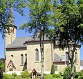
Category:St. Antonius (Reichshof)
Jump to navigation
Jump to search
| Object location | | View all coordinates using: OpenStreetMap |
|---|
| Upload media | |||||
| Instance of | |||||
|---|---|---|---|---|---|
| Location | Denklingen, Reichshof, Oberbergischer Kreis, Cologne Government Region, North Rhine-Westphalia, Germany | ||||
| Heritage designation | |||||
 | |||||
Media in category "St. Antonius (Reichshof)"
The following 2 files are in this category, out of 2 total.
-
 Denklingen, Kirche Sankt Antonius.jpg 2,636 × 2,522; 1.53 MB
-
 Reichshof Denklingen - Hauptstraße + St. Antonius 01 ies.jpg 5,616 × 3,744; 16.04 MB

