Category:Spurn Point pilot station
Jump to navigation
Jump to search
Media in category "Spurn Point pilot station"
The following 14 files are in this category, out of 14 total.
-
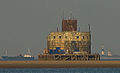 Haile-Sand-Fort.jpg 1,141 × 693; 111 KB
-
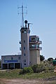
 Humber Pilot Station - geograph.org.uk - 621942.jpg 640 × 427; 60 KB
-
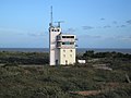
 Humber VTS - geograph.org.uk - 1358380.jpg 423 × 640; 104 KB
-
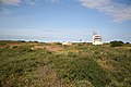
 HumberVTS.JPG 2,592 × 3,872; 3.33 MB
-
 Panoramic view of Spurn Point - geograph.org.uk - 1096081.jpg 640 × 360; 42 KB
-
 Pilot and lifeboat station, Spurn Point - geograph.org.uk - 3203159.jpg 1,024 × 768; 111 KB
-
 Pilot Station at Spurn Point - geograph.org.uk - 3124047.jpg 640 × 427; 65 KB
-
 Pilot Station, Spurn Point - geograph.org.uk - 307776.jpg 640 × 476; 69 KB
-
 Single handed - geograph.org.uk - 1320387.jpg 640 × 480; 51 KB
-
 Spurn 3.jpg 3,072 × 2,304; 2.72 MB
-
 Spurn Head - geograph.org.uk - 1469333.jpg 640 × 480; 52 KB
-
 Spurn Point - east side - geograph.org.uk - 1353004.jpg 640 × 427; 274 KB
-
 Spurn Point - geograph.org.uk - 622516.jpg 640 × 427; 66 KB
-
 Spurn Point Lighthouse - geograph.org.uk - 10472.jpg 640 × 480; 45 KB


