Category:Spanish-language SVG maps showing history of North America
Jump to navigation
Jump to search
Subcategories
This category has the following 5 subcategories, out of 5 total.
Media in category "Spanish-language SVG maps showing history of North America"
The following 10 files are in this category, out of 10 total.
-
Borders proposed by the Count of Aranda-es.svg 983 × 639; 3.21 MB
-
Expansión territorial de Rusia.svg 1,944 × 1,511; 948 KB
-
Mapa del Virreinato de la Nueva España (1794).svg 885 × 758; 1.41 MB
-
Mapa del Virreinato de la Nueva España (1819).svg 885 × 664; 1.06 MB
-
Maya civilization location map - geography(1).svg 1,800 × 1,500; 1.52 MB
-
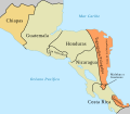
Provincias Unidas de Centroamérica 1823.svg 1,209 × 1,053; 116 KB
-
PROVINCIAS YUCATÁN 1549.svg 1,768 × 1,981; 246 KB
-
Spanish North America.svg 5,088 × 5,084; 16.3 MB
-
Voyages of Ilya Voznesensky (1840-1848) - es.svg 1,482 × 1,086; 1,011 KB
-
War of Jenkins' Ear map-es.svg 484 × 563; 124 KB


