Category:Spanish-language SVG maps of Antarctica
Jump to navigation
Jump to search
Media in category "Spanish-language SVG maps of Antarctica"
The following 13 files are in this category, out of 13 total.
-
Antarctica and the Southern Ocean-es.svg 2,373 × 2,768; 162 KB
-
Antarctica Farthest Souths-es.svg 1,144 × 1,289; 78 KB
-
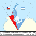
Disputa antártica entre Argentina y Chile (1946-presente).svg 728 × 845; 782 KB
-
Gobernación de la Terra Australis (1539-1555), España.svg 744 × 1,219; 1.67 MB
-
Governorate of Terra Australis (1539-1555), Spain.svg 744 × 1,219; 1.67 MB
-
James Caird es.svg 900 × 800; 116 KB
-
James Ross ESP.svg 503 × 621; 4.33 MB
-
MaresAntárticos.svg 1,941 × 1,542; 121 KB
-
Ross Island Mapa topografico ESP.svg 1,510 × 1,211; 418 KB
-
Territorio Chileno Antártico y la Antártida Argentina según Chile.svg 727 × 720; 972 KB


