Category:Spalt
Jump to navigation
Jump to search
municipality of Germany | |||||
| Upload media | |||||
| Pronunciation audio | |||||
|---|---|---|---|---|---|
| Instance of |
| ||||
| Part of |
| ||||
| Location | Roth, Middle Franconia, Bavaria, Germany | ||||
| Population |
| ||||
| Area |
| ||||
| Elevation above sea level |
| ||||
| Different from | |||||
| official website | |||||
 | |||||
Subcategories
This category has the following 10 subcategories, out of 10 total.
Media in category "Spalt"
The following 16 files are in this category, out of 16 total.
-
DEU Spalt COA.svg 979 × 1,068; 25 KB
-
Wappen von Spalt.png 196 × 206; 8 KB
-
Bad Sauerbrunn Partnergemeinde Spalt.jpg 2,048 × 3,072; 5.14 MB
-
Blick auf das Plateau von Burg Sandeskron.jpg 4,931 × 3,288; 5.37 MB
-
Die Befestigung der Alten Bürg im Norden.jpg 4,354 × 2,903; 4.4 MB
-
Franken, Spalt - geo.hlipp.de - 5027.jpg 640 × 480; 83 KB
-
Fußgängerbrücke über die Rezat - panoramio.jpg 2,000 × 1,398; 954 KB
-
Gebetbuch von Michael Ottmann für Kreszentia Topf.jpg 1,481 × 1,217; 1.03 MB
-
Keilberg (Spalt) Luftaufnahme (2020).jpg 4,056 × 3,040; 4.88 MB
-
Riesen-Holzstühle zum Relaxen - panoramio.jpg 2,499 × 1,706; 752 KB
-
Spalt - Versendungskarte über einen Ballen Hopfen - 1907.jpg 605 × 471; 81 KB
-
Spalt BarefootPark kerscher03.jpg 2,382 × 1,790; 817 KB
-
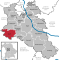
Spalt im Lk Roth.png 390 × 391; 18 KB
-
Spalt in RH.svg 592 × 607; 1.05 MB
-
Spalt Stadtansicht.jpg 4,626 × 2,600; 6.97 MB
-
Spalt von Süden.jpg 4,626 × 2,600; 6.68 MB


