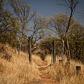
Category:Southwest Australia Savanna Ecoregion
Jump to navigation
Jump to search
terrestrial ecoregion in Western Australia | |||||
| Upload media | |||||
| Instance of | |||||
|---|---|---|---|---|---|
| Location | |||||
| Has part |
| ||||
 | |||||
The Southwest Australia Savanna Ecoregion is a designated ecoregion by WWF and One Earth. It is classified as a Mediterranean Forests, Woodlands & Scrub Biome. It is one of eight ecoregions in the South Australian Mediterranean Forests, Woodlands & Scrub Bioregion.
Subcategories
This category has the following 22 subcategories, out of 22 total.
A
B
- Badgingarra National Park (37 F)
- Boyagin Nature Reserve (41 F)
C
- Corrigin Nature Reserve (8 F)
D
- Damboring Nature Reserve (2 F)
- Dumbleyung Lake (6 F)
E
- Edel Land National Park (4 F)
F
G
- Gorge Rock Nature Reserve (13 F)
H
- Hutt Lagoon (8 F)
K
L
- Lake Ewlyamartup (8 F)
- Leaning Tree, Greenough (10 F)
P
- Parkeyerring Lake (19 F)
- Puntapin Rock (3 F)
T
- Tathra National Park (1 F)
W
- Watheroo National Park (13 F)
Media in category "Southwest Australia Savanna Ecoregion"
The following 43 files are in this category, out of 43 total.
-
.00 2745 West Australian coastal road "Brand Highway".jpg 4,500 × 3,000; 13.09 MB
-
Acacia acanthaster habit.jpg 4,800 × 3,200; 12.95 MB
-
Acacia acanthaster large.jpg 4,800 × 3,200; 9.64 MB
-
Bootenal Springs.JPG 2,432 × 3,648; 2.14 MB
-
Brand Hwy 194 S Warradarge.jpg 1,600 × 1,200; 583 KB
-
Clackline gnangarra-1.jpg 4,928 × 3,264; 13.13 MB
-
Coastline - panoramio - Halooch (2).jpg 4,288 × 2,848; 5.7 MB
-
Cottage ruins - panoramio.jpg 1,920 × 1,113; 787 KB
-
Culham gnangarra 041021-10.jpg 11,110 × 3,831; 9.76 MB
-
Cyanothamnus bussellianus.jpg 4,608 × 3,072; 2.71 MB
-
Daviesia intricata habit.jpg 786 × 534; 94 KB
-
Dowerin tin dog creek dry.jpg 1,600 × 1,200; 987 KB
-
Fig 6 Mouth of Hutt River.jpg 2,272 × 1,704; 1.11 MB
-
Fitzgerald Terrace, West Toodyay, Western Australia. 2015.jpg 3,648 × 2,736; 1.09 MB
-
Ford crossing of Avon River, West Toodyay, Western Australia 2015.jpg 3,648 × 2,736; 1.29 MB
-
Galahs in tree, Trayning, 2014.JPG 2,736 × 2,736; 5.84 MB
-
Galena Bridge Murchison River Rest Stop (2635023942).jpg 800 × 600; 142 KB
-
Gate to somewhere - panoramio.jpg 1,200 × 1,200; 1,015 KB
-
Grevillea tenuiflora foliage and flowers.jpg 3,072 × 4,608; 2.06 MB
-
Grevillea tenuiflora habit.jpg 3,456 × 4,608; 3.83 MB
-
Hakea hastata flowers.jpg 4,608 × 3,072; 2.84 MB
-
Hakea hastata habit.jpg 3,456 × 4,608; 3.61 MB
-
Holland Track through bushland near Badgebup.jpg 3,264 × 2,448; 4.7 MB
-
Meteor impact cracter - panoramio.jpg 3,648 × 2,736; 1.96 MB
-
Micromyrtus flava flowers.jpg 1,024 × 683; 283 KB
-
Micromyrtus flava.jpg 1,024 × 683; 690 KB
-
Moloch horridus 30420037.jpg 2,048 × 1,536; 1.25 MB
-
Nearby fields - panoramio.jpg 1,800 × 1,200; 794 KB
-
Neobatrachus pelobatoides.jpg 2,048 × 1,536; 1.67 MB
-
Paynes Find tree.jpg 720 × 960; 196 KB
-
Ricinocarpos velutinus habit.jpg 750 × 501; 322 KB
-
Right bank approach to ford crossing of Avon River, West Toodyay, Western Australia 2015.jpg 3,229 × 2,357; 1.28 MB
-
Sminthopsis dolichura 225432371.jpg 2,048 × 1,365; 1.28 MB
-
View of Yalgoo from Yalgoo lookout, September 2021 01.jpg 3,264 × 2,448; 2.44 MB
-
View of Yalgoo from Yalgoo lookout, September 2021 03.jpg 3,264 × 2,448; 2.79 MB
-
View of Yalgoo from Yalgoo lookout, September 2021.jpg 3,264 × 2,448; 3.07 MB
-
Warradarge overview.jpg 1,600 × 1,200; 811 KB
-
Wyalkatchem bush on Flint.jpg 1,600 × 1,200; 1.07 MB
-
Wyalkatchem bush on Lindsay.jpg 1,600 × 1,200; 680 KB
-
Yarling Brook, Wickepin, October 2020 01.jpg 4,608 × 3,456; 7.46 MB
-
Yornaning Dam, November 2020 07.jpg 4,608 × 3,456; 6.88 MB


