
Category:Southern Alps
mountain range on the South Island in New Zealand  | |||||
| Upload media | |||||
| Instance of | |||||
|---|---|---|---|---|---|
| Located in protected area | |||||
| Location | Mackenzie District, Canterbury Region, New Zealand | ||||
| Length |
| ||||
| Highest point | |||||
| Elevation above sea level |
| ||||
 | |||||
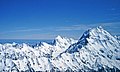
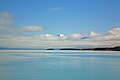
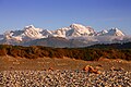
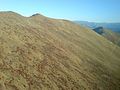
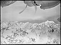
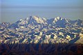
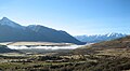
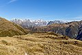
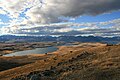
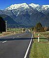
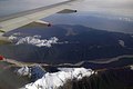
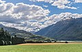
English: The Southern Alps is a mountain range which runs along the western side of the South Island of New Zealand.
Subcategories
This category has the following 56 subcategories, out of 56 total.
*
A
- Mount Aspiring / Tititea (6 F)
B
- De la Beche (6 F)
- Mount Broome (2 F)
C
D
- Mount Dampier (6 F)
- Douglas Peak (3 F)
F
- Fettes Peak (2 F)
G
H
- Mount Haidinger (6 F)
- Harper Pass (7 F)
- Mount Hicks (6 F)
- Hochstetter Dome (2 F)
- Hochstetter Glacier (3 F)
I
- Island Saddle (30 F)
L
- Lauper Peak (4 F)
- Mount Lendenfeld (11 F)
M
- The Minarets (10 F)
- Mount Sefton (69 F)
- Mount Technical (8 F)
N
- Niobe Peak (2 F)
O
P
- Porters Pass (13 F)
- Mount Potts (8 F)
R
S
- Saint Arnaud Range (21 F)
- Silberhorn (New Zealand) (4 F)
T
- Mount Tasman (41 F)
- Torres Peak (8 F)
V
Media in category "Southern Alps"
The following 150 files are in this category, out of 150 total.
-
 00 0985 Mount Cook - New Zealand Alps.jpg 2,950 × 2,000; 7.29 MB
-
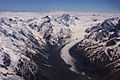
 00 1283 View of the New Zealand Alps (aerial view).jpg 2,941 × 2,000; 7.61 MB
-
 00 1286 New Zealand Alps - Mount Cook (Māori "Aoraki").jpg 3,025 × 1,800; 7.46 MB
-
 00 1287 Mount Cook - New Zealand Alps.jpg 2,993 × 1,800; 5.66 MB
-
 00 1683 Lake Pukaki - Neuseeland, Südinsel.jpg 4,200 × 2,800; 10.56 MB
-
 00 1686 Neuseeland (Südinsel) - Mount Cook Rd. 80 (Lake Pukaki).jpg 4,200 × 2,800; 11.57 MB
-
-
 500px photo (28859859).jpeg 1,920 × 1,081; 232 KB
-
 7274 Canterbury Agricultural College Field Trip to Mt Hutt and the Rakaia River bed.jpg 5,771 × 4,206; 7.35 MB
-
 Above The Treeline Southern Alps I.jpg 1,600 × 1,200; 340 KB
-
 Above The Treeline Southern Alps II.jpg 1,600 × 1,200; 434 KB
-
 Aerial view of the New Zealand Southern Alps.jpg 2,689 × 1,418; 3.6 MB
-

-
 Air Safari over Southern Alps.jpg 3,000 × 1,939; 4.3 MB
-
-
 Alpes du Sud (New Zealand).jpg 2,000 × 565; 109 KB
-
 Alpine Fault SRTM (vertical).jpg 1,746 × 5,342; 4.16 MB
-
 Aoraki Mount Cook and Mount Tasman, Southern Alps, New Zealand, 22 July 2005.jpg 3,264 × 2,176; 8.15 MB
-
 Ashburton Southern Alps.jpg 2,020 × 2,658; 1.19 MB
-
 Barrhill 095.JPG 5,472 × 3,648; 3.63 MB
-
 Bismarck Peaks.jpg 3,717 × 1,641; 3.74 MB
-
 Bismarck, Bulow, Halcombe.jpg 4,226 × 2,059; 5.07 MB
-
 Brixen (IT), Südalpen -- 2024 -- 0048.jpg 3,289 × 4,933; 7.6 MB
-
 Christchurch and the Alps from up top.jpg 5,472 × 3,648; 17.33 MB
-
 Cook River Weheka upriver from bridge.jpg 3,600 × 2,366; 3.43 MB
-
Cows and sunset in New Zealand.webm 1 min 19 s, 1,920 × 1,080; 17.53 MB
-
 Craggy Rocks Of The Southern Alps I.jpg 1,600 × 1,200; 362 KB
-
 De La Beche NZ.jpg 2,328 × 2,516; 2.63 MB
-
 Dome Mountain.jpg 3,879 × 2,875; 9.27 MB
-
 EN-SouthernAlps-NewZealand.jpg 2,563 × 1,411; 1.69 MB
-
 Flight from Rotorua to Queenstown. Over South Island.jpg 3,866 × 2,172; 1.81 MB
-
 Foothills And Fields Of Southern Alps II.jpg 1,600 × 1,200; 188 KB
-
 Foothills And Fields Of Southern Alps III.jpg 1,200 × 1,600; 234 KB
-
 Garden of Eden Ice Plateau.jpg 3,441 × 2,342; 3.53 MB
-
 Glenorchy wharf.jpg 2,272 × 1,704; 1.55 MB
-
 Humboldt Mountains (6709699375).jpg 4,000 × 3,000; 2.51 MB
-

-
 Jervois and Meteor.jpg 2,232 × 2,206; 2.01 MB
-
 John Gully - In the Southern Alps - Google Art Project.jpg 4,957 × 3,745; 4.74 MB
-
 La Perouse NZ.jpg 3,445 × 1,711; 3.98 MB
-
 Lake Alexandrina, New Zealand map.png 1,185 × 667; 1.33 MB
-
 Lake Alexandrina.jpg 1,993 × 1,309; 405 KB
-
 Lake Pukaki.jpg 3,872 × 2,592; 4.44 MB
-
 Lake Tekapo.jpg 5,098 × 1,390; 2.77 MB
-
 Lyttle Peak.jpg 1,432 × 1,499; 1.09 MB
-
 M Mudflats.jpg 859 × 644; 102 KB
-
 Macaulay River valley, South Canterbury, New Zealand.jpg 786 × 502; 611 KB
-
 Main Divide from Toaroha Range, West Coast Region, New Zealand.jpg 5,472 × 3,648; 14.96 MB
-
 Main Divide from Yeats Ridge Hut, West Coast Region, New Zealand.jpg 7,386 × 2,902; 14.42 MB
-
 Marko Several Lakes In McKenzie Basin.jpg 1,800 × 1,200; 1.21 MB
-
 Matheson Frame MRD.jpg 4,032 × 3,024; 1.9 MB
-
 McKenzie Country With Southern Alps.jpg 1,632 × 1,224; 387 KB
-
 Mount Chudleigh of Southern Alps.jpg 1,862 × 1,588; 1.37 MB
-
 Mount Chudleigh.jpg 2,236 × 1,833; 2.74 MB
-
 Mount Darwin (New Zealand).jpg 4,800 × 2,119; 4.87 MB
-
 Mount De la Beche.jpg 3,968 × 2,976; 5.19 MB
-
 Mount Dechen from ISS.jpg 2,212 × 1,384; 1.24 MB
-
 Mount Earnslaw (6706375633).jpg 4,000 × 3,000; 2.34 MB
-
 Mount Maori NZ crop.jpg 1,151 × 1,167; 966 KB
-
 Mount Maori NZ.jpg 1,935 × 1,975; 3.05 MB
-
 Mount Turner and Mount Broome Southern Alps NZ (cropped).jpg 1,040 × 694; 651 KB
-
 Mount Turner and Mount Broome Southern Alps NZ.jpg 2,907 × 1,938; 4.28 MB
-
 Mount Ward from ISS.jpg 1,494 × 1,021; 705 KB
-
 Mountains in New Zealand.jpg 1,699 × 2,027; 673 KB
-
 Mt Aspiring National Park, New Zealand.jpg 1,952 × 1,314; 1.47 MB
-
 Mts. Green, Walter, Elie De Beaumont.jpg 1,534 × 1,621; 1.31 MB
-
 Mts. McCullaugh and Hooker.jpg 4,000 × 3,000; 3.58 MB
-
 Muffin Break On The Trans Scenic.jpg 1,600 × 1,200; 453 KB
-
 Near Porters Pass New Zealand 57.jpg 2,048 × 1,365; 345 KB
-
 New Zealand tramping from Crow Hut to Arthurs Pass.jpg 4,752 × 3,168; 3.94 MB
-
 Nox, Chaos, Niobe.jpg 4,288 × 2,848; 8.76 MB
-
 NZ Alpes 001 (17233133836).jpg 800 × 533; 49 KB
-
 NZ Alpes 002 (17259114855).jpg 800 × 533; 47 KB
-
 NZ Alpes 003 (17386442645).jpg 800 × 533; 43 KB
-
 NZ Alpes 004 (17386423915).jpg 800 × 533; 73 KB
-
 NZ Alpes 005 (17384462842).jpg 800 × 533; 50 KB
-
 NZ Alpes 006 (17386442385).jpg 800 × 533; 57 KB
-
 NZ Alpes 007 (17384462592).jpg 533 × 800; 67 KB
-
 NZ Alpes 008 (17386085901).jpg 800 × 533; 74 KB
-
 NZ Alpes 009 (17384462332).jpg 533 × 800; 70 KB
-
 NZ Alpes 010 (17386441735).jpg 533 × 800; 73 KB
-
 NZ Alpes 011 (16766167553).jpg 533 × 800; 89 KB
-
 NZ Alpes 012 (17386085151).jpg 533 × 800; 89 KB
-
 NZ Alpes 013 (16763912674).jpg 533 × 800; 78 KB
-
 NZ Alpes 014 (17386440945).jpg 800 × 533; 95 KB
-
 NZ Alpes 015 (16763912204).jpg 800 × 533; 104 KB
-
 NZ Alpes 016 (17198637888).jpg 800 × 533; 94 KB
-
 NZ Alpes 017 (17384460712).jpg 800 × 533; 93 KB
-
 NZ Alpes 018 (17384460452).jpg 800 × 533; 84 KB
-
 NZ Alpes 019 (17360482056).jpg 800 × 533; 80 KB
-
 NZ Alpes 020 (17386439895).jpg 800 × 527; 92 KB
-
 NZ Alpes 021 (17200212919).jpg 800 × 308; 68 KB
-
 NZ Alpes 022 (17178986737).jpg 800 × 533; 96 KB
-
 NZ Alpes 023 (17384443622).jpg 800 × 533; 86 KB
-
 NZ Alpes 024 (17386082801).jpg 533 × 800; 98 KB
-
 NZ Alpes 025 (17200212229).jpg 800 × 533; 108 KB
-
 NZ Alpes 026 (17198635948).jpg 533 × 800; 81 KB
-
 NZ Alpes 027 (16766164063).jpg 533 × 800; 88 KB
-
 NZ arthurs pass SI.jpg 1,400 × 1,050; 543 KB
-
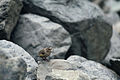
 NZ Rock Wren among Rocks (cropped).jpg 855 × 780; 462 KB
-
 NZ Rock Wren among Rocks.jpg 3,360 × 2,240; 4.31 MB
-
 NZ Southern Alps (21375512489).jpg 3,456 × 4,608; 3.43 MB
-
 NZL-mtcook-gletscher.jpg 1,215 × 807; 475 KB
-
 Ohinetamatea MRD 01.jpg 1,024 × 768; 312 KB
-
 Ohinetamatea MRD 02.jpg 1,024 × 768; 220 KB
-
Paragliding in the Southern Alps.webm 4 min 10 s, 1,920 × 1,080; 176.35 MB
-
 Phipps Peak, New Zealand.jpg 2,293 × 2,030; 3.62 MB
-
 Pollux and Castor nz.jpg 922 × 903; 454 KB
-
 Receveur Peak, New Zealand.jpg 3,008 × 2,000; 1.51 MB
-
 Red Peak NZ.jpg 2,179 × 1,830; 2.66 MB
-
 Sibbald and D'Archiac.jpg 3,441 × 1,671; 3.87 MB
-

-
 Snowdrift Range.jpg 4,302 × 2,420; 1.83 MB
-
 Southern Alps from Christchurch Airport - panoramio.jpg 2,048 × 1,360; 1.19 MB
-
 Southern Alps from Hamilton Peak.jpg 14,742 × 1,710; 6.09 MB
-
 Southern Alps from Makarora Valley 01.jpg 3,840 × 1,987; 3.99 MB
-
 Southern Alps from Makarora Valley 02.jpg 3,840 × 1,584; 2.72 MB
-
 Southern Alps from Makarora Valley 03.jpg 3,840 × 1,881; 4.55 MB
-
 Southern Alps from Makarora Valley 04.jpg 3,840 × 2,560; 6.58 MB
-
 Southern Alps from Makarora Valley 05.jpg 3,840 × 2,560; 6.72 MB
-
 Southern Alps from Mount Hutt.JPG 3,072 × 2,304; 2.92 MB
-
 Southern Alps From Mount Iron.jpg 6,942 × 1,870; 4.64 MB
-
 Southern Alps from Mt Hutt, NZ.jpg 3,072 × 2,304; 3.4 MB
-
 Southern Alps from Mt Hutt, NZ1.jpg 2,304 × 3,072; 3.33 MB
-
 Southern Alps from Mt Hutt, NZ2.jpg 3,072 × 2,304; 3.43 MB
-
 Southern Alps from Mt Hutt, NZ3.jpg 3,072 × 2,304; 2.92 MB
-
 Southern Alps from Mt Hutt, NZ4.jpg 3,072 × 2,304; 3.35 MB
-
 Southern Alps in Winter.jpg 4,272 × 2,848; 3.3 MB
-
 Southern Alps, New Zealand in 1965.jpg 2,797 × 2,102; 633 KB
-
 Southern Alps, NZ (52293699119).jpg 7,445 × 4,964; 1,012 KB
-
 Southernalpsbanner.JPG 3,072 × 440; 510 KB
-
 Southernalpsbanner2.JPG 3,072 × 436; 573 KB
-
 SQ 777-200ER over the Southern Alps (21536238576).jpg 3,456 × 4,608; 3.16 MB
-
 Summit ridge, Southern Alps.jpg 532 × 808; 542 KB
-
 Sunset in the Southern Alps (4750371088).jpg 2,865 × 2,413; 512 KB
-
 The Kea, a New Zealand problem (1909) · Marriner · 022.jpg 1,574 × 1,157; 264 KB
-
 The Kea, a New Zealand problem (1909) · Marriner · 026.jpg 1,586 × 1,093; 274 KB
-
 The Kea, a New Zealand problem (1909) · Marriner · 030.jpg 1,504 × 1,099; 205 KB
-
 Torlesse Ranges, Southern Alps, New Zealand.jpg 3,000 × 596; 2.37 MB
-
 Torres Peak.jpg 1,606 × 1,283; 1.23 MB
-
 Twizel landscape.NZ.jpg 2,400 × 1,344; 2.97 MB
-
 Two Thumb Range, Canterbury, New Zealand crop.jpg 1,857 × 1,546; 2.29 MB
-
 View of Southern Alps from Hokitika.jpg 3,762 × 952; 1.78 MB
-
 View of Southern Alps NZ.jpg 3,918 × 1,530; 4.13 MB
-

-
 Whitcombe and Lauper.jpg 920 × 635; 500 KB
-
 Wilkin Valley NZ.jpg 3,513 × 2,215; 5.14 MB
-
 Winding Road Somewhere East Lake Pukaki.jpg 1,500 × 800; 230 KB
-
 Winter Landscape in Western Southland.jpg 1,600 × 1,200; 747 KB
-
 新西兰南岛 多布森山 Mount Dobson - panoramio.jpg 2,400 × 1,600; 1.61 MB

.jpg)
.jpg)


_-_Mount_Cook_Rd._80_(Lake_Pukaki).jpg)
.jpeg)


.jpg)

,_1949_-_Flickr_-_State_Library_of_NSW.jpg)


,_S%C3%BCdalpen_--_2024_--_0048.jpg)


.jpg)


.jpg)


.jpg)


.jpg)


.jpg)
.jpg)
.jpg)
.jpg)
.jpg)
.jpg)
.jpg)
.jpg)
.jpg)
.jpg)
.jpg)
.jpg)
.jpg)
.jpg)
.jpg)
.jpg)
.jpg)
.jpg)
.jpg)
.jpg)
.jpg)
.jpg)
.jpg)
.jpg)
.jpg)
.jpg)

.jpg)

.jpg)


.jpg)
.jpg)

.jpg)
_%C2%B7_Marriner_%C2%B7_022.jpg)
_%C2%B7_Marriner_%C2%B7_026.jpg)
_%C2%B7_Marriner_%C2%B7_030.jpg)


.jpg)
.jpg)
.jpg)