Category:South Wales Gas Pipeline
Jump to navigation
Jump to search

gas pipeline in the United Kingdom  | |||||
| Upload media | |||||
| Instance of | |||||
|---|---|---|---|---|---|
| Location | |||||
| Connects with | |||||
| Date of official opening |
| ||||
| Diameter |
| ||||
| Length |
| ||||
 | |||||
English: South Wales Gas Pipeline aka Milford Haven–Tirley pipeline
Media in category "South Wales Gas Pipeline"
The following 44 files are in this category, out of 44 total.
-
 A new bridge over the Dulas - geograph.org.uk - 471141.jpg 640 × 480; 130 KB
-

-
 Gas pipeline in the Loughor valley - geograph.org.uk - 552674.jpg 480 × 640; 90 KB
-
 Gas pipeline work south of Hay - geograph.org.uk - 471080.jpg 640 × 480; 88 KB
-
 Gas pipeline works - geograph.org.uk - 509008.jpg 600 × 450; 76 KB
-
 Gas pipes near Eldersfield - geograph.org.uk - 535122.jpg 640 × 426; 113 KB
-
 LNG pipeline construction at Sentry Cross closeup.jpg 2,560 × 1,920; 3.68 MB
-
 LNG pipeline construction at Sentry Cross.jpg 2,560 × 1,920; 3.54 MB
-
 Pipeline activity looking west - geograph.org.uk - 483511.jpg 640 × 480; 340 KB
-
 Pipeline construction - geograph.org.uk - 566730.jpg 640 × 480; 56 KB
-
 Pipeline crosses the M4 - geograph.org.uk - 177126.jpg 640 × 480; 117 KB
-
 Pipeline earthworks near Derwydd - geograph.org.uk - 529652.jpg 640 × 480; 87 KB
-
 Pipeline installation heading for Tirley - geograph.org.uk - 483506.jpg 640 × 480; 323 KB
-
 Pipeline zigzags through the landscape - geograph.org.uk - 483501.jpg 640 × 454; 278 KB
-
 Stacked pipes at LNG pipeline construction.jpg 2,560 × 1,920; 3.2 MB
-
 Y biblin LNG -The LNG pipeline - geograph.org.uk - 421616.jpg 640 × 480; 78 KB
-
 Course of gas pipeline near Werntoe - geograph.org.uk - 557912.jpg 640 × 426; 127 KB
-

-

-

-
-
 Ffelindre to Tirley Gas Pipeline, Kempley - geograph.org.uk - 436901.jpg 640 × 426; 122 KB
-
 Gas pipe near Eldersfield - geograph.org.uk - 535132.jpg 640 × 426; 99 KB
-
 Gas pipeline under construction - geograph.org.uk - 642369.jpg 640 × 480; 61 KB
-
 Glanyrafon Farm and Afon Tywi - geograph.org.uk - 539281.jpg 640 × 480; 139 KB
-
 High pressure gas main - geograph.org.uk - 461898.jpg 640 × 602; 96 KB
-

-

-
 LNG pipeline west of Waterston - geograph.org.uk - 217400.jpg 640 × 480; 79 KB
-
 New gas pipeline - geograph.org.uk - 437297.jpg 640 × 480; 56 KB
-
 New gas pipeline near Cusop - geograph.org.uk - 442303.jpg 640 × 480; 89 KB
-
 Pipeline ascends Allt-y-fanog - geograph.org.uk - 257116.jpg 640 × 480; 74 KB
-
 Pipeline descends to the Loughor - geograph.org.uk - 177701.jpg 640 × 480; 103 KB
-
 Pipeline near Cusop - geograph.org.uk - 435632.jpg 640 × 480; 84 KB
-
 Pipeline running east of Felindre - geograph.org.uk - 177728.jpg 640 × 480; 92 KB
-
 Pipeline through the Towy valley - geograph.org.uk - 520954.jpg 640 × 480; 97 KB
-
 Pipeline works - geograph.org.uk - 520963.jpg 640 × 480; 107 KB
-
 Pipeline works - geograph.org.uk - 580181.jpg 640 × 480; 95 KB
-
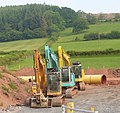
 Pipeline works, RDX 27 - geograph.org.uk - 512084.jpg 600 × 450; 66 KB
-
 Pipes near Llyswen - geograph.org.uk - 353168.jpg 640 × 427; 90 KB
-
 Public notice about pipeline installation - geograph.org.uk - 483497.jpg 640 × 450; 319 KB
-
 RDX 30 - geograph.org.uk - 525258.jpg 600 × 430; 56 KB
-
 Road To Maescar - geograph.org.uk - 486775.jpg 640 × 442; 126 KB
-
 The pipeline has been laid - geograph.org.uk - 566044.jpg 640 × 480; 76 KB


