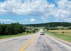
Category:South Dakota Highway 40
Jump to navigation
Jump to search
 | number: | (forty-) |
|---|---|---|
| State highways in South Dakota: | 20 · 21 · 22 · 25 · 26 · 27 · 28 · 30 · 32 · 34 · 36 · 37 · 38 · 40 · 42 · 43 · 44 · 45 · 46 · 47 · 48 · 49 · 50 · 52 · 53 |
state highway in Pennington, Custer, and Oglala Lakota counties in South Dakota, United States | |||||
| Upload media | |||||
| Instance of | |||||
|---|---|---|---|---|---|
| Location |
| ||||
| Transport network | |||||
| Owned by | |||||
| Maintained by | |||||
| Inception |
| ||||
| Length |
| ||||
| Terminus | |||||
 | |||||
English: Media related to South Dakota Highway 10, a 37.369-mile (60.140 km) state highway in Pennington, Custer, and Oglala Lakota counties in South Dakota, United States.
Subcategories
This category has the following 2 subcategories, out of 2 total.
R
- Red Shirt Bridge (7 F)
Pages in category "South Dakota Highway 40"
This category contains only the following page.
Media in category "South Dakota Highway 40"
The following 6 files are in this category, out of 6 total.
-
East Custer, SD, USA - panoramio (20).jpg 3,113 × 2,488; 1.36 MB
-
East Custer, SD, USA - panoramio (21).jpg 3,206 × 2,568; 1.81 MB
-
East Custer, SD, USA - panoramio (23).jpg 3,820 × 2,764; 2.03 MB
-
SD 40.svg 600 × 600; 13 KB
-
SD 40A.svg 750 × 600; 14 KB
-
South Dakota Highway 40.png 1,030 × 716; 64 KB


