
Category:Sotogahama, Aomori
town in Higashitsugaru district, Aomori prefecture, Japan   Bandera de Sotogahama   | |||||
| Upload media | |||||
| Instance of | |||||
|---|---|---|---|---|---|
| Location | Higashitsugaru District, Aomori Prefecture, Japan | ||||
| Located in or next to body of water | |||||
| Legal form |
| ||||
| Inception |
| ||||
| Population |
| ||||
| Area |
| ||||
| Replaces |
| ||||
| official website | |||||
 | |||||
Subcategories
This category has the following 17 subcategories, out of 17 total.
K
M
- Mimmaya Station (48 F)
N
- Naka-Oguni Station (14 F)
O
- Ōdai Station (8 F)
- Odai Yamamoto I site (4 F)
S
- Sotogahama Town Bus (3 F)
T
- Taikenkodo Station (3 F)
- Tappi-kaitei Station (11 F)
Ō
Media in category "Sotogahama, Aomori"
The following 76 files are in this category, out of 76 total.
-
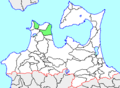
 Location of Sotogahama town, Aomori prefecture, Japan.svg 779 × 755; 17 KB
-
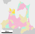 Sotogahama in Aomori Prefecture Ja.svg 800 × 770; 30 KB
-
 Sotogahama in Aomori Prefecture.png 1,081 × 801; 38 KB
-
 Population distribution of Sotogahama, Aomori, Japan.svg 512 × 256; 22 KB
-
 Emblem of Sotogahama, Aomori.svg 592 × 418; 2 KB
-
 Aomori-National road 339, known as Tatsudomari line-m.jpg 1,920 × 1,440; 1.65 MB
-
 Aomorikendo 12 Sotogahama Town.JPG 2,816 × 2,112; 1.27 MB
-
 Aomorikendo 230 Sotogahama Town.JPG 2,816 × 2,112; 1.47 MB
-
 Aomorikendo 281 Sotogahama Town.JPG 2,816 × 2,112; 1.65 MB
-
 Benchmark Tappi Japan 20220509.jpg 2,304 × 1,696; 3.65 MB
-
 Cave of Japan Aomori prif Sotogahama town Minmaya IMG 6733.jpg 2,304 × 1,728; 1.33 MB
-
 Cave of Japan Aomori prif Sotogahama town Minmaya IMG 6738.jpg 2,304 × 1,728; 1.05 MB
-
 Cave of Japan Aomori prif Sotogahama town Minmaya IMG 6740.jpg 2,304 × 1,728; 1.16 MB
-
 Emblem of Kanita, Aomori (1970–2005).svg 512 × 496; 5 KB
-
 Emblem of Minmaya, Aomori (1965–2005).svg 512 × 502; 3 KB
-
 Emblem of Tairadate, Aomori (1970–2005).svg 512 × 340; 3 KB
-
 Flag of Kanita, Aomori (1970–2005).png 506 × 324; 7 KB
-
 Flag of Kanita, Aomori (1970–2005).svg 324 × 216; 15 KB
-
 Flag of Minmaya, Aomori (1965–2005).png 552 × 332; 6 KB
-
 Flag of Minmaya, Aomori (1965–2005).svg 324 × 216; 4 KB
-
 Flag of Sotogahama Aomori.JPG 383 × 279; 11 KB
-
 Flag of Sotogahama Aomori.svg 2,560 × 1,707; 4 KB
-
 Flag of Tairadate Aomori (1970–2005).png 428 × 270; 5 KB
-
 Flag of Tairadate Aomori (1970–2005).svg 324 × 216; 7 KB
-
 Higashitsugaru District in Aomori Prefecture.png 1,081 × 801; 38 KB
-
 Japan National Road No.339.jpg 1,320 × 990; 693 KB
-
 JP-Network Kanita-84033.jpg 2,048 × 1,536; 653 KB
-
 JP-Network Minmaya-84034.jpg 2,048 × 1,536; 640 KB
-
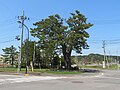 Kajiya no Ipponmatsu 1.jpg 5,184 × 3,888; 5.13 MB
-
 Kajiya no Ipponmatsu 2.jpg 5,184 × 3,888; 6.99 MB
-
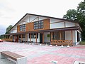
 Kanita Elementary School Sotogahama 200921.jpg 1,600 × 1,200; 688 KB
-
 Kanita Station Front Street.JPG 1,280 × 960; 470 KB
-
 Map.Tairadate-Vill.Aomori.png 328 × 241; 8 KB
-
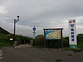
 Michinoeki Tairadate.jpg 3,264 × 2,448; 2.56 MB
-
 Michinoeki-tairadate.jpg 800 × 600; 138 KB
-
 Mimmaya Elementary School 200919.jpg 1,600 × 1,200; 697 KB
-
 Mimmaya Junior High School 200919.jpg 1,600 × 1,200; 723 KB
-
 Minmaya Aomori chapter.jpg 314 × 248; 14 KB
-
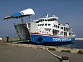
 Mtsuwan Ferry Kamosika Aomori Prf Jp.jpg 4,000 × 2,672; 5.64 MB
-
 Mutsuwan Ferry Kamosika.JPG 1,600 × 1,200; 865 KB
-
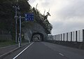 National Route 339 tunnels in Minmaya.jpg 3,038 × 2,133; 1.33 MB
-
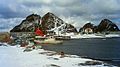 Obijima.jpg 427 × 240; 41 KB
-
 Route 339 Chokandai.jpg 3,264 × 2,448; 3.39 MB
-
 Route 339 Sotogahama Town 1.JPG 2,816 × 2,112; 1.66 MB
-
 Route 339, view from Chokandai.jpg 3,264 × 2,448; 3.33 MB
-
 Seikan Ferry 3gou-Hayabusa in Mutu Bay.JPG 1,457 × 1,014; 832 KB
-
 Sotogahama Aomori chapter.JPG 214 × 164; 8 KB
-
 Sotogahama Police Station 1.jpg 5,184 × 3,888; 4.7 MB
-
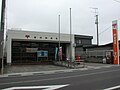
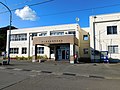
 Sotogahama town hall.JPG 4,000 × 1,501; 2.43 MB
-
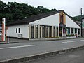
 Sotogahama Town Tairadate Branch Office 200919.jpg 1,600 × 1,200; 768 KB
-
 Sotogahamatown.PNG 328 × 241; 7 KB
-
 Symbol of Kanita Aomori.png 322 × 280; 7 KB
-
 Symbol of Tairadate Aomori.png 332 × 218; 5 KB
-
 Tairadate Elementary School 200919.jpg 1,600 × 1,200; 637 KB
-
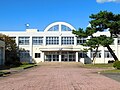 Tairadate Junior High Schoo 200919l.jpg 1,600 × 1,200; 730 KB
-
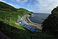
 Takanozaki sotogahama.jpg 3,648 × 2,736; 6.44 MB
-
 Tsugaru line 20210812161759 (51822650652).jpg 4,032 × 3,024; 4.47 MB
-
 Tsugaru line 20210812161827 (51823705718).jpg 4,032 × 3,024; 2.96 MB
-
 かもしか (8049687022).jpg 1,632 × 1,224; 342 KB
-
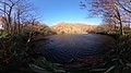 さい沼.jpg 3,804 × 2,132; 5.11 MB
-
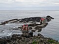
 三厩鐇泊の洞門 IMG 5463 stitch.JPG 7,687 × 5,145; 6.52 MB
-
 地図-青森県外ヶ浜町-2006.png 389 × 260; 7 KB
-
 大平山本I遺跡.jpg 640 × 480; 100 KB
-
 大平駅付近の風景 - panoramio.jpg 5,472 × 3,648; 9.29 MB
-
 特急スーパー白鳥から - panoramio.jpg 4,896 × 2,752; 3.84 MB
-
 眺瞰台より.jpg 4,800 × 3,200; 8.05 MB
-
 蟹田駅付近の風景 - panoramio (1).jpg 4,752 × 3,168; 1.74 MB
-
 蟹田駅付近の風景 - panoramio.jpg 4,752 × 3,168; 1.76 MB
-
 蟹田駅近くの海岸 - panoramio (1).jpg 4,752 × 3,168; 2.16 MB
-
 蟹田駅近くの海岸 - panoramio (2).jpg 4,752 × 3,168; 1.36 MB
-
 蟹田駅近くの海岸 - panoramio (3).jpg 4,752 × 3,168; 1.48 MB
-
 蟹田駅近くの海岸 - panoramio (4).jpg 4,752 × 3,168; 1.4 MB
-
 蟹田駅近くの海岸 - panoramio (5).jpg 4,752 × 3,168; 2.6 MB
-
 蟹田駅近くの海岸 - panoramio.jpg 4,752 × 3,168; 1.32 MB
-
 赤っぽい花のあじさい IMG 5442.JPG 4,608 × 3,456; 5.16 MB
-
 階段国道 0001.jpg 240 × 320; 24 KB


.svg)
.svg)
.svg)
.png)
.svg)
.png)
.svg)

.png)
.svg)


.jpg)
.jpg)
.jpg)


.jpg)

.jpg)
.jpg)
.jpg)
.jpg)
.jpg)


