Category:Somerset and Dorset Joint Railway
Jump to navigation
Jump to search
disused railway line in England | |||||
| Upload media | |||||
| Instance of |
| ||||
|---|---|---|---|---|---|
| Location | Somerset, South West England, England | ||||
| Owned by |
| ||||
| Has part(s) |
| ||||
| Inception |
| ||||
| Date of official closure |
| ||||
| Terminus | |||||
| Replaces |
| ||||
| Replaced by | |||||
| |||||
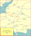
The Somerset and Dorset Joint Railway ran from Bath to the south coast of England. It was closed in 1966.
Subcategories
This category has the following 15 subcategories, out of 15 total.
C
- Charlton Viaduct (20 F)
- Chilcompton Tunnel (1 F)
- Combe Down Tunnel (14 F)
G
- Gartell Light Railway (39 F)
M
S
T
- Tucking Mill Viaduct (6 F)
Media in category "Somerset and Dorset Joint Railway"
The following 64 files are in this category, out of 64 total.
-
'Grampus' 20 ton ballast & sleeper wagon.jpg 6,000 × 4,000; 7.18 MB
-
A long dismantled railway - geograph.org.uk - 515675.jpg 640 × 480; 135 KB
-
Ashington Bridge.webp 1,200 × 744; 219 KB
-
Ashington Cutting (2) - geograph.org.uk - 206383.jpg 640 × 480; 156 KB
-
Ashington Cutting - geograph.org.uk - 205456.jpg 640 × 480; 164 KB
-
Bath To Midford 1903.png 4,257 × 5,428; 6.05 MB
-
Beautifully restored SDJR Coach (21913021116).jpg 4,288 × 3,216; 3.53 MB
-
Brog Street in Spring - geograph.org.uk - 1252267.jpg 640 × 480; 110 KB
-
Course of dismtd rly - geograph.org.uk - 437947.jpg 640 × 430; 276 KB
-
Dismantled railway embankment - geograph.org.uk - 179221.jpg 640 × 480; 79 KB
-
Dismantled railway near Grove Farm - geograph.org.uk - 520711.jpg 640 × 480; 114 KB
-
Dismantled Railway north of Marsh Lane - geograph.org.uk - 578444.jpg 430 × 640; 422 KB
-
Dismantled Railway south of Marsh Lane - geograph.org.uk - 578434.jpg 430 × 640; 351 KB
-
Dismantled Railwayline - geograph.org.uk - 109530.jpg 640 × 426; 146 KB
-
Dismay at Dismantling - geograph.org.uk - 370802.jpg 640 × 480; 162 KB
-
Dismtd Rly heads west - geograph.org.uk - 437958.jpg 640 × 430; 238 KB
-
Disused footbridge over a disused railway - geograph.org.uk - 222751.jpg 600 × 450; 144 KB
-
Disused railway bridge - geograph.org.uk - 185567.jpg 640 × 480; 147 KB
-
Disused Railway Bridge and River Brue - geograph.org.uk - 81268.jpg 640 × 480; 102 KB
-
Disused railway crosses railway - geograph.org.uk - 47837.jpg 640 × 427; 153 KB
-
Disused Railway near Lower Writhlington - geograph.org.uk - 700862.jpg 640 × 426; 146 KB
-
Former railway bridge - geograph.org.uk - 428816.jpg 640 × 477; 98 KB
-
Ham Woods Viaduct.jpg 1,024 × 768; 231 KB
-
Inside SDJR First 4.JPG 910 × 1,366; 389 KB
-
Level Crossing gates at Knoll Lane. - geograph.org.uk - 1591600.jpg 640 × 427; 93 KB
-
Map of Somerset & Dorset Joint Railway 1926.jpg 851 × 1,261; 309 KB
-
Marker to the past - geograph.org.uk - 1601142.jpg 640 × 480; 242 KB
-
Minehead - Kilmersdon with SDJR First 4.JPG 1,366 × 820; 335 KB
-
North Dorset Trailway near Corfe Mullen - geograph.org.uk - 982339.jpg 640 × 480; 158 KB
-
Old route Somerset & Dorset railway - panoramio.jpg 4,288 × 2,848; 5.3 MB
-
Overgrown cutting on dismtd rly - geograph.org.uk - 437953.jpg 430 × 640; 158 KB
-
Poole Bournemouth Railway Network.jpg 1,560 × 938; 208 KB
-
Radstock Loco Shed.jpg 640 × 392; 65 KB
-
Railway Relic at Single Hill - geograph.org.uk - 448773.jpg 640 × 480; 128 KB
-
River Stour, Blandford Forum - old Somerset & Dorset railway viaduct (14070646129).jpg 2,592 × 1,728; 1.24 MB
-
S&d 1875.gif 2,659 × 3,042; 262 KB
-
S&d 1890.gif 2,659 × 3,042; 264 KB
-
S&d at 1862.gif 2,659 × 3,042; 242 KB
-
S&DR George England 2-4-0 No. 13.jpg 3,072 × 1,889; 799 KB
-
SDJR First Class Coach at Washford on West Somerset Railway (8581190482).jpg 2,592 × 1,944; 1.31 MB
-
Somerset and Dorset Joint Railway, 30 January 2012 (1).jpg 3,376 × 2,236; 990 KB
-
Somerset and Dorset Joint Railway, 30 January 2012 (2).jpg 3,350 × 2,242; 941 KB
-
Somerset and Dorset Joint Railway, 30 January 2012 (3).jpg 3,249 × 2,256; 1.21 MB
-
Somerset and Dorset Joint Railway, 30 January 2012 (4).jpg 3,340 × 2,200; 892 KB
-
Somerset and Dorset War Memorial, Highbridge.JPG 1,666 × 1,250; 912 KB
-
Soton to Weymouth 1874.gif 1,457 × 842; 88 KB
-
S^DJR Viaduct, Wellow. - panoramio.jpg 2,720 × 1,872; 1.81 MB
-
The former railway line from Radstock to Shepton Mallet - geograph.org.uk - 2276389.jpg 2,048 × 1,536; 1.53 MB
-
The old S&D - geograph.org.uk - 6064420.jpg 3,296 × 2,472; 3.46 MB
-
Waiting for the cyclists^ - geograph.org.uk - 47856.jpg 640 × 427; 151 KB
-
Washford - SDJR first 4 with Kilmersdon.jpg 1,024 × 683; 374 KB
-
Wellow viaduct (Bridge No. 22) - geograph.org.uk - 363205.jpg 640 × 480; 107 KB
-
Wellow Viaduct - geograph.org.uk - 84629.jpg 640 × 480; 50 KB
-
Wellowsignalbox.JPG 2,848 × 2,136; 1.21 MB
-
Who's pinched my tunnel^^ - geograph.org.uk - 47843.jpg 640 × 427; 139 KB
-
Disused railway bridge - geograph.org.uk - 185606.jpg 640 × 480; 141 KB


