Category:Soboth
Jump to navigation
Jump to search
former municipality in Austria | |||||
| Upload media | |||||
| Instance of | |||||
|---|---|---|---|---|---|
| Location |
| ||||
| Area |
| ||||
| Elevation above sea level |
| ||||
 | |||||
Subcategories
This category has the following 7 subcategories, out of 7 total.
G
- Gedenkstätte Soboth (8 F)
- Grenzlandschule Soboth (3 F)
O
- Obere Glashütte, Soboth (48 F)
P
S
- Stausee Soboth (30 F)
Media in category "Soboth"
The following 37 files are in this category, out of 37 total.
-
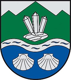
AUT Soboth COA.jpg 400 × 453; 64 KB
-
Deutschlandsberg Bezirkshandkarte 1910.jpg 6,800 × 9,957; 91.47 MB
-
Deutschlandsberg Eibiswald Schwanberg Völkermarkt Misstal Windischgraz Unterdrauburg 1920.jpg 11,867 × 9,510; 91.64 MB
-
Fahrpläne Deutschlandsberg Glashütten Wies Soboth 1969-70.jpg 5,309 × 3,736; 9.6 MB
-
Fahrpläne Deutschlandsberg Schwanberg Wies 1975-76.jpg 10,573 × 8,327; 12.51 MB
-
Fahrpläne Stainz Leibnitz Soboth Sommer 1956.jpg 5,344 × 4,323; 7.79 MB
-
Fahrpläne Stainz Preding Wies Soboth 1956-57.jpg 5,434 × 4,308; 5.41 MB
-
Fahrpläne Wies Stainz Mooskirchen Leibnitz Soboth St Lorenzen 1961-62.jpg 5,320 × 4,184; 15.73 MB
-
Geologische Karte Unterdrauburg 1926.jpg 11,909 × 9,764; 65.31 MB
-
GKB Bus Streckenliste 2019.jpg 419 × 868; 85 KB
-
ID 436 Tilia.jpg 3,000 × 2,000; 1.31 MB
-
ID 437 Tilia.jpg 2,000 × 3,000; 2.16 MB
-
ID 442 Linde.jpg 2,318 × 3,000; 2.16 MB
-
ID 443.jpg 2,000 × 3,000; 2.39 MB
-
ID 444+443+442+445.jpg 3,000 × 2,000; 2.05 MB
-
ID 444.jpg 1,958 × 3,000; 2.13 MB
-
ID 445.jpg 2,093 × 3,000; 2.19 MB
-
ID 446 Tilia.jpg 2,000 × 3,000; 2 MB
-
ID 447 Tilia.jpg 2,000 × 3,000; 1.88 MB
-
ID 448 Tilia.jpg 2,180 × 3,000; 2.09 MB
-
ID 489 Alte Hütte 01.jpg 2,000 × 3,000; 1.58 MB
-
ID 489 Alte Hütte 02.jpg 3,000 × 2,000; 1.38 MB
-
ID 489 Alte Hütte015.jpg 2,000 × 3,000; 1.63 MB
-
Josef Krainer Volksschule Laaken 1948 1969.jpg 1,426 × 965; 757 KB
-
Map at soboth.png 400 × 240; 3 KB
-
Soboth Dienstgebäude.jpg 2,896 × 1,944; 7.38 MB
-
Soboth Dienstgebäude1.jpg 2,896 × 1,944; 7 MB
-
Soboth Dr Gustav Groß Volksschule Soboth Rückseite.jpg 6,396 × 4,056; 33.22 MB
-
Soboth Hausgang.jpg 2,896 × 1,944; 3.47 MB
-
Soboth im Bezirk DL.png 645 × 645; 29 KB
-
Soboth Laaken Rothwein alte Grenzen 1910 k.jpg 8,048 × 10,073; 67.93 MB
-
Soboth Parkplatz.jpg 2,896 × 1,653; 5.33 MB
-
Soboth Parkplatz2 dt Grenzland.jpg 2,896 × 1,944; 7.04 MB
-
Soboth Sonnenuntergang Koralmzug.jpg 2,896 × 1,944; 2.86 MB
-
Soboth von St Leonhard zum Sausee2.jpg 1,944 × 2,896; 4.05 MB
-
Sobothstausee Erklärung zum Kalkofen.jpg 1,944 × 2,896; 6.65 MB
-
Spezialkarte der Österreichisch-ungarischen Monarchie - Unterdrauburg 1926.jpg 13,822 × 10,555; 32.71 MB


