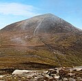
Category:Slieve Donard
Jump to navigation
Jump to search
Deutsch: Der Slieve Donard (Sliabh Dónairt) ist mit 849 m der höchste Berg Nordirlands. Er liegt im County Down an der Ostküste beim Städtchen Newcastle.
English: Slieve Donard is a 850 m (2,789 ft) mountain in County Down, Northern Ireland. It is part of the Mourne Mountains and the highest peak in Northern Ireland and in the wider province of Ulster.
Français : Le Slieve Donard est le sommet le plus haut de l' Irlande du Nord avec 850 mètres. Faisant partie des Mourne Mountains, il est situé près de Newcastle, dans le comté de Down, à trois kilomètres de la mer.
Gaeilge: Sliabh in oirthuaisceart na hÉireann is ea é Sliabh Dónairt, i gContae an Dúin, Cúige Uladh. Tá sé 849 m in airde agus é ag seasamh beagnach cois na farraige, ar imeall shliabhraon na mBeanna Bóirce.
Italiano: Lo Slieve Donard (in gaelico irlandese Sliabh Dónairt) è un monte situato nella contea di Down, Irlanda del Nord. L'altitudine di 850 metri lo rende il monte più alto dell'Irlanda del Nord e anche della più ampia provincia dell'Ulster e la diciannovesima cima dell'isola d'Irlanda.
Norsk nynorsk: Slieve Donard er eit fjell i County Down i Nord-Irland. Det er ein del av Mourne Mountains og den høgaste toppen i provinsen Ulster.
Polski: Slieve Donard ( irl. Sliabh Dónairt; według różnych źródeł 849-852 m n.p.m.) – szczyt w górach Mourne w hrabstwie Down w prowincji Ulster.
Русский: Слив Донард — вершина в горах Морн на территории графства Даун, Северная Ирландия. Слив Донард является высочайшей точкой в Морн и на территории Северной Ирландии и провинции Ольстер.
Svenska: miniatyr|Slieve Donard.
mountain in County Down, Northern Ireland, UK | |||||
| Upload media | |||||
| Instance of | |||||
|---|---|---|---|---|---|
| Location | Northern Ireland | ||||
| Mountain range | |||||
| Topographic prominence |
| ||||
| Elevation above sea level |
| ||||
 | |||||
Media in category "Slieve Donard"
The following 51 files are in this category, out of 51 total.
-
Autumnal scene in Islands Park - geograph.org.uk - 5179305.jpg 3,626 × 2,158; 1.21 MB
-
Dundrum and the Mournes - geograph.org.uk - 1246024.jpg 640 × 381; 54 KB
-
Gently shelving Murlough Beach at low tide - geograph.org.uk - 4781833.jpg 1,600 × 1,200; 378 KB
-
Inner Dundrum Bay from the slopes of Slieve Donard - geograph.org.uk - 4763603.jpg 1,600 × 1,035; 148 KB
-
Low cloud over Slieve Donard - geograph.org.uk - 1000355.jpg 640 × 364; 63 KB
-
Mourne wall donard.jpg 395 × 263; 74 KB
-
Murlough Beach, August 2010 (04).JPG 4,272 × 2,848; 3.16 MB
-
Murlough Beach, August 2010 (08).JPG 2,848 × 4,272; 4.53 MB
-
Murlough Beach, October 2010 (01).JPG 4,272 × 2,848; 4.12 MB
-
Murlough Strand from the sand dunes - geograph.org.uk - 2187081.jpg 1,024 × 759; 253 KB
-
Newcastle and Slieve Donard from the beach.jpg 2,048 × 1,536; 435 KB
-
Percy Bysshe and Slieve Donard - geograph.org.uk - 1139452.jpg 640 × 517; 283 KB
-
Rippled sand on Murlough Beach - geograph.org.uk - 2877774.jpg 1,024 × 755; 181 KB
-
Sands at low tide at Tyrella South - geograph.org.uk - 2385326.jpg 640 × 480; 87 KB
-
Slieve Donard (2) - geograph.org.uk - 1132400.jpg 640 × 395; 64 KB
-
Slieve Donard (3) - geograph.org.uk - 1246177.jpg 640 × 352; 79 KB
-
Slieve Donard (4) - geograph.org.uk - 1264381.jpg 640 × 414; 96 KB
-
Slieve Donard (5) - geograph.org.uk - 1264413.jpg 640 × 376; 66 KB
-
Slieve Donard (late morning) - geograph.org.uk - 971294.jpg 640 × 393; 55 KB
-
Slieve Donard - geograph.org.uk - 1138189.jpg 640 × 427; 247 KB
-
Slieve Donard - geograph.org.uk - 830112.jpg 640 × 378; 60 KB
-
Slieve Donard - geograph.org.uk - 860898.jpg 640 × 480; 45 KB
-
Slieve Donard at 100 km.jpg 4,229 × 3,144; 2.97 MB
-
Slieve Donard Summit Cairn - geograph.org.uk - 1521811.jpg 640 × 480; 59 KB
-
Slieve Donard, County Down, August 2010.JPG 4,272 × 2,848; 3.58 MB
-
Slieve Donard.jpg 4,253 × 1,080; 3.18 MB
-
Snow on Slieve Donard - geograph.org.uk - 1147852.jpg 640 × 356; 47 KB
-
Summit cairn, Slieve Commedagh - geograph.org.uk - 1773778.jpg 640 × 378; 182 KB
-
Sun, snow and Slieve Donard - geograph.org.uk - 1148118.jpg 640 × 456; 38 KB
-
The Donard Icehouse - geograph.org.uk - 437617.jpg 640 × 480; 86 KB
-
The Mourne Wall ascending Slieve Donard - geograph.org.uk - 4441636.jpg 1,600 × 1,200; 309 KB
-
The Mourne Wall ascending to the summit of Slieve Donard - geograph.org.uk - 4709612.jpg 1,523 × 1,501; 665 KB
-
The path up to Slieve Donard - geograph.org.uk - 1521933.jpg 640 × 480; 95 KB
-
The Promenade Footbridge over the Shimna Estuary - geograph.org.uk - 1723117.jpg 1,600 × 1,200; 458 KB
-
The remnants of groynes on Murlough Strand - geograph.org.uk - 4780052.jpg 1,600 × 1,200; 413 KB
-
The road to Newcastle Co. Down (17169197481).jpg 2,000 × 1,905; 1.9 MB
-
The Shimna River above the Shimna Bridge - geograph.org.uk - 1748080.jpg 1,600 × 1,157; 412 KB
-
The summit of Slieve Donard - geograph.org.uk - 103268.jpg 640 × 480; 79 KB
-
Top of Slieve Donard.jpg 640 × 480; 38 KB
-
Towards Slieve Donard - geograph.org.uk - 1138191.jpg 640 × 480; 260 KB
-
Towards Slieve Donard - geograph.org.uk - 1140053.jpg 640 × 486; 297 KB
-
View southwards along the strand at Newcastle - geograph.org.uk - 2161768.jpg 1,024 × 767; 209 KB
-
View towards Slieve Donard - geograph.org.uk - 1409594.jpg 640 × 428; 86 KB


