Category:Sleaford
Jump to navigation
Jump to search
Deutsch: Sleaford ist eine Stadt in England, Großbritannien. Sie liegt in der Grafschaft Lincolnshire, am Fluss Slea und südöstlich der Stadt Lincoln.
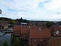
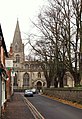
English: Sleaford is a town within the North Kesteven district of Lincolnshire, England. It is thirteen miles (21 km) northeast of Grantham, seventeen miles (27 km) west of Boston, and nineteen miles (30 km) south of Lincoln, and had a total resident population of around 14,500 in 6,167 households at the time of the 2001 census.
Nederlands: Sleaford is een plaats in het bestuurlijke gebied North Kesteven, in het Engelse graafschap Lincolnshire. De plaats telt 15.000 inwoners.
Română: Sleaford este un oraş în comitatul Lincolnshire, regiunea East Midlands, Anglia. Oraşul se află în districtul North Kesteven a cărui reşedinţă este.

market town and civil parish in Lincolnshire, England, UK  | |||||
| Upload media | |||||
| Instance of | |||||
|---|---|---|---|---|---|
| Location | North Kesteven, Lincolnshire, East Midlands, England | ||||
| Population |
| ||||
| Different from | |||||
| official website | |||||
 | |||||
Subcategories
This category has the following 19 subcategories, out of 19 total.
G
H
M
- Money's Mill, Sleaford (8 F)
N
Q
R
- Sleaford railway station (52 F)
- River Slea in Sleaford (60 F)
S
- Sleaford Castle (13 F)
- Sleaford North Junction (5 F)
- Snow in Sleaford (5 F)
- Streets in Sleaford (12 F)
Media in category "Sleaford"
The following 200 files are in this category, out of 791 total.
(previous page) (next page)-
 1 and 1a Jermyn Street Sleaford UK - view towards Southgate.jpg 4,032 × 3,024; 4.29 MB
-
 10 and 12 Southgate Sleaford UK.jpg 1,840 × 2,221; 605 KB
-
 11 Southgate Sleaford UK.jpg 4,032 × 3,024; 4.12 MB
-
 12 and 10 Boston Road Sleaford UK.jpg 4,032 × 3,024; 4.41 MB
-
 12a, 12 and 10 Boston Road Sleaford UK.jpg 4,032 × 3,024; 4.23 MB
-
 13 Southgate Sleaford UK.jpg 2,703 × 2,277; 1.31 MB
-
 13-16 Market Place Sleaford UK (Sleaford Library).jpg 3,024 × 4,032; 4.32 MB
-
 13-17 Boston Road Sleaford UK.jpg 4,032 × 3,024; 5.83 MB
-
 15 Southgate Sleaford UK.jpg 3,024 × 2,870; 1.89 MB
-
 15a Southgate Sleaford UK.jpg 2,028 × 2,550; 1.48 MB
-
 17 Market Place Sleaford UK.jpg 2,321 × 2,529; 1.04 MB
-
 17 Southgate Sleaford UK.jpg 2,341 × 2,979; 1.51 MB
-
 17, 19 and 21 North Gate, Sleaford - geograph.org.uk - 4900027.jpg 5,184 × 3,456; 2.89 MB
-
 187 Dwellings to go... - geograph.org.uk - 6022521.jpg 4,608 × 3,456; 3.7 MB
-
 19 and 19a Market Place Sleaford UK.jpg 3,024 × 2,623; 1.34 MB
-
 19-25 Boston Road Sleaford UK.jpg 4,032 × 3,024; 5.43 MB
-
 20 (or 20a) Market Place Sleaford UK.jpg 2,494 × 2,999; 1.64 MB
-
 20 and 21 Jermyn Street Sleaford UK.jpg 4,032 × 3,024; 6.32 MB
-
 21 and 22 Market Place Sleaford UK.jpg 3,024 × 4,032; 4.06 MB
-
 21 Southgate Sleaford UK.jpg 1,955 × 2,554; 1.11 MB
-
 22 and 23 Jermyn Street Sleaford UK.jpg 4,032 × 3,024; 6.39 MB
-
 23 Northgate, Sleaford - geograph.org.uk - 5576293.jpg 1,024 × 768; 165 KB
-
 23 to 25 Southgate Lincolnshire UK.jpg 4,032 × 3,024; 4.8 MB
-
 23 to 27 Southgate Sleaford UK.jpg 4,032 × 3,024; 4.37 MB
-
 24 Jermyn Street Sleaford UK.jpg 4,032 × 3,024; 6.89 MB
-
 24 Market Place Sleaford UK.jpg 2,490 × 3,301; 1.56 MB
-
 25 Jermyn Street Sleaford UK.jpg 4,032 × 3,024; 4.45 MB
-
 25-31 Boston Road Sleaford UK.jpg 4,032 × 3,024; 5.34 MB
-
 26 Jermyn Street Sleaford UK.jpg 4,032 × 3,024; 5.14 MB
-
 27 and 29 North Gate, Sleaford - geograph.org.uk - 4900058.jpg 5,184 × 3,456; 3.89 MB
-
 27 Jermyn Street Sleaford.jpg 3,024 × 4,032; 4.79 MB
-
 27 Southgate Sleaford UK.jpg 4,032 × 3,024; 4.28 MB
-
 27-29 Northgate, Sleaford - geograph.org.uk - 5576305.jpg 1,024 × 768; 156 KB
-
 29 to 31 Southgate Sleaford UK.jpg 4,032 × 3,024; 4.37 MB
-
 3 Boston Road Sleaford UK with 75 Southgate behind.jpg 4,032 × 3,024; 4.74 MB
-
 30 and 32 Riverside Close Sleaford UK.jpg 4,032 × 3,024; 6.21 MB
-
 33 North Gate, Sleaford - geograph.org.uk - 4900118.jpg 5,184 × 3,456; 3.68 MB
-
 33 to 37 Southgate Sleaford UK.jpg 4,032 × 3,024; 3.93 MB
-
 33-37 and 41 Boston Road Sleaford UK.jpg 3,525 × 2,283; 1.61 MB
-
 4-6 Market Street Sleaford UK.jpg 1,994 × 1,980; 992 KB
-
 44 and 42 Southgate Sleaford UK.jpg 2,446 × 2,267; 1.16 MB
-
 49 and 49a Southgate Sleaford UK.jpg 4,032 × 3,024; 5.01 MB
-
 5 and 7 North Gate, Sleaford - geograph.org.uk - 4899985.jpg 5,184 × 3,456; 3.1 MB
-
 51 and 53 North Gate, Sleaford - geograph.org.uk - 4900832.jpg 5,184 × 3,456; 2.43 MB
-
 51 and 53 Northgate, Sleaford - geograph.org.uk - 5576412.jpg 1,024 × 851; 143 KB
-
 51 Southgate Sleaford UK - The Grapes public house.jpg 2,400 × 3,088; 1.93 MB
-
 53 Southgate Sleaford UK.jpg 2,688 × 3,112; 2.04 MB
-
 53a and 53 Southgate Sleaford UK.jpg 3,024 × 4,032; 4 MB
-
 53a Southgate Sleaford UK.jpg 2,460 × 3,286; 1.76 MB
-
 54 and 52 Southgate Sleaford UK.jpg 3,259 × 2,635; 1.81 MB
-
 55 and 57 Southgate Sleaford UK.jpg 3,024 × 4,032; 4.02 MB
-
 58 Southgate Sleaford UK.jpg 2,396 × 2,935; 1.38 MB
-
 59 to 61 Southgate Sleaford UK.jpg 2,465 × 2,668; 1.69 MB
-
 60-58 Southgate Sleaford UK.jpg 4,032 × 3,024; 3.82 MB
-
 63 and 65 Eastgate, Sleaford - geograph.org.uk - 5574528.jpg 1,024 × 768; 146 KB
-
 67 Southgate Sleaford UK - south front.jpg 2,757 × 3,345; 1.96 MB
-
 69 Southgate Sleaford UK.jpg 2,846 × 2,445; 1.42 MB
-
 7 Southgate Sleaford UK.jpg 3,024 × 4,032; 3.94 MB
-
 7-13 Boston Road Sleaford UK.jpg 4,032 × 3,024; 5.58 MB
-
 7-9 Market Place Sleaford UK.jpg 4,032 × 2,268; 3.28 MB
-
 71a 71 and 73 Southgate Sleaford UK.jpg 4,032 × 3,024; 4.18 MB
-
 73 Southgate Sleaford UK.jpg 2,163 × 2,633; 1.07 MB
-
 75 Southgate Sleaford UK - west front.jpg 2,732 × 2,856; 1.62 MB
-
 75 Southgate Sleaford UK.jpg 3,024 × 4,032; 4.27 MB
-
 9 Southgate Sleaford UK.jpg 3,024 × 4,032; 3.87 MB
-
 A frosty Imp - geograph.org.uk - 3309443.jpg 800 × 600; 148 KB
-
 A quiet moment on the A17, Sleaford by-pass - geograph.org.uk - 5604345.jpg 3,456 × 2,592; 3.93 MB
-
 A race against the weather - geograph.org.uk - 3599893.jpg 800 × 600; 81 KB
-
 A ride in the snow^ - geograph.org.uk - 3309571.jpg 800 × 600; 52 KB
-
 A specialist shop - geograph.org.uk - 5676368.jpg 6,032 × 4,014; 5.77 MB
-
 A15 bridge over the River Slea (dry) - geograph.org.uk - 2828139.jpg 640 × 480; 104 KB
-
 A15 by passing Sleaford - geograph.org.uk - 4787264.jpg 1,024 × 808; 99 KB
-

-
 A15 Sleaford bypass - geograph.org.uk - 4787269.jpg 1,024 × 610; 95 KB
-
 A15 towards Lincoln - geograph.org.uk - 2828136.jpg 640 × 480; 45 KB
-
 A15 towards Lincoln - geograph.org.uk - 2828148.jpg 640 × 480; 57 KB
-
 A153 eastbound - geograph.org.uk - 5822901.jpg 640 × 480; 60 KB
-
 A153 westbound - geograph.org.uk - 5822542.jpg 640 × 480; 65 KB
-
 A17 and a dark sky - geograph.org.uk - 5955314.jpg 6,459 × 1,700; 923 KB
-
 A17 Approaching Holdingham Roundabout - geograph.org.uk - 4937825.jpg 640 × 480; 432 KB
-
 A17 at Asgarby turn (geograph 5672654).jpg 640 × 481; 36 KB
-

-
 A17 bend, west of Sleaford - geograph.org.uk - 5672650.jpg 640 × 479; 43 KB
-
 A17 bridge over East Road.jpg 1,280 × 960; 195 KB
-
 A17 bridge over the river Slea - geograph.org.uk - 627458.jpg 640 × 480; 98 KB
-
 A17 east - geograph.org.uk - 4413696.jpg 1,024 × 683; 200 KB
-
 A17 eastbound - geograph.org.uk - 6678236.jpg 640 × 391; 40 KB
-
 A17 eastbound - geograph.org.uk - 6678242.jpg 640 × 375; 43 KB
-
 A17 eastbound - geograph.org.uk - 6678245.jpg 640 × 389; 44 KB
-
 A17 eastbound - geograph.org.uk - 6678248.jpg 640 × 409; 48 KB
-
 A17 eastbound - geograph.org.uk - 6678265.jpg 640 × 412; 48 KB
-
 A17 eastbound - geograph.org.uk - 6678269.jpg 640 × 480; 57 KB
-
 A17 Entering Holdingham Roundabout - geograph.org.uk - 4937827.jpg 640 × 480; 477 KB
-
 A17 lay-by - geograph.org.uk - 4741223.jpg 640 × 480; 45 KB
-
 A17 Layby East of Holdingham - geograph.org.uk - 4937832.jpg 640 × 427; 352 KB
-
 A17 near to Holdingham - geograph.org.uk - 4937824.jpg 640 × 480; 437 KB
-
 A17 nearing Holdingham Roundabout - geograph.org.uk - 3651545.jpg 640 × 481; 46 KB
-
 A17 towards Newark - geograph.org.uk - 2828150.jpg 640 × 480; 38 KB
-
 A17 west - geograph.org.uk - 4413708.jpg 1,024 × 683; 170 KB
-
 A17 west of Sleaford - geograph.org.uk - 5070764.jpg 4,354 × 2,840; 4.24 MB
-
 A17 westbound - geograph.org.uk - 3767783.jpg 640 × 211; 28 KB
-
 A17 westbound - geograph.org.uk - 3767784.jpg 640 × 301; 29 KB
-
 A17, Junction for Sleaford - geograph.org.uk - 4937851.jpg 640 × 427; 433 KB
-
 A17, Sleaford Bypass - geograph.org.uk - 4937845.jpg 640 × 480; 412 KB
-
 AA Box 446 - geograph.org.uk - 1044169.jpg 480 × 640; 123 KB
-

-
 Across the field toward Mareham Lane Farm - geograph.org.uk - 6200324.jpg 4,608 × 3,456; 4.21 MB
-
 Air field - geograph.org.uk - 4402432.jpg 4,608 × 3,456; 3.43 MB
-
 Alan Potter's Navigation mosaic by the River Slea - geograph.org.uk - 4881952.jpg 3,456 × 5,184; 4.18 MB
-
 Alan Potter's Navigation mosaic by the River Slea - geograph.org.uk - 4881953.jpg 3,456 × 5,184; 4.47 MB
-
 Alan Potter's Navigation mosaic by the River Slea - geograph.org.uk - 4881954.jpg 3,456 × 5,184; 4.11 MB
-

-
 Alleyway off North Gate, Sleaford. - geograph.org.uk - 935970.jpg 480 × 640; 110 KB
-
 An early morning swim^ - geograph.org.uk - 3309505.jpg 800 × 600; 195 KB
-
 Anas platyrhynchos mallard family at Sleaford, Lincolnshire.jpg 640 × 480; 102 KB
-
 Anas platyrhynchos mallard female and chicks at Sleaford, Lincolnshire.jpg 2,816 × 2,112; 2.65 MB
-
 Another New Development in Town Road - geograph.org.uk - 6022518.jpg 6,300 × 3,460; 2.5 MB
-
 Apple core - geograph.org.uk - 6512957.jpg 4,608 × 3,456; 3.86 MB
-
 Approach to former maltings, Sleaford - geograph.org.uk - 6057018.jpg 640 × 479; 132 KB
-
 Approaching Sleaford on the B1517 - geograph.org.uk - 5786276.jpg 2,533 × 1,901; 771 KB
-
 Arcade - Sleaford - geograph.org.uk - 1876732.jpg 1,500 × 996; 1.28 MB
-
 Arthur's Court - geograph.org.uk - 3826616.jpg 800 × 533; 148 KB
-
 Ash Villa School, Greylees - geograph.org.uk - 6579330.jpg 1,024 × 768; 158 KB
-

-
 Avenue at Greylees - geograph.org.uk - 6579346.jpg 1,024 × 768; 327 KB
-

-
 B1518 Lincoln Road on entering Sleaford - geograph.org.uk - 1136003.jpg 640 × 480; 160 KB
-
 Barber shop in Sleaford - geograph.org.uk - 5533881.jpg 3,887 × 4,926; 3.54 MB
-
 Barclays Bank - geograph.org.uk - 5576499.jpg 1,024 × 768; 138 KB
-

-

-
 Bass maltings, Sleaford, aerial 2020 - geograph.org.uk - 6360361.jpg 1,024 × 683; 201 KB
-
 Bench and bridge on the River Slea - geograph.org.uk - 6372069.jpg 5,202 × 3,465; 2.92 MB
-

-
 Berkeley Court - Sleaford - geograph.org.uk - 1876784.jpg 1,500 × 996; 1.25 MB
-
 Between two bridges - geograph.org.uk - 1639868.jpg 640 × 425; 75 KB
-

-
 Bit Of A Lean At Sleaford RFC - geograph.org.uk - 1116740.jpg 480 × 640; 42 KB
-
 Black shed - geograph.org.uk - 7114661.jpg 1,024 × 768; 191 KB
-
 Blason ville uk Sleaford (Lincolnshire).svg 600 × 660; 29 KB
-
 Boiling Wells Farm - geograph.org.uk - 2431355.jpg 800 × 532; 86 KB
-
 Boiling Wells Farm - geograph.org.uk - 2431357.jpg 800 × 531; 83 KB
-
 Boot scraper near the market square - Sleaford - geograph.org.uk - 1876723.jpg 1,500 × 996; 1.23 MB
-

-

-
 Boston Road recreation ground playground - geograph.org.uk - 6374413.jpg 5,202 × 3,465; 3.51 MB
-
 Boston Road recreation ground toilet block - geograph.org.uk - 6374416.jpg 5,202 × 3,465; 3.3 MB
-
 Boston Road, Sleaford, Lincs. - geograph.org.uk - 4262060.jpg 3,222 × 2,398; 1.16 MB
-
 Breedon concrete plant, Sleaford - geograph.org.uk - 7114646.jpg 1,024 × 768; 162 KB
-
 Bridleway and house near Holdingham Anna - geograph.org.uk - 5574471.jpg 1,024 × 768; 147 KB
-
 Bridleway to North Rauceby - geograph.org.uk - 5574476.jpg 1,024 × 768; 211 KB
-
 Bridleway to North Rauceby - geograph.org.uk - 5575479.jpg 1,024 × 625; 174 KB
-

-
 Bridleway to North Rauceby, or is it^ - geograph.org.uk - 5575484.jpg 1,024 × 768; 152 KB
-
 Brinkley Hill Farm - geograph.org.uk - 2828149.jpg 1,024 × 571; 56 KB
-
 Bristol Arcade Sleaford - interior looking northwards towards the Market Place.jpg 3,024 × 4,032; 5.67 MB
-
 Bristol Arcade Sleaford UK.jpg 4,032 × 3,024; 3.78 MB
-
 Bristol Arms plaque - geograph.org.uk - 3823778.jpg 796 × 800; 313 KB
-
 Broiler farm along the Drove - geograph.org.uk - 3634711.jpg 1,600 × 1,200; 669 KB
-
 Building a home - geograph.org.uk - 3488287.jpg 800 × 589; 170 KB
-
 Buildings in the market place, Sleaford - geograph.org.uk - 6953835.jpg 2,000 × 1,500; 840 KB
-
 Buildings on East Gate, Sleaford (1) - geograph.org.uk - 6579149.jpg 1,946 × 1,460; 719 KB
-
 Buildings on East Gate, Sleaford (2) - geograph.org.uk - 6579151.jpg 1,946 × 1,460; 893 KB
-
 Buith Road Brecon Sleaford RJD 85.jpg 2,868 × 1,788; 563 KB
-
 Bungalow on London Road, Sleaford - geograph.org.uk - 3565171.jpg 640 × 480; 74 KB
-
 Café, shops and war memorial, Market Place, Sleaford - geograph.org.uk - 6953844.jpg 2,000 × 1,500; 783 KB
-
 Canal Junction - geograph.org.uk - 3160406.jpg 4,320 × 3,240; 5.37 MB
-
 Car park by the River Slea - geograph.org.uk - 5676574.jpg 6,032 × 4,014; 4.6 MB
-
 Car park in Holdingham Services - geograph.org.uk - 5651467.jpg 2,304 × 1,728; 833 KB
-
 Carre Street - geograph.org.uk - 6426095.jpg 480 × 640; 54 KB
-
 Carre Street Vicinity, Sleaford, Lincs. - geograph.org.uk - 4262830.jpg 2,710 × 3,305; 1.84 MB
-
 Carre Street Vicinity, Sleaford, Lincs. - geograph.org.uk - 4262890.jpg 3,552 × 2,185; 1.75 MB
-
 Carre Street Vicinity, Sleaford, Lincs. - geograph.org.uk - 4262915.jpg 3,896 × 3,022; 2.31 MB
-
 Carre Street Vicinity, Sleaford, Lincs. - geograph.org.uk - 4262991.jpg 3,950 × 2,455; 1.87 MB
-
 Carre Street Vicinity, Sleaford, Lincs. - geograph.org.uk - 4263101.jpg 3,765 × 2,966; 2.18 MB
-
 Carre Street Vicinity, Sleaford, Lincs. - geograph.org.uk - 4263146.jpg 3,390 × 2,951; 1.91 MB
-
 Carre Street, Sleaford - geograph.org.uk - 6579162.jpg 1,600 × 1,200; 489 KB
-
 Carre Street, Sleaford, Lincs. - geograph.org.uk - 4262728.jpg 3,385 × 2,849; 2.14 MB
-
 Carre Street, Sleaford, Lincs. - geograph.org.uk - 4262746.jpg 3,408 × 2,505; 2.16 MB
-
 Carre Street, Sleaford, Lincs. - geograph.org.uk - 4263435.jpg 2,004 × 2,910; 1.25 MB
-
 Carre's Almshouses, Sleaford - geograph.org.uk - 6579155.jpg 1,946 × 1,460; 810 KB
-
 Carre's Charity, Northgate - geograph.org.uk - 5574526.jpg 1,024 × 768; 143 KB
-
 Carre's Hospital - geograph.org.uk - 5576984.jpg 1,024 × 768; 187 KB
-
 Castlefield, Sleaford - geograph.org.uk - 2062350.jpg 640 × 480; 67 KB
-

-

-

-

-

-

-

-
 Charles Kirk designed building, 62 Southgate, Sleaford, Lincolnshire.jpg 1,917 × 2,375; 382 KB
-
 Charlie Penson - geograph.org.uk - 4926617.jpg 1,024 × 683; 269 KB
-
 Chicken sheds amid snowy fields - geograph.org.uk - 1637185.jpg 640 × 425; 83 KB
-
 Church Alley - geograph.org.uk - 5676384.jpg 6,032 × 4,014; 4.5 MB
-
 Church and Seminary - geograph.org.uk - 5676353.jpg 9,001 × 5,828; 7.44 MB
-
 Church door - geograph.org.uk - 5676365.jpg 4,014 × 6,032; 4.77 MB
-
 Church Lane Fire Station - Sleaford - geograph.org.uk - 1640131.jpg 640 × 425; 61 KB
-

-
 Church nameboard - geograph.org.uk - 5676358.jpg 5,658 × 3,860; 5.2 MB


.jpg)


_Market_Place_Sleaford_UK.jpg)


_-_geograph.org.uk_-_2828139.jpg)


.jpg)


,_Sleaford_(6)_-_geograph.org.uk_-_1135684.jpg)


_-_geograph.org.uk_-_1135635.jpg)


_-_geograph.org.uk_-_6360321.jpg)
_-_geograph.org.uk_-_6360338.jpg)


_-_geograph.org.uk_-_1136795.jpg)


.svg)


,_Sleaford_(2)_-_geograph.org.uk_-_1135644.jpg)
,_Sleaford_(3)_-_geograph.org.uk_-_1135652.jpg)


_-_geograph.org.uk_-_6579149.jpg)
_-_geograph.org.uk_-_6579151.jpg)


