Category:Slamannan
Jump to navigation
Jump to search
village in Falkirk, Scotland, UK | |||||
| Upload media | |||||
| Instance of | |||||
|---|---|---|---|---|---|
| Location |
| ||||
| Population |
| ||||
| Area |
| ||||
| official website | |||||
 | |||||
English: Slamannan ( Scottish Gaelic: Sliabh Mhanainn, slope of the Manau tribe) is a village in the Falkirk Council area in Central Scotland. It stands on the cross of the B803 and B8022 roads, and near the banks of the River Avon. The nineteenth century parish church can accommodate upwards of seven hundred people.
Gàidhlig: 'S e baile ann an Siorrachd Rinn Friù an Ear a tha ann an Sliabh Mhanainn no Sliabh Manann (Beurla: Slamannan). Tha e suidhichte air crois nan rathaidean B803 agus B8022 faisg air bruach Abhainn Athfhinn.
Subcategories
This category has the following 12 subcategories, out of 12 total.
B
- Balquhatstone House (3 F)
D
G
H
- Hillhead Farm, Falkirk (3 F)
L
- Loanrigg Farm (3 F)
O
- Oakersdykes Farm (4 F)
R
- Royal Hotel, Slamannan (4 F)
S
- Shortrig Farm (5 F)
- Slamannan memorial clock (4 F)
- Slamannan parish church (5 F)
- Slamannan war memorial (5 F)
Media in category "Slamannan"
The following 66 files are in this category, out of 66 total.
-
Approaching Easter Greenrig - geograph.org.uk - 990746.jpg 640 × 480; 42 KB
-
Barn, Greenhill - geograph.org.uk - 1502308.jpg 640 × 480; 88 KB
-
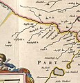
Blaeu - Atlas of Scotland 1654 - STERLINENSIS - Slamannan.jpg 1,332 × 1,381; 685 KB
-
Byre at Jawhills - geograph.org.uk - 1406988.jpg 640 × 480; 113 KB
-
Cattle at Parkhead Farm - geograph.org.uk - 989631.jpg 640 × 480; 42 KB
-
Cows Near Southfield - geograph.org.uk - 147234.jpg 640 × 480; 149 KB
-
Crosshill - geograph.org.uk - 1589423.jpg 640 × 480; 99 KB
-
Culloch Burn - geograph.org.uk - 1525985.jpg 640 × 480; 137 KB
-
Culloch Burn, Slamannan - geograph.org.uk - 1613474.jpg 640 × 480; 138 KB
-
Driveway - geograph.org.uk - 179965.jpg 640 × 480; 100 KB
-
Driveway to Wester Jaw Farm - geograph.org.uk - 989625.jpg 640 × 480; 91 KB
-
Fannyside Muir - geograph.org.uk - 1603829.jpg 640 × 480; 78 KB
-
Field of buttercups. - geograph.org.uk - 192790.jpg 640 × 480; 79 KB
-
Fields at Stoneridge - geograph.org.uk - 179901.jpg 640 × 480; 126 KB
-
Flooded Field Near Todsbughts - geograph.org.uk - 147250.jpg 640 × 480; 149 KB
-
Flooding, River Avon - geograph.org.uk - 1592115.jpg 640 × 359; 68 KB
-
Former Opencast Coal Mine - geograph.org.uk - 147313.jpg 640 × 480; 158 KB
-
Gate near Easter Greenrig - geograph.org.uk - 990747.jpg 640 × 480; 44 KB
-
Grangeneuk Farm - geograph.org.uk - 990751.jpg 640 × 480; 43 KB
-
Grass field, Slamannan - geograph.org.uk - 1526010.jpg 640 × 480; 112 KB
-
Grassland, Crossburn - geograph.org.uk - 1589431.jpg 640 × 480; 83 KB
-
Grassland, Hillend - geograph.org.uk - 1589205.jpg 640 × 359; 58 KB
-
Grassland, Loanhead - geograph.org.uk - 1593902.jpg 640 × 480; 111 KB
-
Grazing cattle by Balmitchell - geograph.org.uk - 1593414.jpg 640 × 418; 68 KB
-
High St, Slamannan - geograph.org.uk - 985394.jpg 640 × 480; 39 KB
-
Line of Disused Railway Near Lodge Farm - geograph.org.uk - 147243.jpg 640 × 480; 155 KB
-
Looking northeast from Drumriggend Road - geograph.org.uk - 1746338.jpg 968 × 648; 126 KB
-
McClenaghan, Slamannan - geograph.org.uk - 1534899.jpg 640 × 480; 87 KB
-
Old colliery buildings. - geograph.org.uk - 189608.jpg 640 × 413; 60 KB
-
Old Flax Kiln - geograph.org.uk - 1746316.jpg 968 × 648; 254 KB
-
Parkhead Farm - geograph.org.uk - 989630.jpg 640 × 480; 60 KB
-
Pasture and plantation - geograph.org.uk - 989621.jpg 640 × 480; 83 KB
-
Peatrigend, Slamannan - geograph.org.uk - 213159.jpg 640 × 480; 114 KB
-
Railway trackbed near Slamannan - geograph.org.uk - 1593919.jpg 640 × 480; 177 KB
-
Rashy ground by Hillend - geograph.org.uk - 1589202.jpg 640 × 480; 92 KB
-
Salterhill Smallholding - geograph.org.uk - 416247.jpg 640 × 480; 99 KB
-
Sheep grazings - geograph.org.uk - 179968.jpg 640 × 480; 104 KB
-
Sheep, Nappyfaulds - geograph.org.uk - 1534882.jpg 640 × 480; 100 KB
-
Sheep, The Neucks - geograph.org.uk - 1589440.jpg 640 × 480; 75 KB
-
Shelter belt, Loanhead - geograph.org.uk - 1593898.jpg 480 × 640; 156 KB
-
Shortrig Farm ,Slamannan near Falkirk - geograph.org.uk - 213142.jpg 640 × 480; 90 KB
-
Silage store, Oakersdykes - geograph.org.uk - 1589211.jpg 640 × 391; 108 KB
-
Slamannan - geograph.org.uk - 1225599.jpg 640 × 427; 257 KB
-
Slamannan - geograph.org.uk - 1225603.jpg 640 × 334; 159 KB
-
Slamannan - geograph.org.uk - 138655.jpg 640 × 480; 189 KB
-
Slamannan Co-operative Society bakery workers in 1920.jpg 1,200 × 733; 136 KB
-
Slamannan Co-operative Society Model T Ford lorry in 1923.jpg 1,181 × 718; 123 KB
-
Slamannan Co-operative Society registered office.jpg 1,200 × 757; 201 KB
-
Slamannan Post Office - geograph.org.uk - 1525976.jpg 640 × 422; 74 KB
-
Small bus shelter - geograph.org.uk - 1318536.jpg 640 × 480; 115 KB
-
South Arnloss - geograph.org.uk - 179937.jpg 640 × 480; 97 KB
-
Spoil heap in field, Drumriggend - geograph.org.uk - 989618.jpg 640 × 480; 55 KB
-
The guardians of Grangeneuk Farm - geograph.org.uk - 990748.jpg 640 × 480; 64 KB
-
The Motte, Slamannan - geograph.org.uk - 1612106.jpg 640 × 480; 80 KB
-
Threaprig - geograph.org.uk - 1589216.jpg 640 × 480; 82 KB
-
Track Leading to Shielknowes - geograph.org.uk - 147264.jpg 480 × 640; 180 KB
-
Tups, Dyke - geograph.org.uk - 1534888.jpg 640 × 577; 103 KB
-
Volvo Graveyard - geograph.org.uk - 416194.jpg 640 × 480; 147 KB
-
Wind sculpted trees, Redbrae - geograph.org.uk - 1593418.jpg 640 × 480; 118 KB


