Category:Sketch maps
Jump to navigation
Jump to search
This category is reserved for hand-drawn or similarly crude maps commonly used to demonstrate rough directions (for driving, walking etc.); instead of a precise map.
(Sketches on pre-existing maps should be filed in the category of the original map; also please note that original map's copyright claims are more important than those of the sketch artist.)
Subcategories
This category has the following 3 subcategories, out of 3 total.
Media in category "Sketch maps"
The following 86 files are in this category, out of 86 total.
-
133 of '(The new guide to Delhi.)' (11100770565).jpg 2,635 × 3,643; 1.37 MB
-
137 of 'The new guide to Delhi' (11074718305).jpg 2,741 × 3,685; 1.45 MB
-
23 of '(The new guide to Delhi.)' (11100531423).jpg 1,434 × 2,336; 498 KB
-
29 of 'The new guide to Delhi' (11072549914).jpg 1,839 × 2,361; 630 KB
-
312 of '(Italy and her Invaders, Vol. 1-4.)' (11219804026).jpg 1,460 × 2,430; 442 KB
-
93 of '(The new guide to Delhi.)' (11103295825).jpg 1,435 × 2,277; 509 KB
-
97 of 'The new guide to Delhi' (11071145115).jpg 1,834 × 2,353; 639 KB
-
An English holiday with car and camera (1908) (14592072449).jpg 3,440 × 2,646; 1.61 MB
-
Bannerdale Crags sketch map.JPG 512 × 384; 25 KB
-
Bethelainville Airdrome - Map Sketch.jpg 3,094 × 4,174; 1.76 MB
-
Binsey sketch map.JPG 512 × 384; 24 KB
-
Blencathra sketch map.JPG 512 × 384; 24 KB
-
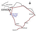
Borders Drove Roads.jpg 1,587 × 1,333; 411 KB
-
Bowscale Fell sketch map.JPG 512 × 384; 23 KB
-
Burgundy (PSF).jpg 594 × 345; 114 KB
-
Carl Side sketch map.JPG 512 × 384; 24 KB
-
Cartina-reda.png 745 × 240; 23 KB
-
Chanonry Old Aberdeen Hospitals.jpg 1,653 × 2,338; 463 KB
-
Chanonry Plan 14 2 14.jpg 1,653 × 2,338; 611 KB
-
Commercial grain farming.jpg 527 × 267; 42 KB
-
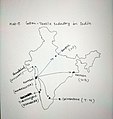
Cotton textile industry in India.jpg 646 × 683; 157 KB
-
Cotton textile industry in world.jpg 640 × 417; 66 KB
-
Deeside Drove Roads.jpg 2,338 × 1,653; 330 KB
-
Dzibilnocac Campeche 1986 Sketch Map.jpg 643 × 988; 227 KB
-
EK Quarry 1983.jpg 3,024 × 4,032; 1.94 MB
-
Europa BV043420913 (cropped).jpg 751 × 1,228; 121 KB
-
Farmer Giles of Ham Sketch Map.svg 747 × 698; 10 KB
-
Figure 1- Examples of Anti-Access and Area Denial Capabilities (15223188706).jpg 2,273 × 1,421; 138 KB
-
Final Sketch map 1.jpg 1,600 × 900; 182 KB
-
Flow mapa.png 846 × 514; 171 KB
-
Great Calva sketch map.JPG 512 × 384; 23 KB
-
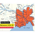
Highest Expansion of Dev Empire during Danujmardan Ramnath Dev.jpg 1,920 × 1,920; 1.73 MB
-
Ishikawaken Chirishosetsu Cape Suzu sketch map.tif 911 × 511; 3 KB
-
Iturbide Campeche 1986 Sketch Map.jpg 744 × 1,166; 374 KB
-
Knott sketch map.JPG 512 × 384; 24 KB
-
KoN Hospital Site 6 7 14.jpg 3,302 × 2,377; 3.2 MB
-
Lairig-ghru-sketch-map.jpg 600 × 881; 51 KB
-
Latrigg sketch map.JPG 512 × 384; 20 KB
-
Location of All Souls Church.jpg 1,500 × 2,070; 621 KB
-
Lonscale Fell sketch map.JPG 512 × 384; 24 KB
-
Lords Seat sketch map.JPG 512 × 384; 28 KB
-
Mapa del Partido de Coronel Rosales.jpg 948 × 676; 127 KB
-
Mapa nimbus wikipedia.jpg 1,649 × 1,275; 485 KB
-
Maptokisc.jpg 255 × 300; 14 KB
-
Martigny Airfield - Map Sketch.jpg 4,241 × 3,156; 1.83 MB
-
Mental map.png 600 × 726; 253 KB
-
Mitteldevonische Grenzkalke Bierenbachtal.jpg 1,229 × 884; 92 KB
-
Mungrisdale sketch map.JPG 512 × 384; 25 KB
-
Newton middle-east map.jpg 1,912 × 1,384; 439 KB
-
Pacifique, Atlantique, Océan Indien - btv1b5970581r (1 of 2).jpg 3,688 × 4,848; 2.11 MB
-
Pacifique, Atlantique, Océan Indien - btv1b5970581r (2 of 2).jpg 7,288 × 4,888; 4.05 MB
-
PlanWPTDU.jpg 3,648 × 2,736; 4.8 MB
-
Robinson sketch map.JPG 512 × 384; 27 KB
-
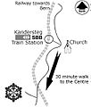
Route map.jpg 1,217 × 812; 117 KB
-
Schetskaart eiland voormalig Kasteel Ruwiel - Oud Aa, Stichtse Vecht, Utrecht, 2022.jpg 2,182 × 1,876; 442 KB
-
Scouting for girls, adapted from Girl guiding - A Sketch Map.png 1,931 × 747; 101 KB
-
Sketch map, Maya ruins in central Acanceh Yucatan, 1977.jpg 12,430 × 8,876; 14.84 MB
-
Skiddaw sketch map.JPG 512 × 384; 21 KB
-
Souther Fell sketch map.JPG 512 × 384; 25 KB
-
Spital Glen Muick 1 3 14.jpg 2,857 × 2,913; 311 KB
-
Stadtplan1.jpg 1,600 × 1,200; 157 KB
-
Stadtplan2.jpg 1,600 × 1,200; 156 KB
-
Super Mapa.jpg 750 × 1,000; 78 KB
-
Telchaquillo Yucatan - sketch map 1977.png 1,280 × 1,104; 1.26 MB
-
The Quarterly journal of the Geological Society of London (1907) (14777447145).jpg 1,896 × 2,984; 677 KB
-
Villena. Área; de 1780 (Fernández Vila de Ugarte).jpg 1,600 × 1,105; 410 KB
-
Whitehall sketch map Chinese.png 503 × 736; 137 KB
-
WP 20141126 003.jpg 2,592 × 1,456; 1.22 MB
-
Карта депортации кумыкского населения.jpg 683 × 610; 51 KB
-
Карта Капибарии.jpg 1,600 × 1,094; 245 KB
-
Схема п. Очеретино.jpg 1,904 × 1,400; 1.2 MB
-
סיור הליכות ג'יין, התחדשות עירונית בשדרות הרצל באשדוד, יוני 2024 07.jpg 6,240 × 4,160; 11.23 MB
-
סיור הליכות ג'יין, התחדשות עירונית בשדרות הרצל באשדוד, יוני 2024 08.jpg 4,160 × 6,240; 11.24 MB
-
李劳庄位置图.gif 746 × 560; 32 KB


