Category:Skerray
Jump to navigation
Jump to search
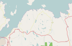
English: Skerray is a remote hamlet on the north coast of Caithness, Scottish Highlands and is in the Scottish council area of Highland. There is an additional location called Skerray which is located 1 mile to the west.
human settlement in Highland, Scotland, UK | |||||
| Upload media | |||||
| Instance of | |||||
|---|---|---|---|---|---|
| Location |
| ||||
 | |||||
Media in category "Skerray"
The following 47 files are in this category, out of 47 total.
-
Coast south of Sleiteil - geograph.org.uk - 4890425.jpg 1,024 × 576; 366 KB
-
Coomb Island - geograph.org.uk - 226562.jpg 640 × 480; 116 KB
-
Highland calf in Skerray.jpg 749 × 562; 95 KB
-
Land erosion at bend in River Borgie - geograph.org.uk - 496415.jpg 640 × 480; 136 KB
-
Loch Buidhe - geograph.org.uk - 494570.jpg 640 × 480; 116 KB
-
Looking down on a reef on the coast at Airdtorrisdale - geograph.org.uk - 4526900.jpg 4,000 × 3,000; 4.13 MB
-
Old jetty in Lamigo Bay - geograph.org.uk - 2569455.jpg 4,000 × 3,000; 2.06 MB
-
Pebble beach at Skerry Bay - geograph.org.uk - 306103.jpg 640 × 480; 88 KB
-
Skerray Bay - geograph.org.uk - 4368218.jpg 2,512 × 1,854; 1.67 MB
-
Skerray Bay harbour - geograph.org.uk - 733181.jpg 640 × 416; 109 KB
-
Skerray Free Church - geograph.org.uk - 577738.jpg 640 × 480; 89 KB
-
Skerray Harbour - geograph.org.uk - 2050026.jpg 640 × 480; 78 KB
-
Skerray map.png 1,414 × 901; 241 KB
-
Skerray Post Office - geograph.org.uk - 2494688.jpg 1,000 × 750; 243 KB
-
The River Borgie from Borgie Bridge - geograph.org.uk - 577721.jpg 640 × 480; 105 KB
-
Borgie Bridge - geograph.org.uk - 577716.jpg 640 × 480; 105 KB
-
Bridge for track passing over burn - geograph.org.uk - 494589.jpg 640 × 480; 101 KB
-
Clàr-loch Mòr - geograph.org.uk - 597552.jpg 640 × 480; 70 KB
-
Farm house - geograph.org.uk - 494632.jpg 640 × 480; 124 KB
-
Farmhouse at Borgie - geograph.org.uk - 496408.jpg 640 × 480; 150 KB
-
Graveyard at Airdtorrisdale - geograph.org.uk - 577733.jpg 640 × 480; 105 KB
-
Hill at Dalcharn, south of Lochan Dubh - geograph.org.uk - 494558.jpg 640 × 480; 100 KB
-
Houses at Achnabat - geograph.org.uk - 494660.jpg 640 × 480; 160 KB
-
Loch Crocach - geograph.org.uk - 620248.jpg 640 × 617; 109 KB
-
Loch Cròcach - geograph.org.uk - 596779.jpg 640 × 480; 76 KB
-
Loch Modsarie - geograph.org.uk - 494620.jpg 640 × 480; 112 KB
-
Lochan Dubh - geograph.org.uk - 494551.jpg 640 × 480; 111 KB
-
Natural Arch, Eilean nan Ron - geograph.org.uk - 253289.jpg 500 × 375; 67 KB
-
Old peat diggings - geograph.org.uk - 494608.jpg 640 × 480; 129 KB
-
Old stone bothy, thatched - geograph.org.uk - 496428.jpg 640 × 480; 107 KB
-
Peat digs - geograph.org.uk - 494653.jpg 640 × 480; 137 KB
-
Pier at Skerray harbour - geograph.org.uk - 494647.jpg 640 × 480; 108 KB
-
Port na h-Uaille, Eilean nan Ron - geograph.org.uk - 253287.jpg 500 × 375; 80 KB
-
River Borgie - geograph.org.uk - 496386.jpg 640 × 480; 139 KB
-
Road Bridge - geograph.org.uk - 577787.jpg 640 × 433; 83 KB
-
Road junction by Borgie Bridge - geograph.org.uk - 496421.jpg 640 × 480; 104 KB
-
Rocky entrance to Skerry Bay harbour - geograph.org.uk - 306085.jpg 640 × 480; 85 KB
-
Sand bar in the bay - geograph.org.uk - 496379.jpg 640 × 480; 120 KB
-
Sheep handling pens - geograph.org.uk - 494615.jpg 640 × 480; 147 KB
-
Sheep handling pens - geograph.org.uk - 496403.jpg 640 × 480; 145 KB
-
Skerray Harbour - geograph.org.uk - 577752.jpg 640 × 453; 51 KB
-
Thatched cottage - geograph.org.uk - 496424.jpg 640 × 480; 121 KB


