Category:Sioux maps
Jump to navigation
Jump to search
Subcategories
This category has only the following subcategory.
M
Media in category "Sioux maps"
The following 44 files are in this category, out of 44 total.
-
Sioux01.png 1,286 × 1,445; 2.63 MB
-
1825 Prairie du Chien Line.jpg 1,275 × 1,650; 495 KB
-
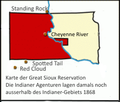
Agencies.png 300 × 254; 46 KB
-
Battlefields (approx.) - U.S. Army and Lakotas, 1854-1890.png 500 × 371; 298 KB
-
Battlefields between the Lakotas and the U.S. Army from 1854 to 1890 (approx.).png 2,485 × 2,790; 14.1 MB
-
Bozeman Trail, the forts and the Indian territories.jpg 1,720 × 2,052; 458 KB
-
Dakota USC2000 PHS.svg 959 × 593; 173 KB
-
Dakotatribesmap.jpg 891 × 649; 212 KB
-
Dept of Northwest Map 1862-65.jpg 1,700 × 2,200; 882 KB
-
Early Indian treaty territories, North Dakota - an overview map.png 1,279 × 830; 418 KB
-
Early Indian treaty territories, North Dakota. Map and overview.png 1,278 × 1,675; 2.99 MB
-
Grande réserve sioux.png 1,223 × 947; 238 KB
-
Granderéservesioux2.png 1,223 × 947; 238 KB
-
JNN-1843-Map.jpg 9,484 × 11,491; 11.96 MB
-
Lakota 1851 treaty territory. (Area 408, 516, 584, 597, 598 and 632).png 1,790 × 1,438; 5.25 MB
-
Lakota map closeup.svg 512 × 347; 107 KB
-
Lakota map.svg 512 × 414; 231 KB
-
Location of Lower Brule Reservation.svg 6,226 × 3,832; 51 KB
-
Lower sioux indian reservation.png 200 × 228; 14 KB
-
Map of the Sioux Country.png 3,073 × 1,921; 3.69 MB
-
National-atlas-indian-reservations-south-dakota.gif 764 × 584; 84 KB
-
Pine Ridge Indian Reservation Location.png 397 × 255; 4 KB
-
Pine Ridge Reservation Road System FDOT.jpg 443 × 326; 21 KB
-
Pine Ridge Reservation SD.png 1,000 × 707; 251 KB
-
Pineridgereservationmap.png 493 × 379; 71 KB
-
Rosebud Indian Reservation Location.png 397 × 255; 4 KB
-
Rosebudreservationmap.png 500 × 388; 83 KB
-
Sioux territory.png 220 × 176; 41 KB
-
Sioux-Aufstand.png 1,503 × 1,009; 2.21 MB
-
Sioux-Kriege 1866-1891.png 1,543 × 1,179; 2.93 MB
-
Sioux-treaty-lands.png 500 × 371; 258 KB
-
Siouxreservationmap.png 500 × 500; 259 KB
-
Sketch of the Blue Water Creek field of action.jpg 3,000 × 4,807; 2.73 MB
-
Standing rock.gif 200 × 300; 12 KB
-
Stoney lang.png 560 × 483; 70 KB
-
The Arikara War, 1823.png 1,778 × 1,171; 825 KB
-
Wpdms washington dakota territories 1861.idx.png 232 × 168; 10 KB
-
Zone de conflit entre les Sioux et le Général Custer.png 766 × 383; 108 KB


