Category:Silloth
Jump to navigation
Jump to search
port town in Cumbria, England  | |||||
| Upload media | |||||
| Instance of | |||||
|---|---|---|---|---|---|
| Location | Silloth-on-Solway, Allerdale, Cumbria, North West England, England | ||||
| official website | |||||
 | |||||
English: Silloth (sometimes known as Silloth-on-Solway) is a port town in Cumbria, England. It sits on the shoreline of the Solway Firth, 22 miles (36 km) west of Carlisle.
The town is an example of a Victorian seaside resort in the North of England.
Subcategories
This category has the following 7 subcategories, out of 7 total.
C
E
- East Cote Light (9 F)
L
- Lees Scar Light (5 F)
P
- Port of Silloth (17 F)
R
- RAF Silloth (5 F)
S
- Silloth Lifeboat Station (1 F)
W
Media in category "Silloth"
The following 73 files are in this category, out of 73 total.
-
 .Sundown at Silloth - geograph.org.uk - 46417.jpg 640 × 480; 187 KB
-
 Aircraft Hangar converted to factory - geograph.org.uk - 63490.jpg 640 × 480; 55 KB
-
 B5300 April 2019 Closure.jpg 4,032 × 3,024; 4.26 MB
-
 Balladoyle - geograph.org.uk - 462547.jpg 640 × 480; 101 KB
-
 Careful with that axe, Eugene. - geograph.org.uk - 125762.jpg 640 × 480; 122 KB
-
 Carr's Flour Mill - geograph.org.uk - 508269.jpg 640 × 421; 51 KB
-
 Carr's flour mill, Silloth - geograph.org.uk - 206470.jpg 640 × 480; 61 KB
-
 Criffel Street, Silloth - geograph.org.uk - 462380.jpg 640 × 480; 188 KB
-
 Criffel Street, Silloth.jpg 640 × 475; 96 KB
-
 Distant view of Silloth - geograph.org.uk - 6109292.jpg 4,032 × 3,024; 809 KB
-
 Drain - geograph.org.uk - 96722.jpg 640 × 427; 90 KB
-
 Eden Street Silloth on Solway.jpg 1,471 × 1,469; 927 KB
-
 Eden Street, Silloth - geograph.org.uk - 939003.jpg 640 × 480; 79 KB
-
 Empty benches at Silloth - geograph.org.uk - 1305566.jpg 640 × 480; 48 KB
-
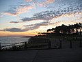
 Evening over the Solway, 10 May 2005. - geograph.org.uk - 136917.jpg 640 × 480; 64 KB
-
 Hardware Shop, Silloth - geograph.org.uk - 125742.jpg 640 × 480; 122 KB
-

-
 Outer harbour, Silloth docks - geograph.org.uk - 3048917.jpg 1,024 × 768; 446 KB
-

-
 Pond at West Border Farm - geograph.org.uk - 1495140.jpg 640 × 480; 68 KB
-
 Queens Hotel, Silloth.jpg 3,456 × 2,304; 2.91 MB
-
 Silloth and the Solway Firth - geograph.org.uk - 1766156.jpg 3,872 × 2,592; 2.71 MB
-
 Silloth boats - panoramio.jpg 3,264 × 2,448; 2.01 MB
-
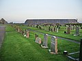 Silloth Cemetery - geograph.org.uk - 600866.jpg 640 × 480; 166 KB
-
 Silloth Cemetery, Sign - geograph.org.uk - 600858.jpg 640 × 480; 174 KB
-
 Silloth Factory arial photo.jpg 4,608 × 3,455; 6.31 MB
-
 Silloth Fire Station - geograph.org.uk - 343167.jpg 640 × 480; 52 KB
-
 Silloth Seafront. - geograph.org.uk - 3404363.jpg 640 × 480; 55 KB
-
 Silloth, Cumbria - from pavillion - panoramio.jpg 2,048 × 1,536; 356 KB
-
 Silloth, Cumbrian west coast - main street - panoramio.jpg 2,048 × 1,536; 452 KB
-
 Silloth, Cumbrian west coast - panoramio (1).jpg 2,048 × 1,536; 267 KB
-
 Silloth, Cumbrian west coast - panoramio.jpg 2,048 × 1,536; 402 KB
-
 Silloth, West Beach - geograph.org.uk - 613703.jpg 640 × 480; 114 KB
-
 Silloth, West Beach, view of Criffel - geograph.org.uk - 674608.jpg 640 × 427; 67 KB
-
 Silloth, with modified fingerpost, Sept 1994 - Flickr - sludgegulper.jpg 1,787 × 1,169; 193 KB
-
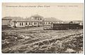 SillothConvalescentPostcard0001.jpg 1,126 × 736; 228 KB
-
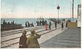 SillothPierPostcard.jpg 1,059 × 634; 298 KB
-
 SillothWestBeach.jpg 2,272 × 1,704; 1.43 MB
-
 Sillón chiquito.jpg 1,599 × 899; 141 KB
-
 Solway Holiday Village - geograph.org.uk - 124482.jpg 640 × 480; 49 KB
-
 The Pavilion at Silloth - geograph.org.uk - 939021.jpg 640 × 480; 65 KB
-
 The Pavilion at Silloth, Solway Firth - geograph.org.uk - 939091.jpg 640 × 480; 23 KB
-
 The Pavilion, Silloth - geograph.org.uk - 939078.jpg 640 × 480; 56 KB
-
 The Promenade at Silloth - geograph.org.uk - 938992.jpg 640 × 480; 62 KB
-
 The Promenade at Silloth - geograph.org.uk - 939046.jpg 640 × 480; 87 KB
-
 The Promenade at Silloth, Cumbria - geograph.org.uk - 1118188.jpg 640 × 425; 54 KB
-
 Track from East Border Farm - geograph.org.uk - 1500310.jpg 640 × 480; 59 KB
-

-
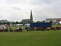 Vintage Rally at Silloth - geograph.org.uk - 939100.jpg 640 × 480; 49 KB
-
 Vulcan bomber over Silloth - geograph.org.uk - 1448593.jpg 640 × 480; 311 KB
-
 War Memorial, Silloth.jpg 505 × 1,250; 536 KB
-
 West Causewayhead - geograph.org.uk - 571995.jpg 640 × 480; 219 KB
-
 West Causewayhead - geograph.org.uk - 571996.jpg 640 × 480; 210 KB
-
 West Causewayhead - geograph.org.uk - 571997.jpg 640 × 480; 208 KB
-
 West Causewayhead - geograph.org.uk - 571998.jpg 640 × 480; 188 KB
-
 West Causewayhead - geograph.org.uk - 571999.jpg 640 × 480; 120 KB
-
 West Causewayhead - geograph.org.uk - 572001.jpg 480 × 640; 187 KB
-
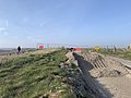
 Beach and low dunes near Silloth - geograph.org.uk - 1824.jpg 494 × 298; 21 KB
-
 Bridge over dismantled railway - geograph.org.uk - 1447415.jpg 640 × 460; 125 KB
-
 Criffel street - geograph.org.uk - 617106.jpg 640 × 480; 65 KB
-
 Criffel Street, Silloth - geograph.org.uk - 618813.jpg 640 × 480; 64 KB
-
 Drain, Wolsty - geograph.org.uk - 572006.jpg 640 × 480; 195 KB
-
 Light - geograph.org.uk - 462540.jpg 640 × 480; 104 KB
-
 Looking up the coast from Silloth - geograph.org.uk - 372907.jpg 640 × 480; 72 KB
-
 Sea wall - geograph.org.uk - 193638.jpg 640 × 480; 212 KB
-
 Signpost at Silloth - geograph.org.uk - 125732.jpg 480 × 640; 122 KB
-
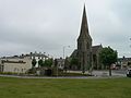
 Silloth - geograph.org.uk - 58109.jpg 640 × 480; 100 KB
-
 Silloth former National School - geograph.org.uk - 87866.jpg 640 × 480; 92 KB
-
 Silloth Green - geograph.org.uk - 87864.jpg 640 × 470; 66 KB
-
 Silloth Promenade - geograph.org.uk - 206471.jpg 640 × 480; 57 KB
-
 Silloth Promenade - geograph.org.uk - 87863.jpg 640 × 480; 104 KB
-
 Solway Coast Discovery Centre - geograph.org.uk - 40355.jpg 640 × 249; 44 KB
-
 Steam engine, Carr's flour mill - geograph.org.uk - 707649.jpg 640 × 427; 103 KB


.jpg)


