Category:Silesian German-language maps
Appearance
|
|||
Media in category "Silesian German-language maps"
The following 24 files are in this category, out of 24 total.
-
Aeberlausitz.png 900 × 574; 203 KB
-
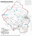
Aeberschläsing, Landkreese 1927 - 1938.png 1,565 × 1,235; 281 KB
-
Groofschoft Glootz.GIF 758 × 516; 62 KB
-
Heemtekoarte Schläsing.png 1,970 × 1,500; 4.83 MB
-
Koarte der Grofschoaft Glootz.png 971 × 935; 228 KB
-
Koarte des gleetzischen Mundoartgebietes.PNG 591 × 893; 182 KB
-
Koarte Krees Grienberg.png 1,153 × 733; 335 KB
-
Koarte Landkrees Bunzel.png 1,773 × 1,386; 3.39 MB
-
Koarte Landkrees Gruttke.png 912 × 1,002; 1.69 MB
-
Koarte Landkrees Herschbrich.png 925 × 624; 1.06 MB
-
Koarte Landkrees Lischwitz.png 1,040 × 955; 1.7 MB
-
Koarte Landkrees Neisse.png 1,150 × 1,019; 2.06 MB
-
Koarte Niederschläsing.png 715 × 469; 139 KB
-
Koarte Oberschläsing.png 858 × 869; 205 KB
-
Koarte Schläsing.png 718 × 433; 67 KB
-
Koarte vu Aeberschläsing.png 4,172 × 4,702; 3.09 MB
-
Landkreese - Woiwodschoaft Niederschläsing.png 1,129 × 1,024; 283 KB
-
Landkreese - Woiwodschoaft Schläsing.png 1,158 × 1,124; 301 KB
-
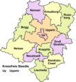
Landkreese - Woiwodschoaft Uppeln.png 951 × 1,024; 210 KB
-
Schläsche Aeberlausitz.png 981 × 720; 134 KB
-
Schläsches Sproachgebiet.png 718 × 433; 61 KB
-
Schläsing.png 440 × 314; 27 KB
-
Woiwodschoaft Niederschläsing.png 1,600 × 1,467; 2.23 MB
-
Woiwodschoaft Uppeln.png 1,600 × 1,810; 2.94 MB


