Category:Silenen
Jump to navigation
Jump to search
municipality in the canton of Uri, Switzerland | |||||
| Upload media | |||||
| Pronunciation audio | |||||
|---|---|---|---|---|---|
| Instance of | |||||
| Location | Uri, Switzerland | ||||
| Located in or next to body of water | |||||
| Official language | |||||
| Population |
| ||||
| Area |
| ||||
| Elevation above sea level |
| ||||
| official website | |||||
 | |||||
Subcategories
This category has the following 21 subcategories, out of 21 total.
A
B
- Bälmeten (15 F)
- Bocktschingel (9 F)
- Bristensee (2 F)
C
- Chli Windgällen (3 F)
- Chrüzlistock (6 F)
G
- Gross Windgällen (82 F)
H
- Hüfifirn (45 F)
M
- Mutsch (Glarus Alps) (1 F)
N
- Piz Nair (Glarus Alps) (6 F)
O
S
- Sunnig Wichel (6 F)
T
Media in category "Silenen"
The following 49 files are in this category, out of 49 total.
-
Amsteg - GBT Access and Cable Tunnel (30821223371).jpg 3,461 × 5,200; 8.5 MB
-
Amsteg - GBT Access and Cable Tunnel (30821328341).jpg 5,200 × 3,467; 7.01 MB
-
Amsteg - GBT Access Tunnel (30274938954).jpg 5,200 × 3,467; 6.37 MB
-
Amsteg - GBT Access Tunnel (30608126860).jpg 5,200 × 3,466; 7.43 MB
-
Amsteg - GBT Access Tunnel (30608128430).jpg 5,200 × 3,467; 9.3 MB
-
Amsteg - GBT Access Tunnel (30792928252).jpg 5,200 × 3,467; 9.36 MB
-
Amsteg - GBT Access Tunnel (30792931632).jpg 5,200 × 3,467; 6.76 MB
-
Amsteg - GBT Access Tunnel (30793265552).jpg 5,200 × 3,467; 5.55 MB
-
Amsteg - GBT Access Tunnel (30793268472).jpg 5,200 × 3,467; 11.95 MB
-
Amsteg - GBT Access Tunnel (30821329901).jpg 5,200 × 3,467; 8.27 MB
-
Amsteg - GBT Access Tunnel (30873102796).jpg 5,200 × 3,466; 8.96 MB
-
Amsteg - GBT Access Tunnel (30873105956).jpg 5,200 × 3,466; 9.91 MB
-
Amsteg - GBT Access Tunnel (30873108196).jpg 3,466 × 5,200; 7.21 MB
-
Amsteg - GBT Access Tunnel (30873109906).jpg 5,200 × 3,466; 10.11 MB
-
Amsteg - GBT Access Tunnel-Feed Point Cavern (30273269793).jpg 5,200 × 3,467; 8.84 MB
-
Amsteg - GBT Access Tunnel-Feed Point Cavern (30274947534).jpg 5,200 × 3,466; 9.19 MB
-
Amsteg - GBT Cable Tunnel (30273271113).jpg 5,200 × 3,466; 6.07 MB
-
Amsteg - GBT Cable Tunnel (30275048304).jpg 5,200 × 3,466; 8.75 MB
-
Amsteg - GBT Cable Tunnel (30821218981).jpg 3,467 × 5,200; 5.74 MB
-
Amsteg - GBT Cable Tunnel (30821221621).jpg 5,200 × 3,467; 8.15 MB
-
Amsteg - GBT Cable Tunnel (30934985901).jpg 5,200 × 3,467; 7.35 MB
-
Amsteg - GBT Cable Tunnel (30934988771).jpg 5,200 × 3,467; 9.3 MB
-
Amsteg - GBT Cable Tunnel (31013344846).jpg 5,200 × 3,466; 8.06 MB
-
Amsteg - GBT Feed Point Cavern (30274941874).jpg 5,200 × 3,467; 8.05 MB
-
Amsteg - GBT Feed Point Cavern (30274944374).jpg 5,200 × 3,467; 6.28 MB
-
Bristen-Edelweiss.jpg 1,200 × 800; 1.17 MB
-
Bristen-Golzernsee.jpg 1,200 × 800; 941 KB
-
Bristen-Kapelle.jpg 1,200 × 800; 1.15 MB
-
Bristen-See.jpg 1,200 × 800; 1.05 MB
-
CHE Silenen Flag.svg 254 × 254; 27 KB
-
CHE Silenen Logo.png 215 × 115; 21 KB
-
ChilcherbergenWW.jpg 4,240 × 2,832; 6.41 MB
-
ETH-BIB-Maderanertal, Golzernsee, Hüfifirn-Inlandflüge-LBS MH01-006915.tif 6,779 × 4,823; 93.67 MB
-
ETH-BIB-Schneerhorn, vom Klausen-Pass-Dia 247-12596.tif 3,758 × 2,840; 30.64 MB
-
ETH-BIB-Seewligrat, Gross Windgällen, Schärhorn v. W. aus 3600 m-Inlandflüge-LBS MH01-002393.tif 4,331 × 6,326; 78.42 MB
-
ETH-BIB-Witenalpstock, Oberalpstock, Düssi, Tödi-Inlandflüge-LBS MH05-04-07.tif 3,508 × 2,419; 24.33 MB
-
Fingerpost Chrüzlipass.jpg 1,944 × 2,592; 1.2 MB
-
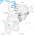
Karte Gemeinde Silenen 2007.png 1,476 × 1,533; 661 KB
-
Karte Gemeinde Silenen.png 826 × 860; 227 KB
-
Pfaffen Spherical Panorama.jpg 22,016 × 11,008; 45.19 MB
-
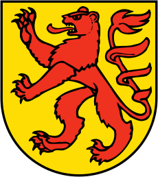
Wappen Silenen.svg 408 × 458; 16 KB
-
Silenen UR.png 254 × 254; 29 KB
-
Silenen-Blazono.png 216 × 251; 43 KB
-
Silenen.jpg 1,200 × 800; 1.15 MB
-
Wappen Silenen.png 207 × 215; 68 KB


