Category:Signs in the Metropolitan Borough of Calderdale
Jump to navigation
Jump to search
Subcategories
This category has the following 15 subcategories, out of 15 total.
Media in category "Signs in the Metropolitan Borough of Calderdale"
The following 30 files are in this category, out of 30 total.
-
A sign at Todmorden Train Station - geograph.org.uk - 2068992.jpg 800 × 600; 234 KB
-
A58 Whitehall Road East - geograph.org.uk - 5162977.jpg 1,600 × 1,065; 490 KB
-
Beware of fairies.jpg 471 × 427; 107 KB
-
Broom Hill Road - geograph.org.uk - 974659.jpg 640 × 480; 147 KB
-
BWB marker post on canal towpath, Sowerby Bridge - geograph.org.uk - 2423498.jpg 2,048 × 1,536; 820 KB
-
Damaged Sign, Water Stalls Road - geograph.org.uk - 1803397.jpg 2,560 × 1,920; 1.44 MB
-
Entering Calderdale - geograph.org.uk - 4388011.jpg 640 × 480; 54 KB
-
EUDC water main hydrant and valve plates - geograph.org.uk - 3405388.jpg 1,500 × 2,000; 595 KB
-
Footpath signpost on Thornhills Beck Lane for Brighouse FP59 - geograph.org.uk - 4426533.jpg 2,000 × 1,500; 1.57 MB
-
Gate on Brighouse FP76, Clifton - geograph.org.uk - 4676531.jpg 2,048 × 1,536; 1.32 MB
-
Look out for the little folk - geograph.org.uk - 773026.jpg 480 × 640; 101 KB
-
MCWW water main marker post, Jay House Lane, Clifton - geograph.org.uk - 2663052.jpg 1,500 × 2,000; 1.25 MB
-
Old Toll House (geograph 6114975).jpg 300 × 400; 177 KB
-
Plaque at Baitings Reservoir - geograph.org.uk - 3534433.jpg 2,000 × 1,298; 736 KB
-
Public footpath sign on Toothill Bank - geograph.org.uk - 3362756.jpg 2,000 × 1,474; 1.09 MB
-
Road to the former Milner Royd Sewage Works - geograph.org.uk - 2884585.jpg 2,000 × 1,462; 1.02 MB
-
Salem Fields, Hebden Bridge - geograph.org.uk - 431911.jpg 640 × 480; 181 KB
-
Sat-nav warning sign on Ellen Royd Lane, Luddendenfoot - geograph.org.uk - 5604851.jpg 2,000 × 1,500; 1.13 MB
-
Sign on one of the arches of Wheatley Viaduct - geograph.org.uk - 1893053.jpg 1,024 × 928; 397 KB
-
Stile on Sowerby Bridge FP112 (Link F) - geograph.org.uk - 4587021.jpg 2,048 × 1,536; 1.02 MB
-
Stonely Barn Farm - geograph.org.uk - 727668.jpg 640 × 453; 158 KB
-
Straight from the horse's mouth (5927316350).jpg 3,000 × 4,000; 7.3 MB
-
UK Calderdale.jpg 1,038 × 896; 166 KB
-
Water main marker post, Hob Lane - geograph.org.uk - 4646095.jpg 1,456 × 1,968; 978 KB
-
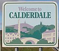
Welcome to Calderdale - geograph.org.uk - 1064112.jpg 640 × 427; 101 KB


