Category:Shubert's maps of Vilno Governorate
Jump to navigation
Jump to search
Media in category "Shubert's maps of Vilno Governorate"
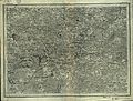
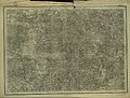
The following 21 files are in this category, out of 21 total.
-
 Shubert map - R11L04.jpg 7,629 × 5,783; 19.21 MB
-
 Shubert map - R11L06.jpg 7,620 × 5,785; 19.13 MB
-
 Shubert map - R11L07.jpg 7,606 × 5,833; 19.21 MB
-
 Shubert map - R12L03.jpg 7,512 × 5,962; 17.65 MB
-
 Shubert map - R12L04.jpg 7,558 × 5,638; 16.9 MB
-
 Shubert map - R12L05.jpg 7,439 × 5,791; 18.47 MB
-
 Shubert map - R12L06.jpg 7,558 × 5,884; 15.73 MB
-
 Shubert map - R13L03.jpg 7,944 × 5,799; 12.62 MB
-
 Shubert map - R13L04.jpg 7,532 × 5,731; 16.25 MB
-
 Shubert map - R13L05.jpg 7,566 × 5,778; 14.54 MB
-
 Shubert map - R13L06.jpg 7,914 × 6,036; 15.42 MB
-
 Shubert map - R14L03.jpg 7,731 × 5,820; 15.77 MB
-
 Shubert map - R14L04.jpg 7,743 × 5,950; 18.94 MB
-
 Shubert map - R14L05.jpg 7,668 × 5,917; 17.78 MB
-
 Shubert map - R14L06.jpg 7,716 × 5,883; 18.37 MB
-
 Shubert map - R15L03.jpg 7,814 × 6,015; 17.54 MB
-
 Shubert map - R15L04.jpg 7,864 × 6,022; 18.31 MB
-
 Shubert map - R15L05.jpg 7,812 × 5,951; 17.25 MB
-
 Shubert map - R15L06.jpg 5,147 × 3,961; 8.71 MB
-
 Shubert map - R16L03.jpg 8,306 × 6,185; 18.11 MB
-
 Shubert map - R16L05.jpg 7,792 × 5,973; 18.26 MB


