Category:Shubert's maps of Kiev Governorate
Jump to navigation
Jump to search
Media in category "Shubert's maps of Kiev Governorate"
The following 31 files are in this category, out of 31 total.
-
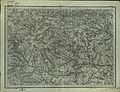
 Shubert map - R20L08.jpg 4,946 × 3,654; 7.05 MB
-
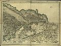
 Shubert map - R20L09.jpg 7,876 × 5,889; 16.99 MB
-
 Shubert map - R21L07.jpg 8,057 × 6,047; 16.44 MB
-
 Shubert map - R21L08.jpg 7,942 × 6,138; 19.03 MB
-
 Shubert map - R21L09.jpg 7,255 × 5,529; 7.3 MB
-
 Shubert map - R22L07.jpg 8,048 × 6,001; 17.23 MB
-
 Shubert map - R22L08.jpg 7,150 × 5,580; 10.71 MB
-
 Shubert map - R22L09.jpg 7,709 × 6,002; 17.54 MB
-
 Shubert map - R23L07.jpg 7,800 × 5,907; 17.23 MB
-
 Shubert map - R23L08.jpg 7,890 × 5,971; 16.98 MB
-
 Shubert map - R23L09 (white).png 4,452 × 3,402; 7.73 MB
-
 Shubert map - R23L09.jpg 4,726 × 3,546; 6.74 MB
-
 Shubert map - R23l10.jpg 7,356 × 5,668; 15.48 MB
-
 Shubert map - R24L07.jpg 7,551 × 6,195; 19.05 MB
-
 Shubert map - R24L08.jpg 7,497 × 5,958; 15.93 MB
-
 Shubert map - R24L09.jpg 7,673 × 5,981; 17.88 MB
-
 Shubert map - R24L10.jpg 7,285 × 5,696; 28.26 MB
-
 Shubert map - R24L11.jpg 7,703 × 5,896; 14.26 MB
-
 Shubert map - R25L07.jpg 7,979 × 5,958; 16.62 MB
-
 Shubert map - R25L08.jpg 7,230 × 5,620; 6.74 MB
-
 Shubert map - R25L09.jpg 7,865 × 6,019; 18.42 MB
-
 Shubert map - R25L10.jpg 7,833 × 5,981; 16.47 MB
-
 Shubert map - R25L11.jpg 7,589 × 5,687; 14.81 MB
-
 Shubert map - R26L08.jpg 7,688 × 5,827; 16.4 MB
-
 Shubert map - R26l09.jpg 7,928 × 5,917; 14.24 MB
-
 Shubert map - R26L10.jpg 5,070 × 3,857; 6.52 MB
-
 Бурти (1869).png 397 × 313; 315 KB
-
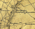 Йосипівка та Розлива (1869).png 434 × 354; 357 KB
-
 Кам'януватка (1869).png 291 × 246; 154 KB
-
 Капітанівка (1869).png 449 × 358; 387 KB
-
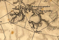 Рейментарівка (1869).png 406 × 277; 256 KB


.png)


.png)
.png)
.png)
.png)
.png)