Category:Shoscombe
Jump to navigation
Jump to search
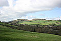
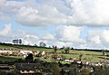
English: Shoscombe is a small village and civil parish in the valley of the Wellow Brook in north-east Somerset, about south of Bath. The parish has a population of 462.
village and civil parish in Somerset, UK  | |||||
| Upload media | |||||
| Instance of | |||||
|---|---|---|---|---|---|
| Location | Bath and North East Somerset, Somerset, South West England, England | ||||
| Population |
| ||||
| Area |
| ||||
 | |||||
Subcategories
This category has only the following subcategory.
Media in category "Shoscombe"
The following 82 files are in this category, out of 82 total.
-
 A367 Peasedown Bypass - geograph.org.uk - 127021.jpg 640 × 430; 98 KB
-
 Arable field by Brinscombe Lane - geograph.org.uk - 4898440.jpg 1,920 × 1,280; 938 KB
-
 Block the House - geograph.org.uk - 2790096.jpg 1,600 × 1,048; 323 KB
-
 Brinscombe Lane - geograph.org.uk - 4898436.jpg 3,072 × 2,048; 1.48 MB
-
 By the Wellow Brook - geograph.org.uk - 4898220.jpg 3,064 × 1,879; 1.46 MB
-
 Byway to Stony Littleton Farm - geograph.org.uk - 4844801.jpg 1,920 × 1,212; 869 KB
-
 Cars and houses at Shoscombe - geograph.org.uk - 4966431.jpg 640 × 479; 141 KB
-
 Disused Railway near Lower Writhlington - geograph.org.uk - 700862.jpg 640 × 426; 146 KB
-
 Double Hill Farm - geograph.org.uk - 4898533.jpg 1,920 × 1,280; 831 KB
-
 Eighteen Mile Bridge - geograph.org.uk - 4898301.jpg 1,920 × 1,288; 860 KB
-
 Eighteen Mile Bridge - geograph.org.uk - 4898307.jpg 1,575 × 1,256; 467 KB
-
 Farm cottages, Shoscombe - geograph.org.uk - 1187283.jpg 640 × 480; 94 KB
-
 Farmland, Stoney Littleton - geograph.org.uk - 4844921.jpg 1,920 × 1,247; 617 KB
-
 Faulkland Lane - geograph.org.uk - 3278509.jpg 3,264 × 2,448; 1.68 MB
-
 Field near Double Hill - geograph.org.uk - 4898492.jpg 1,920 × 1,280; 1.06 MB
-
 Footbridge over Wellow Brook - geograph.org.uk - 4844775.jpg 1,920 × 2,880; 2 MB
-
 Footbridge over Wellow Brook - geograph.org.uk - 4898152.jpg 1,920 × 2,880; 1.44 MB
-
 Footpath from Hang Hill - geograph.org.uk - 4898408.jpg 1,920 × 1,280; 943 KB
-
 Gate on the White Ox Mead Knoll Byway - geograph.org.uk - 1801265.jpg 2,592 × 1,944; 1.45 MB
-
 Grays Hill - geograph.org.uk - 4898270.jpg 1,920 × 1,280; 757 KB
-
 Hang Hill - geograph.org.uk - 4845328.jpg 1,920 × 1,294; 930 KB
-
 Heading towards White Ox Mead Knoll - geograph.org.uk - 1801011.jpg 2,592 × 1,944; 1.59 MB
-
 Hillside, Double Hill - geograph.org.uk - 4839831.jpg 1,920 × 1,280; 561 KB
-
 House by Littleton Lane - geograph.org.uk - 4898232.jpg 1,920 × 1,280; 910 KB
-
 House Under - geograph.org.uk - 4213439.jpg 681 × 1,024; 188 KB
-
 Houses on Barn Hill - geograph.org.uk - 4839674.jpg 1,824 × 886; 363 KB
-
 Junction on Hang Hill - geograph.org.uk - 4898391.jpg 1,916 × 1,212; 768 KB
-
 Lane to Foxcote - geograph.org.uk - 1187276.jpg 480 × 640; 110 KB
-
 Littleton Lane - geograph.org.uk - 4844792.jpg 1,920 × 1,247; 683 KB
-
 Littleton Lane - geograph.org.uk - 4844829.jpg 3,072 × 2,048; 1.62 MB
-
 Littleton Lane - geograph.org.uk - 4844874.jpg 1,920 × 1,218; 915 KB
-
 Littleton Lane - geograph.org.uk - 4844890.jpg 3,001 × 1,628; 1.04 MB
-
 Lower Whitelands, Radstock - geograph.org.uk - 39479.jpg 640 × 480; 96 KB
-
 Meadow by Wellow Brook - geograph.org.uk - 4898114.jpg 1,920 × 1,196; 755 KB
-
 Meadow by Wellow Brook - geograph.org.uk - 4898171.jpg 1,920 × 1,124; 664 KB
-
 Meadow by Wellow Brook - geograph.org.uk - 4898189.jpg 1,920 × 1,280; 1.13 MB
-
 Meadow by Wellow Brook - geograph.org.uk - 4898199.jpg 1,920 × 1,280; 944 KB
-
 Meander - panoramio.jpg 2,048 × 1,536; 889 KB
-
 Near Peasedown St John - geograph.org.uk - 4898552.jpg 1,920 × 1,151; 611 KB
-
 New houses at Shoscombe Vale - geograph.org.uk - 4966433.jpg 640 × 479; 148 KB
-
 Obstructed stile near Double Hill - geograph.org.uk - 4898509.jpg 1,920 × 1,280; 1.25 MB
-

-

-

-
 Path from Brinscombe Lane - geograph.org.uk - 4898430.jpg 1,920 × 1,280; 1.07 MB
-
 Path from Double Hill - geograph.org.uk - 4839825.jpg 1,920 × 1,280; 1.09 MB
-
 Path to Double Hill - geograph.org.uk - 4898476.jpg 1,920 × 2,401; 1.53 MB
-
 Railway Relic at Single Hill - geograph.org.uk - 448773.jpg 640 × 480; 128 KB
-
 Rock exposure, Wellow Book valley - geograph.org.uk - 4898181.jpg 1,920 × 1,280; 1.25 MB
-
 Shoscombe - geograph.org.uk - 1187286.jpg 640 × 480; 102 KB
-
 Shoscombe Farmhouse - geograph.org.uk - 1187295.jpg 480 × 640; 84 KB
-
 Shoscombe Vale - geograph.org.uk - 731848.jpg 640 × 431; 73 KB
-
 Shoscombe, UK - panoramio (1).jpg 4,288 × 2,848; 5.62 MB
-
 Shoscombe, UK - panoramio (2).jpg 4,288 × 2,848; 5.65 MB
-
 Shoscombe, UK - panoramio (3).jpg 4,288 × 2,848; 5.22 MB
-
 Shoscombe, UK - panoramio (4).jpg 4,288 × 2,848; 5.65 MB
-
 Shoscombe, UK - panoramio (5).jpg 4,288 × 2,848; 5.61 MB
-
 Shoscombe, UK - panoramio (6).jpg 4,288 × 2,848; 5.42 MB
-
 Shoscombe, UK - panoramio (7).jpg 4,288 × 2,848; 5.31 MB
-
 Shoscombe, UK - panoramio (8).jpg 4,288 × 2,848; 5.41 MB
-
 Shoscombe, UK - panoramio.jpg 4,288 × 2,848; 5.86 MB
-
 Shoscombe.jpg 626 × 435; 348 KB
-
 Six years on - geograph.org.uk - 3278521.jpg 3,264 × 2,448; 1.7 MB
-

-
 Springfield Farm, Gullen - geograph.org.uk - 4845333.jpg 3,072 × 2,048; 1.07 MB
-
 Stony Littleton - geograph.org.uk - 731830.jpg 640 × 451; 89 KB
-
 Stony Littleton - geograph.org.uk - 731843.jpg 640 × 405; 57 KB
-
 Tank Obstacles at Shoscombe Halt - geograph.org.uk - 6213388.jpg 3,080 × 2,053; 7.01 MB
-
 Terracettes by Littleton Lane - geograph.org.uk - 4898228.jpg 1,920 × 1,280; 891 KB
-
 The Wellow Brook - geograph.org.uk - 700865.jpg 640 × 637; 239 KB
-
 The Wellow Brook - geograph.org.uk - 941389.jpg 640 × 480; 117 KB
-
 Track, Stone Ridge Farm - geograph.org.uk - 4845295.jpg 3,007 × 2,022; 963 KB
-
 View from Lippiat Hill - geograph.org.uk - 728756.jpg 640 × 449; 108 KB
-
 Wellow Brook - geograph.org.uk - 4844808.jpg 1,920 × 1,280; 881 KB
-
 Wellow Brook valley at Single Hill - geograph.org.uk - 4898398.jpg 1,920 × 1,116; 660 KB
-
 Western end of the Byway over White Ox Mead Knoll - geograph.org.uk - 1801000.jpg 2,592 × 1,944; 1.55 MB
-
 Wet footpath near Double Hill - geograph.org.uk - 4898443.jpg 2,048 × 3,072; 1.38 MB
-
 Car showrooms, Peasedown - geograph.org.uk - 688971.jpg 640 × 437; 106 KB
-
 Flooded meadow at Shoscombe - geograph.org.uk - 359334.jpg 640 × 480; 109 KB
-
 Junction on Peasedown Bypass - geograph.org.uk - 127010.jpg 640 × 430; 94 KB
-
 Shoscombe - geograph.org.uk - 359321.jpg 640 × 480; 108 KB
-
 The Apple Tree Inn, Shoscombe - geograph.org.uk - 359326.jpg 640 × 480; 64 KB


.jpg)
.jpg)
.jpg)
.jpg)
.jpg)
.jpg)
.jpg)
.jpg)


