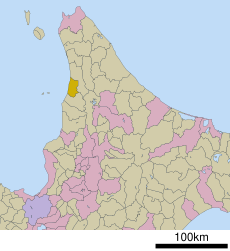
Category:Shosanbetsu, Hokkaido
Jump to navigation
Jump to search
village in Tomamae district, Hokkaido, Japan | |||||
| Upload media | |||||
| Instance of | |||||
|---|---|---|---|---|---|
| Location |
| ||||
| Legal form |
| ||||
| Inception |
| ||||
| Population |
| ||||
| Area |
| ||||
| official website | |||||
 | |||||
English: Shosanbetsu, Hokkaido, Japan
Subcategories
This category has the following 8 subcategories, out of 8 total.
K
- Kyōsei Station (1 F)
S
- Shosambetsu Station (2 F)
T
- Teshio-Ariake Station (2 F)
- Teshio-Ōsawa Station (1 F)
- Teshio-Sakae Station (2 F)
- Toyosaki Station (1 F)
Media in category "Shosanbetsu, Hokkaido"
The following 23 files are in this category, out of 23 total.
-
Haboro bridge 2.jpg 3,951 × 2,442; 1.34 MB
-
Haboro tunnel 1.jpg 4,128 × 2,752; 2.26 MB
-
Haborosen teshioariake.jpg 4,128 × 2,752; 5.13 MB
-
Haborosen teshiosakae.jpg 4,056 × 2,658; 674 KB
-
Hokkaido Shosanbetsu-vill.png 300 × 152; 14 KB
-
Ororon Line - panoramio.jpg 640 × 480; 43 KB
-
Population distribution of Shosanbetsu, Hokkaido, Japan.svg 512 × 256; 22 KB
-
Shosanbetsu in Hokkaido Prefecture Ja.svg 800 × 872; 46 KB
-
Shosanbetsu in Rumoi Subprefecture.gif 616 × 816; 50 KB
-
Shosanbetsu konpira crop.png 1,728 × 655; 2.02 MB
-
Shosanbetsu konpira.JPG 1,728 × 1,152; 1.49 MB
-
Shosanbetsu village center area Aerial photograph.1977.jpg 4,779 × 3,448; 12.07 MB
-
Shosanbetsu village hall.JPG 3,843 × 2,010; 2.35 MB
-
オロロンライン - panoramio - Yobito KAYANUMA (10).jpg 1,600 × 902; 213 KB
-
オロロンライン - panoramio - Yobito KAYANUMA (11).jpg 1,600 × 900; 128 KB
-
オロロンライン - panoramio - Yobito KAYANUMA (12).jpg 1,600 × 900; 177 KB
-
オロロンライン - panoramio - Yobito KAYANUMA (13).jpg 1,600 × 902; 180 KB
-
オロロンライン - panoramio - Yobito KAYANUMA (9).jpg 1,600 × 902; 250 KB
-
初山別 - panoramio.jpg 1,600 × 902; 205 KB
-
初山別みさき台公園キャンプ場 - panoramio (1).jpg 4,896 × 2,752; 5.4 MB
-
初山別みさき台公園キャンプ場 - panoramio.jpg 4,896 × 2,752; 4.32 MB
-
基礎自治体位置図 01485.svg 400 × 604; 13 KB
-
羽幌線橋梁跡 - panoramio.jpg 1,600 × 902; 342 KB


