Category:Shore Road, Bosham
Jump to navigation
Jump to search
Subcategories
This category has the following 4 subcategories, out of 4 total.
Media in category "Shore Road, Bosham"
The following 65 files are in this category, out of 65 total.
-
 Bosham - after high tide - geograph.org.uk - 402545.jpg 640 × 480; 69 KB
-
 Bosham as seen in grey. - geograph.org.uk - 1523856.jpg 640 × 480; 42 KB
-
 Bosham from Shore Road - panoramio.jpg 1,024 × 768; 267 KB
-
 Bosham Harbour - geograph.org.uk - 1371154.jpg 640 × 360; 48 KB
-
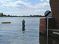
 Bosham Harbour - High Tide - geograph.org.uk - 1370830.jpg 480 × 640; 102 KB
-
 Bosham Harbour - Nice for Ducks (2) - geograph.org.uk - 1370819.jpg 480 × 640; 48 KB
-
 Bosham Harbour From Shore Road - geograph.org.uk - 1371158.jpg 640 × 480; 48 KB
-
 Bosham low road.JPG 1,280 × 960; 471 KB
-
 Bosham Low Tide.JPG 1,280 × 960; 454 KB
-
 Bosham Quay - geograph.org.uk - 1371434.jpg 640 × 480; 54 KB
-
 Bosham, West Sussex-18299492986.jpg 3,182 × 2,448; 3.34 MB
-
 Folly now used by Southern Water - geograph.org.uk - 928690.jpg 480 × 640; 63 KB
-
 High tide at Bosham - geograph.org.uk - 1113106.jpg 640 × 480; 56 KB
-
 High tide on the harbour road.JPG 1,280 × 960; 485 KB
-
 High Tide, Bosham - geograph.org.uk - 1581757.jpg 640 × 480; 58 KB
-
 Shore Road, Bosham - geograph.org.uk - 1031051.jpg 640 × 480; 50 KB
-
 Tide right in at Bosham - geograph.org.uk - 928340.jpg 640 × 480; 62 KB
-
 Waters Edge, Bosham - geograph.org.uk - 1031044.jpg 640 × 475; 49 KB
-
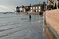 Road at Bosham flooded at High Tide - geograph.org.uk - 407541.jpg 640 × 428; 154 KB
-
 Shore Road - geograph.org.uk - 4068210.jpg 2,907 × 1,248; 327 KB
-
 Shore Road at high tide - geograph.org.uk - 1412390.jpg 640 × 480; 95 KB
-
 Shore Road in Bosham - geograph.org.uk - 5865011.jpg 2,700 × 2,007; 494 KB
-
 Shore Road takes a bend - geograph.org.uk - 5821920.jpg 1,600 × 1,067; 922 KB
-
 Shore Road, Bosham - geograph.org.uk - 1031061.jpg 640 × 476; 55 KB
-
 Shore Road, Bosham - geograph.org.uk - 1370790.jpg 640 × 480; 85 KB
-
 Shore Road, Bosham - geograph.org.uk - 1370800.jpg 640 × 480; 70 KB
-
 Shore Road, Bosham - geograph.org.uk - 1371149.jpg 640 × 360; 51 KB
-
 Shore Road, Bosham - geograph.org.uk - 1472396.jpg 640 × 480; 137 KB
-
 Shore Road, Bosham - geograph.org.uk - 1909754.jpg 800 × 600; 124 KB
-
 Shore Road, Bosham - geograph.org.uk - 3571279.jpg 1,024 × 768; 114 KB
-
 Shore Road, Bosham - geograph.org.uk - 6270962.jpg 640 × 480; 240 KB
-
 Shore Road, Bosham Harbour - geograph.org.uk - 4180331.jpg 3,985 × 2,661; 8 MB
-
 Shore Road, Bosham Harbour - geograph.org.uk - 4180335.jpg 4,240 × 2,832; 5.44 MB
-
 Shore Road, Bosham Harbour - geograph.org.uk - 4180338.jpg 3,973 × 2,653; 6.87 MB
-
 Shore Road, Bosham, at dusk - geograph.org.uk - 2844004.jpg 1,600 × 1,162; 217 KB
-
 Shore Road, Bosham, West Sussex, England.jpg 3,742 × 2,267; 2.43 MB
-
 Shore Road, Bosham-18326415445.jpg 3,156 × 1,687; 2.03 MB
-

-
 The pub car park.JPG 1,280 × 960; 572 KB
-
 The Saltings - geograph.org.uk - 1409461.jpg 640 × 401; 113 KB
-
 Tidal flood at Shore Road - geograph.org.uk - 4877610.jpg 4,608 × 3,456; 4.1 MB
-
 Tree by Shore Road Bosham - geograph.org.uk - 3465625.jpg 3,264 × 2,448; 4.04 MB
-

-

-
 View north on Walton Lane out of Bosham - geograph.org.uk - 3465715.jpg 3,264 × 2,448; 4.61 MB
-
 Village boundary at Bosham - geograph.org.uk - 717841.jpg 640 × 480; 46 KB
-
 Vintage Car on A259 - geograph.org.uk - 3978542.jpg 4,000 × 3,000; 2.83 MB
-
 VW camper van near Bosham Hoe - geograph.org.uk - 2845635.jpg 1,600 × 921; 306 KB
-
 Walton Lane, Bosham - geograph.org.uk - 92278.jpg 640 × 479; 193 KB
-
 Warm summer day and a walk in Bosham - geograph.org.uk - 5435418.jpg 640 × 427; 72 KB
-
 Williams Road in Bosham - geograph.org.uk - 2854008.jpg 1,024 × 768; 247 KB
-
 Cot Lane at Chidham - geograph.org.uk - 595704.jpg 640 × 480; 80 KB
-
 Entrance to The Hamblin Trust - geograph.org.uk - 717741.jpg 640 × 480; 46 KB
-
 Farmland at Mudberry Lane, Bosham - geograph.org.uk - 717787.jpg 640 × 480; 38 KB
-
 Green Lane, Bosham - geograph.org.uk - 717768.jpg 640 × 480; 55 KB
-
 Houses in Ratham Lane - geograph.org.uk - 651554.jpg 640 × 480; 81 KB
-
 Lane Entrance - geograph.org.uk - 595687.jpg 640 × 480; 92 KB
-

-
 Looking north up Delling Lane - geograph.org.uk - 653192.jpg 640 × 480; 63 KB
-

-
 Looking westwards towards Nutbourne - geograph.org.uk - 651404.jpg 640 × 480; 95 KB
-
 Penwarden Way - geograph.org.uk - 654015.jpg 640 × 480; 68 KB
-
 Stonewalls Farm - geograph.org.uk - 92289.jpg 640 × 479; 151 KB
-

-
 Three Miles to Chichester - geograph.org.uk - 1703.jpg 640 × 451; 25 KB


_-_geograph.org.uk_-_1370819.jpg)


