Category:Shire of Douglas
Jump to navigation
Jump to search
local government area of Queensland, Australia | |||||
| Upload media | |||||
| Instance of | |||||
|---|---|---|---|---|---|
| Location | Queensland, AUS | ||||
| Legislative body |
| ||||
| Population |
| ||||
| Area |
| ||||
 | |||||
Subcategories
This category has the following 28 subcategories, out of 28 total.
A
- Agincourt Reef (122 F)
B
C
- Cow Bay, Queensland (1 F)
- Craiglie, Queensland (11 F)
D
- Dedin, Queensland (1 F)
- Degarra, Queensland (2 F)
- Diwan, Queensland (109 F)
F
K
- Killaloe, Queensland (1 F)
- Kimberley, Queensland (1 F)
L
M
- Miallo, Queensland (1 F)
- Mossman Shire Hall (1 F)
N
- Newell, Queensland (5 F)
O
- Oak Beach, Queensland (4 F)
P
R
- Rex Lookout (7 F)
S
- Shannonvale, Queensland (1 F)
- Snapper Island (Queensland) (4 F)
- Syndicate, Queensland (9 F)
T
- Thornton Beach, Queensland (14 F)
W
- Whyanbeel, Queensland (1 F)
Media in category "Shire of Douglas"
The following 12 files are in this category, out of 12 total.
-
 Blue Damselfishs - 2013.04 - panoramio.jpg 3,090 × 2,317; 2.67 MB
-
 Cold Blue (29676961).jpeg 1,152 × 2,048; 295 KB
-
 Coral Reef - 2013.04 - panoramio (1).jpg 2,448 × 3,264; 2.62 MB
-
 Coral Reef - 2013.04 - panoramio.jpg 3,264 × 2,448; 3.56 MB
-
 Coral Sea, Queensland (483705) (9443453426).jpg 3,842 × 2,158; 2.22 MB
-
 Coral Sea, Queensland (483717) (9440673221).jpg 4,560 × 2,564; 2.14 MB
-
 Coral Sea, Queensland (483718) (9443462706).jpg 3,960 × 2,224; 2.02 MB
-
 Ocean view, Captain Cook Highway, 2015 (01).JPG 3,754 × 2,486; 4.97 MB
-
 Ocean view, Captain Cook Highway, 2015 (02).JPG 3,776 × 2,520; 5.26 MB
-
 Pequeño islote en mar abierto, buen sitio para bucear entre la Gran Barrera - panoramio.jpg 2,816 × 1,872; 1.37 MB
-
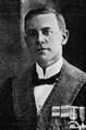 Raymond David Rex.tif 3,978 × 6,000; 22.78 MB
-
 Tongue Reef - 2013.04 - panoramio.jpg 4,534 × 3,400; 2.18 MB

.jpeg)
.jpg)

_(9443453426).jpg)
_(9440673221).jpg)
_(9443462706).jpg)
.JPG)
.JPG)

