Category:Ships on the Humber Estuary
Jump to navigation
Jump to search
Subcategories
This category has the following 4 subcategories, out of 4 total.
B
K
L
Media in category "Ships on the Humber Estuary"
The following 130 files are in this category, out of 130 total.
-
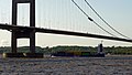
 "RMS Vindava" passing the Humber Bridge - geograph.org.uk - 1721367.jpg 640 × 543; 315 KB
-
 "Trans Agila" Outward Bound - geograph.org.uk - 378142.jpg 640 × 389; 74 KB
-
-
 A Humber Tug - geograph.org.uk - 247499.jpg 640 × 480; 104 KB
-

-
 A North Sea Ferry on the River Humber - geograph.org.uk - 1384360.jpg 640 × 501; 146 KB
-
 A Ship at Saltend Jetty - geograph.org.uk - 713838.jpg 640 × 409; 54 KB
-
 A Sloop on the River Humber - geograph.org.uk - 806206.jpg 640 × 480; 59 KB
-
 Aground - geograph.org.uk - 733028.jpg 640 × 251; 24 KB
-
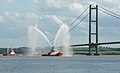
 Berthing Up - geograph.org.uk - 1637078.jpg 640 × 332; 35 KB
-
 Blackboxes In The Humber - geograph.org.uk - 247529.jpg 640 × 480; 108 KB
-
 HMT Bredon.jpg 784 × 531; 36 KB
-
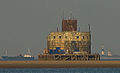
 Bull Sand Fort - geograph.org.uk - 817486.jpg 640 × 318; 40 KB
-
 Containers on the way out to sea - geograph.org.uk - 416938.jpg 640 × 480; 63 KB
-
 Dawn over Salt End - geograph.org.uk - 2688503.jpg 600 × 800; 210 KB
-
 Dreaming of the Future - geograph.org.uk - 836772.jpg 517 × 640; 61 KB
-
 Dredging in the River Humber - geograph.org.uk - 3713616.jpg 4,592 × 3,448; 2.74 MB
-

-
 Eemsborg Humber 2009.jpg 3,072 × 2,304; 684 KB
-
 Fertiliser, Farming and Ferry - geograph.org.uk - 1737437.jpg 3,282 × 2,424; 1.68 MB
-
 Haile Sand Fort - geograph.org.uk - 1108413.jpg 640 × 427; 61 KB
-
 Haile-Sand-Fort.jpg 1,141 × 693; 111 KB
-
 Heading out to sea - geograph.org.uk - 587598.jpg 640 × 427; 34 KB
-
 Heading Upstream - geograph.org.uk - 504863.jpg 640 × 573; 127 KB
-
 Heading Upstream - geograph.org.uk - 505116.jpg 640 × 612; 131 KB
-
 Hedon Haven, River Humber IMG 2722 - panoramio.jpg 1,400 × 933; 409 KB
-
 HMS Explorer (P164) and Westland Sea King air-sea rescue helicopter.JPG 1,232 × 1,510; 606 KB
-
 HMS Explorer (P164).JPG 2,045 × 1,172; 820 KB
-
 Hmt Sapper FL5784.jpg 800 × 590; 50 KB
-
 Humber - geograph.org.uk - 555115.jpg 640 × 480; 56 KB
-
 Humber Bridge and estuary - geograph.org.uk - 1032335.jpg 640 × 457; 180 KB
-
 Humber Bridge00031.jpg 2,240 × 1,680; 1.79 MB
-
 Humber estuary - geograph.org.uk - 1381738.jpg 640 × 480; 88 KB
-
 Humber Estuary - geograph.org.uk - 4209783.jpg 1,753 × 1,151; 364 KB
-
 Humber Estuary - geograph.org.uk - 4215481.jpg 1,745 × 1,139; 638 KB
-
 Humber Estuary - geograph.org.uk - 4224292.jpg 1,677 × 1,019; 551 KB
-
 Humber Estuary, Easington - geograph.org.uk - 1257683.jpg 640 × 428; 62 KB
-
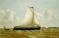
 Humber Morning Calm, by Henry Redmore.jpg 657 × 407; 68 KB
-
 HUMBER PILOT BOAT.jpg 1,212 × 595; 203 KB
-
 Humber Pilots head out to Sea - geograph.org.uk - 544142.jpg 640 × 427; 72 KB
-
 Humber Shipping - geograph.org.uk - 269707.jpg 640 × 480; 109 KB
-
 Humber Shipping - geograph.org.uk - 337480.jpg 640 × 482; 142 KB
-
 Humber Shipping - geograph.org.uk - 400783.jpg 640 × 367; 79 KB
-
 Humber Sloop off South Ferriby Sluice (geograph 5891780).jpg 1,024 × 878; 194 KB
-
 Humber traffic and fort - geograph.org.uk - 2411969.jpg 3,488 × 2,616; 2.2 MB
-
 Imminent Disaster^ - geograph.org.uk - 1859618.jpg 2,828 × 2,033; 1.3 MB
-
 Jetty, Millennium Chemicals - geograph.org.uk - 883480.jpg 629 × 408; 75 KB
-
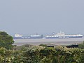
 Major shipping lanes - geograph.org.uk - 1986993.jpg 2,032 × 1,520; 297 KB
-
 Moving the light vessel - geograph.org.uk - 653279.jpg 640 × 480; 41 KB
-
 Muddy Waters - geograph.org.uk - 247501.jpg 640 × 480; 105 KB
-
 Navigation marker on the Humber bank - geograph.org.uk - 2520105.jpg 1,024 × 768; 111 KB
-
 Nearly There^ - geograph.org.uk - 1741155.jpg 3,356 × 2,540; 2.48 MB
-
-

-
 On Our Way Home - geograph.org.uk - 2627958.jpg 3,648 × 2,736; 7.23 MB
-
 On the banks of the Humber - geograph.org.uk - 937844.jpg 640 × 413; 82 KB
-
 One in one out - geograph.org.uk - 3012054.jpg 800 × 600; 58 KB
-
 P and O Ferries seen from Goxhill Haven - geograph.org.uk - 542254.jpg 640 × 424; 106 KB
-
 P S 'Lincoln Castle' off New Holland - geograph.org.uk - 1417744.jpg 640 × 489; 58 KB
-

-
 Paull Holme Sands - geograph.org.uk - 538400.jpg 640 × 410; 31 KB
-
 Paull Lagoon Sunset - geograph.org.uk - 699606.jpg 640 × 471; 34 KB
-
 Paull Tidal Lagoon and a Passing Ship - geograph.org.uk - 630283.jpg 640 × 480; 60 KB
-
 Pushet barge - geograph.org.uk - 653282.jpg 640 × 480; 76 KB
-
 Putting new piles in - geograph.org.uk - 650766.jpg 640 × 426; 61 KB
-
 Rainbow's end in the River Humber - geograph.org.uk - 3685035.jpg 1,024 × 916; 230 KB
-
 Rig and a ship in the Humber Estuary - geograph.org.uk - 3009957.jpg 640 × 427; 26 KB
-

-
 Ruined wharf, Barton upon Humber - geograph.org.uk - 1316753.jpg 640 × 477; 68 KB
-
 Sailing to Rotterdam - geograph.org.uk - 3004635.jpg 3,816 × 2,795; 1.57 MB
-
 Salt End Jetties - geograph.org.uk - 306368.jpg 640 × 399; 50 KB
-
 Salt End Jetties - geograph.org.uk - 861917.jpg 640 × 440; 51 KB
-
 Salt end jetties 2.jpg 1,024 × 768; 289 KB
-
 Saltend Jetty at Sunset - geograph.org.uk - 825228.jpg 640 × 480; 50 KB
-
 Saltend Jetty by Night - geograph.org.uk - 278344.jpg 640 × 456; 39 KB
-
 Seaward Bound - geograph.org.uk - 1171256.jpg 640 × 480; 56 KB
-
 Ship at Tetney Monobuoy (2) (geograph 5270560).jpg 640 × 426; 56 KB
-
 Ship at Tetney Monobuoy (geograph 5270542).jpg 640 × 427; 55 KB
-
 Ship Moorings at Saltend Jetty - geograph.org.uk - 777360.jpg 640 × 392; 46 KB
-
 Ship on the Humber - geograph.org.uk - 557100.jpg 640 × 480; 82 KB
-
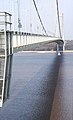
 Ship Passing Under the Humber Bridge - geograph.org.uk - 399767.jpg 425 × 640; 79 KB
-
 Ship under Humber bridge - geograph.org.uk - 309508.jpg 480 × 640; 80 KB
-

-
 Ships heading up the Humber (geograph 4990820).jpg 1,024 × 672; 56 KB
-
 Ships, Immingham Dock - geograph.org.uk - 2695490.jpg 640 × 264; 68 KB
-
 Silhouette of a Ship on the River Humber - geograph.org.uk - 798686.jpg 640 × 521; 111 KB
-
 Skeffling Clough - geograph.org.uk - 316598.jpg 640 × 480; 74 KB
-
 Small Boat on the River Humber - geograph.org.uk - 1475677.jpg 640 × 329; 83 KB
-
 Spurn Point - geograph.org.uk - 258407.jpg 640 × 480; 43 KB
-
 Spurn Point IMG 7906.JPG - panoramio.jpg 1,200 × 801; 399 KB
-
 Spurn traffic - geograph.org.uk - 43015.jpg 640 × 480; 75 KB
-
 SpurnPoint Humber.JPG 2,304 × 1,728; 755 KB
-
 St Andrew's Quay - geograph.org.uk - 993345.jpg 608 × 640; 118 KB
-
 StateLibQld 1 133709 Bayardo (ship).jpg 1,000 × 633; 80 KB
-
 Stone Creek - geograph.org.uk - 297422.jpg 640 × 451; 81 KB
-
 Stuck fast - geograph.org.uk - 653287.jpg 640 × 512; 64 KB
-

-

-
 The Hessle Lifeboat on duty - geograph.org.uk - 836937.jpg 640 × 488; 67 KB
-
 The Humber Bank, Sunk Island - geograph.org.uk - 323853.jpg 438 × 640; 87 KB
-
 The Humber Bridge - geograph.org.uk - 696194.jpg 389 × 640; 66 KB
-
 The Humber Bridge on a misty day - geograph.org.uk - 448547.jpg 640 × 376; 36 KB
-
 The Humber Estuary - geograph.org.uk - 4289555.jpg 1,024 × 768; 127 KB
-
 The Humber keel Willie RMG BHC3722.tiff 4,400 × 3,056; 38.47 MB
-
 The Humber sloop 'Harry' RMG BHC3391.tiff 6,400 × 4,185; 76.63 MB
-
 The Humber, Paull - geograph.org.uk - 861929.jpg 640 × 451; 78 KB
-
 The North Sea Ferry Terminal - geograph.org.uk - 1222103.jpg 640 × 480; 67 KB
-
 The Pride of Bruges leaves Hull - geograph.org.uk - 1395753.jpg 640 × 480; 52 KB
-
 The River Humber - geograph.org.uk - 1604555.jpg 640 × 480; 42 KB
-

-
 Thorngumbald Clough Lights, Paull - geograph.org.uk - 208259.jpg 640 × 436; 84 KB
-
 Tide Gauge at Brough - geograph.org.uk - 1153852.jpg 640 × 448; 64 KB
-
 Trawlers on the Humber - geograph.org.uk - 534371.jpg 640 × 426; 63 KB
-
 Tug Launch - geograph.org.uk - 756591.jpg 640 × 503; 62 KB
-
 Tug Launch at Dusk - geograph.org.uk - 756589.jpg 640 × 483; 54 KB
-
 Tug launch at Paull - geograph.org.uk - 756600.jpg 640 × 480; 88 KB
-
 Tug Mast - geograph.org.uk - 1773782.jpg 2,220 × 3,372; 1.06 MB
-
 Tug-o-War above Mr Hill's sheds - geograph.org.uk - 302878.jpg 640 × 487; 69 KB
-
 Tugboat "Englishman" at the Humber Bridge.JPG 2,816 × 1,880; 1.79 MB
-
 Tugboat "Englishman".JPG 2,588 × 1,566; 1.25 MB
-
 Vessel going downstream on the Humber - geograph.org.uk - 3086334.jpg 1,024 × 768; 142 KB
-
 Waiting for high tide on Read's Island (geograph 5618348).jpg 1,024 × 768; 98 KB
-
 Wingfield Castle 09-1973a2.JPG 1,621 × 1,131; 148 KB
-
 Yacht on the northern shore of Read's Island (geograph 5613623).jpg 1,024 × 768; 117 KB
-
 Brixham Trawler BM-172 on the Humber - geograph.org.uk - 534387.jpg 640 × 436; 95 KB
-
 Clive Sullivan Way, Hull - geograph.org.uk - 260216.jpg 640 × 426; 198 KB
-
 Cutter on the Humber - geograph.org.uk - 540653.jpg 640 × 376; 57 KB
-
 Fog on the River Humber - geograph.org.uk - 205956.jpg 640 × 480; 69 KB
-
 Humber from St. Andrew's Quay - geograph.org.uk - 547230.jpg 640 × 481; 103 KB
-
 Tug Pontoon - geograph.org.uk - 416726.jpg 640 × 480; 54 KB


.jpg)


_and_Westland_Sea_King_air-sea_rescue_helicopter.JPG)
.JPG)


.jpg)


_(geograph_5502543).jpg)
.jpg)


_(geograph_5270560).jpg)
.jpg)


.jpg)


.jpg)


.jpg)
.jpg)


.jpg)

.jpg)


