Category:Shipley, West Sussex
Jump to navigation
Jump to search
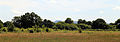
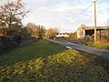
Shipley is a civil parish and village in the Horsham District of West Sussex, England. The parish includes the hamlets of Coolham, Broomer's Corner, Brooks Green, and Dragon's Green. Shipley village lies just off the A272 road 6 miles (10 kilometres) northeast from Storrington.

village and civil parish in Horsham District, West Sussex, England, UK  L'église de Shipley vue depuis le moulin de King's Mill | |||||
| Upload media | |||||
| Instance of | |||||
|---|---|---|---|---|---|
| Location | Horsham, West Sussex, South East England, England | ||||
| Population |
| ||||
| Area |
| ||||
 | |||||
Subcategories
This category has the following 10 subcategories, out of 10 total.
B
- Brooks Green (14 F)
- Broomer's Corner (4 F)
C
D
K
N
- Newbuildings Place (2 F)
S
- King's Mill, Shipley (32 F)
Media in category "Shipley, West Sussex"
The following 200 files are in this category, out of 490 total.
(previous page) (next page)-

-
 'Aesculus hippocastanum' - Horse Chestnut at Shipley, West Sussex, England.JPG 5,472 × 3,648; 9.44 MB
-
 'Clematis viticella' Étoile Violette at Shipley, West Sussex, England.JPG 3,648 × 4,886; 10.08 MB
-
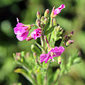
 'Epilobium hirsutum' ~ Great Hairy Willowherb at Shipley, West Sussex, England 01.JPG 3,648 × 4,299; 6.55 MB
-
 'Epilobium hirsutum' ~ Great Hairy Willowherb at Shipley, West Sussex, England 02.JPG 1,932 × 1,932; 1.55 MB
-
 'Epilobium hirsutum' ~ Great Hairy Willowherb at Shipley, West Sussex, England 03.JPG 1,705 × 1,705; 1.28 MB
-
 'Ficus carica' Brown Turkey - fig at Shipley, West Sussex, England.JPG 5,472 × 3,648; 10.32 MB
-
 'Filipendula ulmaria' Meadowsweet or Mead Wort at Shipley, West Sussex, England.JPG 3,896 × 3,004; 8.18 MB
-
 'Greetings' Rosa floribunda at Shipley, West Sussex, England 01.JPG 4,514 × 3,648; 9.03 MB
-
 'Greetings' Rosa floribunda at Shipley, West Sussex, England 02.JPG 4,493 × 3,648; 11.15 MB
-
 'Heracleum sphondylium' - Common Hogweed at Shipley, West Sussex, England 01.jpg 2,795 × 3,001; 3.89 MB
-
 'Heracleum sphondylium' - Common Hogweed at Shipley, West Sussex, England 02.JPG 2,295 × 2,554; 2.63 MB
-
 'Heracleum sphondylium' - Common Hogweed at Shipley, West Sussex, England 03.JPG 2,328 × 2,292; 2.71 MB
-
 'Heracleum sphondylium' - Common Hogweed at Shipley, West Sussex, England 04.JPG 2,948 × 3,208; 5.21 MB
-
 'Heracleum sphondylium' - Common Hogweed at Shipley, West Sussex, England 05.jpg 2,024 × 2,299; 2.63 MB
-
 'Lathyrus latifolius' perenial sweet pea on School Lane at Shipley, West Sussex, England.JPG 3,648 × 5,472; 9.19 MB
-
 'Midsummer Farm' tandem sign - geograph.org.uk - 6476601.jpg 1,632 × 918; 925 KB
-
 'No Public Right of Way' - south of Madgeland Farm - geograph.org.uk - 6471619.jpg 4,605 × 2,590; 3.06 MB
-
 'Philadelphus coronarius' - Mock Orange at Shipley, West Sussex, England.JPG 3,648 × 4,333; 9.82 MB
-
 'Pulicaria dysenterica' - Common fleabane, at Shipley, West Sussex, England.JPG 5,472 × 3,648; 9.77 MB
-
 'Rosa Iceberg' in a hedge at Shipley, West Sussex, Sussex, England.JPG 4,560 × 3,648; 7.51 MB
-

-

-
 'The Countryman', south of Shipley - geograph.org.uk - 6207146.jpg 1,024 × 807; 153 KB
-
 A Portland ram at Shipley, West Sussex, England.JPG 5,232 × 3,352; 6.16 MB
-
 Kingsland, the former home of Hilaire Belloc, Shipley, West Sussex, England.jpg 5,472 × 3,648; 13.21 MB
-
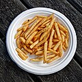 Plate of chips, George and Dragon, Dragons Green, Shipley, West Sussex.jpg 3,860 × 3,860; 8.36 MB
-
 33-34, Bar Lane, The Bar - geograph.org.uk - 5079275.jpg 480 × 640; 97 KB
-
 A cottage and house next church at Shipley, West Sussex, England.JPG 5,472 × 3,648; 11.08 MB
-
 A field and sheep south from School lane at Shipley, West Sussex, England 01.JPG 5,472 × 2,783; 9.2 MB
-
 A field and sheep south from School lane at Shipley, West Sussex, England 02.JPG 5,472 × 2,783; 9.12 MB
-
 A field and sheep south from School lane at Shipley, West Sussex, England 03.JPG 5,472 × 2,783; 9.45 MB
-
 A glimpse of Alpacas - geograph.org.uk - 2151105.jpg 2,592 × 1,944; 2.06 MB
-
 A lightly used footpath - geograph.org.uk - 2420578.jpg 640 × 480; 144 KB
-
 A rather fine tree house - geograph.org.uk - 4704219.jpg 4,608 × 3,456; 3.99 MB
-
 A road autumn colours - geograph.org.uk - 2152706.jpg 2,592 × 1,944; 1.45 MB
-
 A telephone and post box on Red Lane, Shipley, West Sussex, England.JPG 3,648 × 5,472; 9.38 MB
-
 A24 Basing Hill - geograph.org.uk - 6194773.jpg 1,024 × 684; 217 KB
-
 A24 near West Grinstead - geograph.org.uk - 2314961.jpg 4,320 × 3,240; 4.04 MB
-
 A24 towards London - geograph.org.uk - 6197502.jpg 1,024 × 684; 288 KB
-
 A24 Worthing Road northbound - geograph.org.uk - 6197614.jpg 1,024 × 684; 239 KB
-
 A24, The Bar - geograph.org.uk - 4888328.jpg 640 × 480; 101 KB
-
 A272 - geograph.org.uk - 5224210.jpg 640 × 426; 67 KB
-
 A272 at Coolham - geograph.org.uk - 3021173.jpg 1,600 × 1,200; 296 KB
-
 A272 at Coolham - geograph.org.uk - 3021187.jpg 1,600 × 1,200; 377 KB
-
 A272 Junction - geograph.org.uk - 3179382.jpg 2,668 × 2,000; 1.7 MB
-
 A272 Junction - geograph.org.uk - 3179391.jpg 4,000 × 3,000; 4.62 MB
-
 A272 near Scolliers Crossway - geograph.org.uk - 5224214.jpg 640 × 276; 65 KB
-
 A272 West - geograph.org.uk - 3179376.jpg 2,668 × 2,000; 1.5 MB
-
 A272, eastbound - geograph.org.uk - 5224205.jpg 640 × 426; 64 KB
-
 A272, eastbound - geograph.org.uk - 5224213.jpg 640 × 532; 67 KB
-
 A272, eastbound - geograph.org.uk - 5224216.jpg 640 × 391; 53 KB
-
 Abraham's Well alongside Baker's Lane - geograph.org.uk - 1579928.jpg 640 × 480; 143 KB
-
 Adur at Shipley, West Sussex, England 01.JPG 5,472 × 3,648; 18.42 MB
-
 Adur at Shipley, West Sussex, England 02.JPG 5,472 × 3,648; 15.77 MB
-
 Adur at Shipley, West Sussex, England 03.JPG 5,472 × 3,648; 11.61 MB
-
 Adur at Shipley, West Sussex, England 04.JPG 5,472 × 3,648; 16.97 MB
-
 Adur at Shipley, West Sussex, England 05 ~ watermeadow.JPG 5,472 × 3,460; 12.07 MB
-
 Adur at Shipley, West Sussex, England 06.JPG 5,472 × 3,648; 15.51 MB
-
 Adur at Shipley, West Sussex, England 07.JPG 3,648 × 5,472; 15.87 MB
-
 An aspect north at Shipley, West Sussex, England.JPG 4,928 × 3,384; 10.09 MB
-
 An aspect north with village hall and cottage at Shipley, West Sussex, England.JPG 5,385 × 3,526; 9.51 MB
-
 An aspect south to Chanctonbury Ring from Shipley, West Sussex, England.JPG 5,472 × 1,916; 6.31 MB
-
 Andrew Hall Shipley - geograph.org.uk - 1580276.jpg 640 × 480; 68 KB
-
 Apparent cross paths... - geograph.org.uk - 5080677.jpg 800 × 600; 190 KB
-
 Ashbrook Bridge ahead - geograph.org.uk - 1160093.jpg 640 × 480; 91 KB
-
 Bar Lane - geograph.org.uk - 3179055.jpg 4,000 × 3,000; 3.63 MB
-
 Bar Lane - geograph.org.uk - 3179057.jpg 4,000 × 3,000; 4.26 MB
-
 Bar Lane - geograph.org.uk - 3189428.jpg 4,000 × 3,000; 3.1 MB
-
 Bar Lane - geograph.org.uk - 5077887.jpg 550 × 640; 83 KB
-
 Bar Lane at the junction of the A24 - geograph.org.uk - 3400482.jpg 2,048 × 1,536; 1.49 MB
-
 Barn - geograph.org.uk - 6575281.jpg 1,440 × 960; 1.18 MB
-
 Barn at Oxcopse Barn on Hooklands Lane - geograph.org.uk - 2151210.jpg 2,592 × 1,944; 1.45 MB
-
 Barn off Hooklands Lane - geograph.org.uk - 2420577.jpg 640 × 480; 129 KB
-
 Barn on Dragons Green Road - geograph.org.uk - 5227549.jpg 800 × 600; 185 KB
-

-
 Barns at Falconers - geograph.org.uk - 2344732.jpg 640 × 480; 113 KB
-
 Basing Hill - geograph.org.uk - 3438543.jpg 640 × 480; 77 KB
-
 Bay Bridge - geograph.org.uk - 5092326.jpg 465 × 640; 55 KB
-
 Bench Cut Mark - geograph.org.uk - 3021189.jpg 1,600 × 1,200; 270 KB
-
 Bentons Place Farm, Shipley - geograph.org.uk - 430815.jpg 640 × 480; 92 KB
-
 Beware rabbits - geograph.org.uk - 5080512.jpg 800 × 600; 182 KB
-
 Birchwood Cottages - geograph.org.uk - 6538262.jpg 1,600 × 1,054; 523 KB
-
 Birchwood House - geograph.org.uk - 6538268.jpg 1,600 × 1,059; 633 KB
-
 Blonks Barn - geograph.org.uk - 267751.jpg 640 × 480; 117 KB
-
 Blonks Farm off Hooklands Lane - geograph.org.uk - 2151056.jpg 2,592 × 1,944; 1.28 MB
-
 Bluebells near Woodgetters - geograph.org.uk - 233921.jpg 640 × 480; 162 KB
-
 Bottomshole Copse west of Oakwood house - geograph.org.uk - 2151076.jpg 2,592 × 1,944; 2.25 MB
-
 Boxed in - geograph.org.uk - 6575570.jpg 978 × 1,440; 1.07 MB
-
 Bridge across Lancing Brook - geograph.org.uk - 3364187.jpg 1,600 × 1,200; 637 KB
-

-
 Bridleway between Bowford Farm and Blonks Farm - geograph.org.uk - 2150953.jpg 2,592 × 1,944; 2.6 MB
-
 Bridleway bridge - geograph.org.uk - 1158152.jpg 640 × 480; 136 KB
-
 Bridleway BW 1960-1 - geograph.org.uk - 3189563.jpg 4,000 × 3,000; 3.08 MB
-
 Bridleway BW 3215 - geograph.org.uk - 3189417.jpg 4,000 × 3,000; 2.6 MB
-
 Bridleway BW1891 - geograph.org.uk - 3179324.jpg 4,000 × 3,000; 4.68 MB
-
 Bridleway BW1894 - geograph.org.uk - 3179350.jpg 3,194 × 2,000; 1.47 MB
-
 Bridleway BW2815-2 - geograph.org.uk - 3179341.jpg 3,025 × 2,218; 2.19 MB
-
 Bridleway BW3214-1 - geograph.org.uk - 3216032.jpg 4,000 × 3,000; 5.1 MB
-

-
 Bridleway goes east into Marlpost Wood - geograph.org.uk - 5227547.jpg 800 × 600; 187 KB
-
 Bridleway goes north in Dragons Estate - geograph.org.uk - 5227561.jpg 800 × 600; 213 KB
-
 Bridleway goes west from Marlpost Road - geograph.org.uk - 5227545.jpg 800 × 600; 205 KB
-

-
 Bridleway in woods at the Woodgetters - geograph.org.uk - 1417188.jpg 640 × 480; 138 KB
-
 Bridleway Junction - geograph.org.uk - 3345665.jpg 1,600 × 1,200; 319 KB
-
 Bridleway junction on School Road - geograph.org.uk - 5080496.jpg 800 × 600; 191 KB
-
 Bridleway to Hooklands Lane - geograph.org.uk - 3873864.jpg 4,000 × 3,000; 5.72 MB
-

-

-
 Bridleway weaves between fields - geograph.org.uk - 5070674.jpg 800 × 600; 235 KB
-
 Bridleway with Ditch - geograph.org.uk - 3873868.jpg 4,000 × 3,000; 6.3 MB
-
 Bridleway, Shipley - geograph.org.uk - 978242.jpg 640 × 480; 149 KB
-
 Brown field site at Sincox Lane - geograph.org.uk - 5950687.jpg 5,184 × 3,456; 6.55 MB
-
 Bull in field - geograph.org.uk - 6540588.jpg 1,600 × 1,067; 506 KB
-
 Bungalow on Cowfold Road, Coolham - geograph.org.uk - 5846750.jpg 2,048 × 1,536; 1.54 MB
-
 Bus Stop - geograph.org.uk - 3179053.jpg 4,000 × 3,000; 4.01 MB
-
 Bus stop adjacent to Basing Cottage - geograph.org.uk - 3869337.jpg 4,000 × 3,000; 4.13 MB
-
 Bus stop and footpath junction on A24 - geograph.org.uk - 4651917.jpg 800 × 600; 179 KB
-
 Butterstocks Farm, west of Shipley - geograph.org.uk - 6207119.jpg 1,024 × 754; 135 KB
-
 Castle Lane - geograph.org.uk - 5047566.jpg 480 × 640; 56 KB
-
 Cattle grid on Castle Lane - geograph.org.uk - 4706022.jpg 4,608 × 3,456; 3.33 MB
-
 Chimney stacks at School Lane, Shipley, West Sussex.jpg 640 × 480; 92 KB
-
 Christ's Hospital from the air - geograph.org.uk - 5151062.jpg 2,048 × 1,195; 687 KB
-
 Church Farm South - geograph.org.uk - 3521353.jpg 1,194 × 788; 401 KB
-
 Collapsed Stile - geograph.org.uk - 3870247.jpg 4,000 × 3,000; 4.43 MB
-
 Communications mast by bridleway - geograph.org.uk - 5070675.jpg 800 × 600; 139 KB
-
 Converted Barn at Newbuildings Place - geograph.org.uk - 245404.jpg 640 × 462; 76 KB
-
 Converted barn, Lackenhurst.jpg 4,608 × 3,456; 5.93 MB
-
 Converted barn, Lackenhurst.JPG 4,608 × 3,456; 4.52 MB
-
 Coolham Crossroads - geograph.org.uk - 3021180.jpg 1,600 × 1,200; 371 KB
-
 Coolham Crossroads - geograph.org.uk - 3021184.jpg 1,600 × 1,200; 348 KB
-
 Coolham Road - geograph.org.uk - 3345651.jpg 1,600 × 1,200; 319 KB
-
 Coolham Road crosses the River Adur - geograph.org.uk - 5080203.jpg 800 × 600; 147 KB
-

-
 Corner on Dragons Lane - geograph.org.uk - 6537957.jpg 1,600 × 1,061; 768 KB
-
 Cottage at Shipley, rat-trap bond - geograph.org.uk - 4707629.jpg 710 × 1,024; 146 KB
-

-
 Cottage on the west side of the A24 - geograph.org.uk - 2624026.jpg 4,000 × 3,000; 3.55 MB
-
 Cottages near Shipley windmill.JPG 1,280 × 960; 482 KB
-
 Countryman Lane - geograph.org.uk - 5950673.jpg 5,184 × 3,456; 1.14 MB
-

-
 Culvert under bridleway 3214-1 - geograph.org.uk - 4362394.jpg 640 × 428; 173 KB
-
 Curly-horned ram - geograph.org.uk - 2245070.jpg 640 × 480; 116 KB
-
 Cycle race, A272 - geograph.org.uk - 5224215.jpg 640 × 422; 86 KB
-
 Damaged stile - geograph.org.uk - 3870304.jpg 4,000 × 3,000; 4.88 MB
-
 Direction Sign - Signpost, Shipley - geograph.org.uk - 6102408.jpg 338 × 600; 67 KB
-
 Direction sign on Red Lane, Shipley, West Sussex - geograph.org.uk - 2245991.jpg 1,600 × 1,200; 725 KB
-
 Direction Sign – Signpost - geograph.org.uk - 6540210.jpg 480 × 640; 205 KB
-
 Direction Sign – Signpost - geograph.org.uk - 6540211.jpg 724 × 543; 189 KB
-
 Diverted footpath - geograph.org.uk - 3869359.jpg 4,000 × 3,000; 4.89 MB
-
 Do'er Up'er - geograph.org.uk - 6575575.jpg 1,440 × 960; 1.26 MB
-
 Dog walkers in Knepp Park - geograph.org.uk - 5294792.jpg 4,608 × 3,456; 3.64 MB
-
 Dragon Gates - geograph.org.uk - 6538091.jpg 1,600 × 1,262; 732 KB
-
 Dragons Estate welcomes walkers - geograph.org.uk - 5227543.jpg 800 × 600; 202 KB
-
 Dragons Green - geograph.org.uk - 4702835.jpg 1,024 × 768; 198 KB
-
 Dragons Lane - geograph.org.uk - 6214542.jpg 1,600 × 960; 831 KB
-
 Driveway leading to Newbuildings Place - geograph.org.uk - 4702801.jpg 803 × 1,024; 208 KB
-
 Driveway to Knepp Castle - geograph.org.uk - 2624039.jpg 4,000 × 3,000; 3.67 MB
-
 Driveway to Wincave Farm - geograph.org.uk - 2152690.jpg 2,592 × 1,944; 1.86 MB
-
 Durrance Manor Gardens - geograph.org.uk - 3919601.jpg 3,072 × 2,048; 4.16 MB
-
 Eastbound A272 - geograph.org.uk - 3179395.jpg 3,624 × 2,000; 2.15 MB
-
 Entrance to Church Farm North - geograph.org.uk - 1578410.jpg 640 × 480; 90 KB
-
 Entrance to farm - geograph.org.uk - 3392048.jpg 1,600 × 1,051; 388 KB
-
 Entrance to Public Footpath FP1965 - geograph.org.uk - 3345671.jpg 1,600 × 1,200; 313 KB
-
 Entrance to Public Footpath FP1965 - geograph.org.uk - 3345681.jpg 1,600 × 1,200; 274 KB
-

-
 Estate sign, Marlpost Wood - geograph.org.uk - 4362429.jpg 640 × 428; 123 KB
-
 Farm Bridge, River Adur - geograph.org.uk - 5047473.jpg 640 × 480; 85 KB
-
 Farm Entrance - geograph.org.uk - 3243606.jpg 3,950 × 2,126; 1.67 MB
-
 Farm entrance of Bakers Lane - geograph.org.uk - 3273561.jpg 1,600 × 1,200; 499 KB
-
 Farm road and footpath to Trawlers Farm - geograph.org.uk - 1580095.jpg 640 × 480; 137 KB
-

-
 Farmhouse, Goffsland Farm - geograph.org.uk - 2245045.jpg 640 × 480; 112 KB
-
 Fence adjacent to path - geograph.org.uk - 3870296.jpg 4,000 × 3,000; 5.19 MB
-
 Field edge looking north from footpath - geograph.org.uk - 5080737.jpg 800 × 600; 203 KB
-
 Field south of Smoke House Farm - geograph.org.uk - 5080696.jpg 800 × 600; 149 KB
-
 Fingerpost in field - geograph.org.uk - 3869486.jpg 4,000 × 3,000; 4.39 MB
-
 Fingerpost, Stile and Leopard skin - geograph.org.uk - 3870341.jpg 4,000 × 3,000; 4.59 MB
-
 Floodgates Farm - geograph.org.uk - 149484.jpg 640 × 479; 155 KB
-
 Floodgates House - geograph.org.uk - 5047590.jpg 480 × 640; 62 KB
-
 Footbridge east of Cow Barn - geograph.org.uk - 4651921.jpg 800 × 600; 202 KB
-

-
 Footbridge on footpath 1887 - geograph.org.uk - 4362343.jpg 640 × 428; 159 KB
-
 Footbridge over Marlpost Gill - geograph.org.uk - 6471598.jpg 3,918 × 2,204; 2.84 MB
-
 Footbridge over stream - geograph.org.uk - 2245161.jpg 640 × 480; 157 KB
-
 Footbridge over the River Adur - geograph.org.uk - 4706419.jpg 4,608 × 3,456; 3.41 MB
-
 Footbridge south of Smoke House Farm - geograph.org.uk - 5080663.jpg 800 × 600; 154 KB
-
 Footpath 1842 along Green Lane - geograph.org.uk - 3003408.jpg 1,600 × 1,134; 463 KB
-

-
 Footpath 1896, Marlpost Wood - geograph.org.uk - 245400.jpg 480 × 640; 90 KB
-
 Footpath 1904-2 to Emms Farm and Courtlands Farm - geograph.org.uk - 2605398.jpg 4,000 × 3,000; 3.41 MB
-
 Footpath adjacent to hedge - geograph.org.uk - 3869400.jpg 4,000 × 3,000; 4.34 MB
-

-

-
 Footpath around field corner - geograph.org.uk - 5080514.jpg 800 × 600; 148 KB
-
 Footpath between field and woodland - geograph.org.uk - 5222728.jpg 800 × 600; 182 KB
-

-
 Footpath crosses field boundary - geograph.org.uk - 4652026.jpg 800 × 600; 221 KB
-
 Footpath enters Coate's Furzefield - geograph.org.uk - 5230448.jpg 800 × 600; 208 KB


