Category:Sheep pastures in Cornwall
Jump to navigation
Jump to search
Media in category "Sheep pastures in Cornwall"
The following 42 files are in this category, out of 42 total.
-
 Across the Allen valley - geograph.org.uk - 730072.jpg 640 × 480; 72 KB
-
 Cornish flag and fields with sheep - geograph.org.uk - 411206.jpg 480 × 640; 220 KB
-
 Davidstow Moor - geograph.org.uk - 1450146.jpg 640 × 480; 53 KB
-
 Efford Down - geograph.org.uk - 130800.jpg 640 × 424; 92 KB
-
 Farmland near Pabyer Point - geograph.org.uk - 1388713.jpg 640 × 406; 70 KB
-
 Fields of Sheep and Trees - geograph.org.uk - 342714.jpg 640 × 480; 72 KB
-
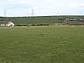
 Roughtor Farm, Near Camelford, Cornwall - geograph.org.uk - 29818.jpg 640 × 480; 131 KB
-

-
 Sheep grazing - geograph.org.uk - 139102.jpg 640 × 480; 85 KB
-

-
 Sheep grazing Fore Down - geograph.org.uk - 65986.jpg 640 × 365; 93 KB
-
 Sheep grazing near Callestick Vean - geograph.org.uk - 31782.jpg 640 × 480; 155 KB
-
 Sheep having their dinner - geograph.org.uk - 342784.jpg 640 × 446; 74 KB
-
 Sheep in field at East Penrest Farm - geograph.org.uk - 1558451.jpg 640 × 480; 77 KB
-
 Sheep on rough pasture near Mawgan Porth - geograph.org.uk - 50484.jpg 640 × 480; 145 KB
-
 Sheep pasture above Siblyback Lake - geograph.org.uk - 1520264.jpg 640 × 480; 92 KB
-
 Sheep pasture above Siblyback Lake - geograph.org.uk - 1520282.jpg 640 × 480; 101 KB
-
 Sheep pasture at Rosecliston - geograph.org.uk - 1775738.jpg 640 × 480; 68 KB
-
 Sheep pasture south of the A30 - geograph.org.uk - 1510467.jpg 640 × 480; 79 KB
-
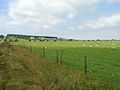
 View east from near Lowertown Farm - geograph.org.uk - 689765.jpg 640 × 480; 70 KB
-
 Lambs on the hill - geograph.org.uk - 430942.jpg 640 × 480; 79 KB
-
 Sheep Country - geograph.org.uk - 375748.jpg 640 × 427; 106 KB
-
 Sheep grazing near Tregony. - geograph.org.uk - 412762.jpg 640 × 480; 63 KB
-
 Sheep Grazing on Marginal Pasture - geograph.org.uk - 151712.jpg 640 × 427; 118 KB
-
 Sheep in the Camel valley, near Burlawn - geograph.org.uk - 51006.jpg 616 × 640; 279 KB
-
 Sheep on the brow of the hill - geograph.org.uk - 492545.jpg 640 × 480; 102 KB
-
 Sheep on the Valleyside - geograph.org.uk - 260938.jpg 640 × 427; 91 KB
-
 Sheep Pasture - geograph.org.uk - 231604.jpg 640 × 427; 81 KB
-
 Sheep Pasture - geograph.org.uk - 291872.jpg 640 × 427; 97 KB
-
 Sheep Pasture - geograph.org.uk - 439313.jpg 640 × 427; 82 KB
-
 Sheep pasture above the A38 - geograph.org.uk - 574561.jpg 640 × 312; 42 KB
-
 Sheep Pasture and Carclaze Farm - geograph.org.uk - 202508.jpg 640 × 423; 125 KB
-
 Sheep pasture at Parson's Pool - geograph.org.uk - 414065.jpg 640 × 427; 103 KB
-
 Sheep pasture at St Eval - geograph.org.uk - 50555.jpg 640 × 480; 100 KB
-
 Sheep Pasture by the A39 - geograph.org.uk - 232058.jpg 640 × 427; 82 KB
-
 Sheep Pasture near Killiserth - geograph.org.uk - 231628.jpg 640 × 426; 99 KB
-
 Sheep pasture near Starapark - geograph.org.uk - 689958.jpg 640 × 480; 85 KB
-
 Sheep Pasture near Wayland - geograph.org.uk - 360388.jpg 640 × 426; 98 KB
-
 Sheep Pasture outside Mitchell - geograph.org.uk - 185710.jpg 640 × 427; 88 KB
-
 Sheep pasture west of the B3266 - geograph.org.uk - 689719.jpg 640 × 480; 72 KB
-
 Sheep, Pasture and an Oak Tree - geograph.org.uk - 416277.jpg 640 × 427; 76 KB
-
 Woodpile and Sheep - geograph.org.uk - 322955.jpg 640 × 427; 110 KB


