Category:Shandaken, New York
Jump to navigation
Jump to search
town in New York | |||||
| Upload media | |||||
| Instance of | |||||
|---|---|---|---|---|---|
| Location | Ulster County, New York | ||||
| Population |
| ||||
| Area |
| ||||
| Elevation above sea level |
| ||||
 | |||||
Images or media created in, of, or otherwise pertaining to the town of Shandaken, NY, USA
Subcategories
This category has the following 11 subcategories, out of 11 total.
B
- Balsam Mountain (3 F)
C
- Cornell Mountain (4 F)
H
- Highmount, New York (2 F)
M
P
- Panther Mountain (4 F)
S
- Slide Mountain (14 F)
W
- Wittenberg Mountain (7 F)
Media in category "Shandaken, New York"
The following 69 files are in this category, out of 69 total.
-
Adopt a highway crop.jpg 942 × 979; 857 KB
-
Allaben-Shandaken, New York (408382719).jpg 2,848 × 2,136; 1.49 MB
-
Allaben-Shandaken, New York (408382723).jpg 2,848 × 2,136; 1.44 MB
-
Allaben-Shandaken, New York (408382734).jpg 2,136 × 2,848; 1.46 MB
-
Allaben-Shandaken, New York (408407436).jpg 2,848 × 2,136; 1.42 MB
-
Allaben-Shandaken, New York (408407439).jpg 2,848 × 2,136; 1.42 MB
-
Allaben-Shandaken, New York (408407444).jpg 2,848 × 2,136; 1.39 MB
-
Balsam Mountain and NY 28.jpg 2,576 × 1,534; 788 KB
-
Beers Ulster County Atlas Page027.jpg 1,865 × 2,355; 686 KB
-
Beers Ulster County Atlas Page028-029.jpg 1,521 × 1,000; 205 KB
-
Beers Ulster County Atlas Page030.jpg 1,000 × 1,272; 148 KB
-
Big Indian-Oliverea, New York (408348460).jpg 2,848 × 2,136; 1.47 MB
-
Big Indian-Oliverea, New York (408348463).jpg 2,848 × 2,136; 1.45 MB
-
Big Indian-Oliverea, New York (408369358).jpg 2,848 × 2,136; 1.49 MB
-
Big Indian-Oliverea, New York (408369360).jpg 2,848 × 2,136; 1.5 MB
-
Big Indian-Oliverea, New York (408369363).jpg 2,848 × 2,136; 1.47 MB
-
Big Indian-Oliverea, New York (408369366).jpg 2,848 × 2,136; 1.47 MB
-
Big Indian-Oliverea, New York (408382740).jpg 2,848 × 2,136; 1.47 MB
-
Big Indian-Oliverea, New York (408382745).jpg 2,848 × 2,136; 1.48 MB
-
Big Indian-Oliverea, New York (408407456).jpg 2,848 × 2,136; 1.43 MB
-
Big Indian-Oliverea, New York (408407465).jpg 2,848 × 2,136; 1.44 MB
-
Burroughs Range from Giant Ledge.jpg 1,024 × 768; 144 KB
-
Catskill Mountains, United States (Unsplash).jpg 2,848 × 2,848; 1.77 MB
-
Chichester, New York (408443301).jpg 2,848 × 2,136; 1.43 MB
-
Chichester, New York (408443302).jpg 2,848 × 2,136; 1.43 MB
-
Deep gorge created in road after Hurricane Irene flooding, Oliverea, NY.jpg 3,652 × 2,588; 7.67 MB
-
Delaware-Greene-Ulster tri-county point on Halcott Mountain south ridge, NY.jpg 4,968 × 3,240; 18.25 MB
-
Esopus Creek above Phoenicia, NY.jpg 3,264 × 2,448; 5.42 MB
-
Esopus Creek above Shandaken, NY.jpg 2,976 × 2,232; 6.44 MB
-
Esopus Creek at Allaben boat access point.jpg 3,012 × 2,198; 5.03 MB
-
Esopus Creek at Burnham Hollow Road, Oliverea, NY 2.jpg 4,912 × 6,928; 21.18 MB
-
Esopus Creek at Burnham Hollow Road, Oliverea, NY.jpg 2,448 × 2,880; 6.13 MB
-
Esopus Creek at Maben Hollow Road, Oliverea, NY 2.jpg 7,360 × 4,912; 22.89 MB
-
Esopus Creek at Maben Hollow Road, Oliverea, NY.jpg 3,264 × 2,448; 7.07 MB
-
Esopus Creek at McKenley Hollow Road, Oliverea, NY.jpg 2,448 × 2,528; 4.09 MB
-
Esopus Creek from Fire House Road, Big Indian, NY.jpg 3,264 × 2,112; 6.2 MB
-
Esopus Creek from NY 28 bridge at Big Indian.jpg 7,360 × 4,912; 20.98 MB
-
Esopus Creek headwaters at Giant Ledge Stream confluence, Oliverea, NY.jpg 3,264 × 2,112; 5.56 MB
-
Esopus Creek near Phoenicia old postcard.jpg 1,093 × 688; 583 KB
-
Esopus Creek near Shandaken 2020 2.jpg 7,360 × 4,912; 23.47 MB
-
Esopus Creek near Shandaken, NY, 2020.jpg 3,138 × 2,298; 8.25 MB
-
Esopus Creek near Shandaken, NY.jpg 1,935 × 2,058; 1 MB
-
Esopus Creek Paddlers.jpg 2,100 × 1,500; 4.77 MB
-
Esopus Creek rock snot sign.jpg 2,000 × 2,632; 1.13 MB
-
Esopus Creek source.jpg 3,006 × 2,463; 4.21 MB
-
First north-south NY 28 signs.jpg 2,224 × 1,560; 755 KB
-
Fog over Catskill Mountains (Unsplash).jpg 2,048 × 1,535; 843 KB
-
FortShandaken.jpg 3,264 × 1,836; 1.97 MB
-
Halcott Mountain from Belleayre ski slope.jpg 1,958 × 1,344; 2.32 MB
-
Hideyo Noguchi's Property In Shandaken, NY.jpg 1,189 × 660; 473 KB
-
Imbricated streambed of Esopus Creek headwaters 2.jpg 7,360 × 4,912; 28.19 MB
-
Imbricated streambed of Esopus Creek headwaters.jpg 2,928 × 2,352; 6.49 MB
-
Japanese knotweed on bank of Esopus Creek, Beechford, NY.jpg 3,264 × 2,448; 7.56 MB
-
Lower-birch-creek-trailhead-at-the-shandaken-wild-forest.jpg 3,840 × 2,160; 3.14 MB
-
NY 212 Western Terminus.JPG 1,600 × 1,200; 438 KB
-
NY road sign in Forest Preserve color scheme.jpg 1,076 × 1,604; 474 KB
-
Otter Falls, Esopus Creek, Oliverea, NY 2.jpg 4,912 × 7,360; 24.49 MB
-
Otter Falls, Esopus Creek, Oliverea, NY.jpg 2,072 × 2,848; 3.72 MB
-
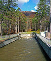
Shandaken Tunnel discharge into Esopus.jpg 3,114 × 2,319; 5.93 MB
-
Shandaken Tunnel south outlet.jpg 806 × 960; 374 KB
-
Shandaken-ny.gif 575 × 425; 26 KB
-
Southern hardwood forest along Esopus Creek, Beechford, NY.jpg 2,448 × 3,264; 7.75 MB
-
Steven Fischer Bridge - Ulster 47.JPG 3,264 × 2,448; 2.33 MB
-
Table Mountain from Curtis-Ormsbee Trail.jpg 4,440 × 3,144; 11.09 MB
-
Tubers on Esopus Creek 2011.jpg 4,000 × 3,000; 6.44 MB
-
Ulster County Route 47 at Winnisook Lake, Oliverea, NY 2.jpg 7,360 × 4,912; 21.2 MB
-
Ulster County Route 47 at Winnisook Lake, Oliverea, NY.jpg 3,210 × 2,046; 4.93 MB
-
Winnisook Lake.jpg 1,200 × 900; 240 KB


