Category:ShakeMaps of earthquakes in Greece
Jump to navigation
Jump to search
Media in category "ShakeMaps of earthquakes in Greece"
The following 22 files are in this category, out of 22 total.
-
 1953 Ionian earthquake shakemap.jpg 787 × 1,013; 285 KB
-
 1986 Kalamata Greece earthquake shakemap.jpg 797 × 1,001; 282 KB
-
 2008 Greece earthquake.jpg 457 × 458; 60 KB
-
 2015 Lefkada earthquake.jpg 612 × 719; 89 KB
-
 2017 Kos earthquake intensity map.jpg 787 × 1,001; 297 KB
-
 2018-10-25 Mouzaki, Greece M6.8 earthquake shakemap (USGS).jpg 612 × 719; 94 KB
-
 2019-11-27 Platanos, Greece M6 earthquake shakemap (USGS).jpg 813 × 1,029; 172 KB
-
 2020-05-02 Ierapetra, Greece M6.6 earthquake shakemap (USGS).jpg 801 × 1,003; 165 KB
-
 2020-10-30 Néon Karlovásion, Greece M7 earthquake shakemap (USGS).jpg 796 × 980; 384 KB
-
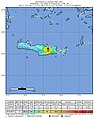 2021 Crete earthquake shakemap.jpg 787 × 1,000; 195 KB
-
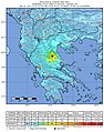
 2021-03-03 M 6.3 - 10 km WNW of Týrnavos, Greece.jpg 787 × 999; 377 KB
-
 2021-03-03 Týrnavos, Greece M6.3 earthquake shakemap (USGS).jpg 787 × 999; 379 KB
-
 2021-09-27 Crete, Greece M6.0 earthquake shakemap (USGS).jpg 787 × 1,000; 186 KB
-
 2021-10-12 Crete, Greece M6.4 earthquake shakemap (USGS).jpg 787 × 1,000; 257 KB
-
 2021-10-12 Palekastro, Greece M6.4 earthquake shakemap (USGS).jpg 787 × 1,000; 247 KB
-
 Earthquake02-14-08.jpg 612 × 710; 85 KB
-
 M 6.3 - 5km S of Plomarion, Greece - intensity.jpg 612 × 718; 113 KB
-
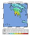
 M 6.6 - 10 km W of Aianí, Greece.jpg 789 × 971; 392 KB
-
 M-6.5-8-km-WNW-of-Galaxídhion -Greece.png 787 × 989; 758 KB
-
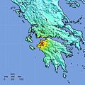
 USGS Shakemap - 1978 Thessaloniki earthquake.jpg 612 × 719; 126 KB
-
 USGS Shakemap - 2008 Peloponnese earthquake.jpg 612 × 719; 102 KB
-
 USGS Shakemap - 2014 Aegean Sea earthquake.jpg 612 × 719; 123 KB


.jpg)
.jpg)
.jpg)
.jpg)


.jpg)
.jpg)
.jpg)
.jpg)


