Category:ShakeMaps of earthquakes in Ecuador
Jump to navigation
Jump to search
Media in category "ShakeMaps of earthquakes in Ecuador"
The following 12 files are in this category, out of 12 total.
-
1970 Peru–Ecuador earthquake intensity.jpg 777 × 1,011; 305 KB
-
1979 Tumaco earthquake ShakeMap.jpg 864 × 792; 143 KB
-
1987 Ecuador-Colombia earthquakes ShakeMap.jpg 864 × 792; 205 KB
-
2013 Nariño earthquake ShakeMap.jpg 864 × 792; 167 KB
-
2014 Quito earthquake.jpg 612 × 717; 141 KB
-
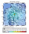
2019-02-22 Palora, Ecuador M7.5 earthquake shakemap (USGS).jpg 862 × 1,061; 433 KB
-
2019-03-31 Santa Elena, Ecuador M6.2 earthquake shakemap (USGS).jpg 927 × 1,068; 272 KB
-
2019-05-26 Lagunas, Peru M8 earthquake shakemap (USGS).jpg 871 × 1,129; 469 KB
-
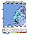
2023-03-18 Baláo, Ecuador M6.8 earthquake shakemap (USGS).jpg 779 × 1,002; 170 KB
-
2023-03-18 Ecuador M6.8 earthquake shakemap (USGS).jpg 779 × 998; 165 KB
-
Manabisismo2017.jpg 612 × 718; 103 KB
-
Shakemap Ecuador April 2016.jpg 762 × 1,001; 288 KB


