Category:ShakeMaps
Jump to navigation
Jump to search
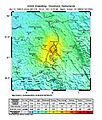
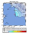
map-type depicting seismic intensity | |||||
Upload media | |||||
Instance of | |||||
---|---|---|---|---|---|
Subclass of | |||||
Main subject |
| ||||
| |||||
- While the USGS site offers JPEG versions of ShakeMaps, the .jpg files inevitably contain lossy compression artifacts. Since the USGS site offers PostScript versions of the same (downloadable in .ps.zip form), then it's possible to extract and then convert .ps files to PNG with the GIMP GhostScript plugin. The requirements are that 'Text antialiasing' is strong, and 'Graphic antialiasing' is set to 'none' during .ps import.
Subcategories
This category has the following 4 subcategories, out of 4 total.
Media in category "ShakeMaps"
The following 200 files are in this category, out of 255 total.
(previous page) (next page)-
1906-04-18 San Fransisco, California M7.9 earthquake shakemap.jpg 753 × 1,016; 372 KB
-
1918-10-11 M 7.1 - Puerto Rico region.jpg 612 × 718; 61 KB
-
1965 Rat Islands earthquake shakemap.jpg 612 × 719; 61 KB
-
1992 Roermond intensity.jpg 612 × 719; 123 KB
-
1993 Futuna earthquake.jpg 612 × 717; 49 KB
-
2001 Kunlun earthquake shakemap.jpg 787 × 972; 469 KB
-
2018-12-19 Easter Island M6.2 earthquake shakemap (USGS).jpg 612 × 719; 51 KB
-
2019-02-12 Agrihan, Northern Mariana Islands M6 earthquake shakemap (USGS).jpg 880 × 1,068; 147 KB
-
2019-04-01 Port Mathurin, Mauritius M6 earthquake shakemap (USGS).jpg 880 × 1,079; 143 KB
-
2019-04-06 Dili, East Timor M6.3 earthquake shakemap (USGS).jpg 868 × 1,068; 149 KB
-
2019-04-18 Western Indian-Antarctic Ridge M6.5 earthquake shakemap (USGS).jpg 868 × 1,084; 144 KB
-
2019-04-23 the Fiji Islands M6 earthquake shakemap (USGS).jpg 889 × 1,080; 153 KB
-
2019-04-29 Carlsberg Ridge M6.2 earthquake shakemap (USGS).jpg 864 × 1,062; 133 KB
-
2019-04-29 Carlsberg Ridge M6.3 earthquake shakemap (USGS).jpg 867 × 1,072; 138 KB
-
2019-06-04 Izu Islands, Japan region M6.3 earthquake shakemap (USGS).jpg 881 × 1,079; 146 KB
-
2019-07-23 Balleny Islands region M6 earthquake shakemap (USGS).jpg 838 × 1,068; 147 KB
-
2019-08-21 Western Indian-Antarctic Ridge M6 earthquake shakemap (USGS).jpg 844 × 1,068; 147 KB
-
2019-08-29 Bandon, Oregon M6.3 earthquake shakemap (USGS).jpg 832 × 1,068; 140 KB
-
2019-09-24 San Antonio, Puerto Rico M6 earthquake shakemap (USGS).jpg 855 × 1,061; 182 KB
-
2019-09-24 Southwest Indian Ridge M6 earthquake shakemap (USGS).jpg 845 × 1,068; 142 KB
-
2019-10-23 Ascension Island M6.3 earthquake shakemap (USGS).jpg 822 × 1,060; 136 KB
-
2019-11-05 the South Sandwich Islands M6.3 earthquake shakemap (USGS).jpg 796 × 1,028; 131 KB
-
2020-01-07 Indios, Puerto Rico M6.4 earthquake shakemap (USGS).jpg 799 × 1,019; 167 KB
-
2020-01-07 Maria Antonia, Puerto Rico M6.4 earthquake shakemap (USGS).jpg 799 × 1,021; 164 KB
-
2020-01-28 East End, Cayman Islands M6.1 earthquake shakemap (USGS).jpg 799 × 1,025; 134 KB
-
2020-01-28 Lucea, Jamaica M7.7 earthquake shakemap (USGS).jpg 801 × 965; 222 KB
-
2020-03-22 Central East Pacific Rise M6.1 earthquake shakemap (USGS).jpg 779 × 998; 121 KB
-
2020-04-12 Amsterdam Island, France M6.1 earthquake shakemap (USGS).jpg 787 × 1,002; 130 KB
-
2020-07-06 Fais, Micronesia M6.2 earthquake shakemap (USGS).jpg 787 × 1,002; 130 KB
-
2020-07-26 South Sandwich Islands region M6.3 earthquake shakemap (USGS).jpg 783 × 1,001; 129 KB
-
2020-07-26 South Sandwich Islands region M6.4 earthquake shakemap (USGS).jpg 783 × 1,001; 132 KB
-
2020-08-06 Prince Edward Islands region M6.3 earthquake shakemap (USGS).jpg 792 × 1,001; 133 KB
-
2020-08-22 Georgetown, Saint Helena M6 earthquake shakemap (USGS).jpg 777 × 997; 130 KB
-
2020-08-31 Chagos Archipelago region M6.1 earthquake shakemap (USGS).jpg 786 × 997; 128 KB
-
2020-08-31 Chagos Archipelago region M6.2 earthquake shakemap (USGS).jpg 777 × 995; 133 KB
-
2020-10-23 West Chile Rise M6 earthquake shakemap (USGS).jpg 785 × 997; 131 KB
-
2020-11-06 South Shetland Islands M6 earthquake shakemap (USGS).jpg 783 × 1,001; 179 KB
-
2020-11-25 Balleny Islands region M6.1 earthquake shakemap (USGS).jpg 787 × 1,001; 136 KB
-
2020-11-30 Sovetskaya Gavan’, Russia M6.4 earthquake shakemap (USGS).jpg 786 × 1,001; 314 KB
-
2020-12-01 Balleny Islands region M6 earthquake shakemap (USGS).jpg 783 × 1,001; 132 KB
-
2020-12-01 Balleny Islands region M6.2 earthquake shakemap (USGS).jpg 784 × 1,001; 132 KB
-
2020-12-10 the Kermadec Islands M6 earthquake shakemap (USGS).jpg 786 × 1,000; 125 KB
-
2020-12-23 Angaur State, Palau M6.1 earthquake shakemap (USGS).jpg 787 × 993; 162 KB
-
2021 Haiti earthquake shakemap.jpg 640 × 782; 343 KB
-
2021 Khövsgöl earthquake shakemap.jpg 787 × 992; 497 KB
-
2021 Loyalty Islands earthquake shakemap.jpg 640 × 805; 205 KB
-
2021-01-23 South Shetland Islands M6.9 earthquake shakemap (USGS).jpg 786 × 992; 175 KB
-
2021-01-23 South Shetland Islands M7 earthquake shakemap (USGS).jpg 804 × 994; 177 KB
-
2021-02-03 Easter Island M6.9 earthquake shakemap (USGS).jpg 786 × 994; 138 KB
-
2021-02-10 the Loyalty Islands M6 earthquake shakemap (USGS).jpg 786 × 996; 122 KB
-
2021-02-10 the Loyalty Islands M6.1 earthquake shakemap (USGS).jpg 786 × 998; 125 KB
-
2021-02-10 the Loyalty Islands M6.2 earthquake shakemap (USGS).jpg 786 × 996; 129 KB
-
2021-02-10 the Loyalty Islands M6.4 earthquake shakemap (USGS).jpg 786 × 997; 129 KB
-
2021-02-10 the Loyalty Islands M7.7 earthquake shakemap (USGS).jpg 786 × 994; 167 KB
-
2021-02-11 the Loyalty Islands M6 earthquake shakemap (USGS).jpg 786 × 997; 132 KB
-
2021-02-17 the Loyalty Islands M6.1 earthquake shakemap (USGS).jpg 786 × 996; 129 KB
-
2021-02-18 Alo, Wallis and Futuna M6.1 earthquake shakemap (USGS).jpg 798 × 998; 136 KB
-
2021-03-06 Gisborne, New Zealand M6.3 earthquake shakemap (USGS).jpg 786 × 995; 158 KB
-
2021-03-14 South Sandwich Islands region M6 earthquake shakemap (USGS).jpg 784 × 1,001; 132 KB
-
2021-03-16 Ust’-Kamchatsk Staryy, Russia M6.6 earthquake shakemap (USGS).jpg 787 × 1,001; 221 KB
-
2021-03-17 Ust’-Kamchatsk Staryy, Russia M6.6 earthquake shakemap (USGS).jpg 787 × 1,001; 220 KB
-
2021-03-20 Macquarie Island M6 earthquake shakemap (USGS).jpg 784 × 1,001; 134 KB
-
2021-03-20 Macquarie Island M6.1 earthquake shakemap (USGS).jpg 784 × 1,001; 134 KB
-
2021-03-20 northern Mid-Atlantic Ridge M6 earthquake shakemap (USGS).jpg 786 × 1,001; 133 KB
-
2021-04-01 Fiji region M6 earthquake shakemap (USGS).jpg 786 × 996; 116 KB
-
2021-05-07 Macquarie Island M6 earthquake shakemap (USGS).jpg 785 × 1,001; 134 KB
-
2021-05-07 Macquarie Island M6.1 earthquake shakemap (USGS).jpg 785 × 1,001; 135 KB
-
2021-08-12 South Sandwich Islands region M6.1 earthquake shakemap (USGS).jpg 783 × 1,001; 130 KB
-
2021-08-17 South Sandwich Islands region M6.1 earthquake shakemap (USGS).jpg 782 × 1,001; 132 KB
-
2021-08-18 South Sandwich Islands region M6 earthquake shakemap (USGS).jpg 783 × 1,001; 128 KB
-
2021-08-24 Severo-Kuril’sk, Russia M6 earthquake shakemap (USGS).jpg 787 × 1,001; 143 KB
-
2021-08-24 Severo-Kuril’sk, Russia M6.1 earthquake shakemap (USGS).jpg 787 × 1,001; 143 KB
-
2021-09-20 Kuril Islands M6 earthquake shakemap (USGS).jpg 791 × 1,001; 139 KB
-
2021-09-20 Kuril Islands M6.1 earthquake shakemap (USGS).jpg 787 × 1,005; 138 KB
-
2021-10-02 Mid-Indian Ridge M6 earthquake shakemap (USGS).jpg 785 × 1,002; 137 KB
-
2021-10-04 South Sandwich Islands region M6.3 earthquake shakemap (USGS).jpg 785 × 1,002; 151 KB
-
2021-11-01 South Sandwich Islands region M6 earthquake shakemap (USGS).jpg 798 × 1,004; 134 KB
-
2021-11-15 South Indian Ocean M6 earthquake shakemap (USGS).jpg 785 × 1,004; 137 KB
-
2021-12-03 South Sandwich Islands region M6 earthquake shakemap (USGS).jpg 784 × 1,001; 133 KB
-
2021-12-12 Macquarie Island M6.5 earthquake shakemap (USGS).jpg 786 × 994; 141 KB
-
2021-12-12 Macquarie Island M6.6 earthquake shakemap (USGS).jpg 786 × 992; 140 KB
-
2021-12-14 Flores Sea M7.3 earthquake shakemap (USGS).jpg 786 × 993; 248 KB
-
2021-12-16 South Sandwich Islands region M6 earthquake shakemap (USGS).jpg 784 × 1,001; 134 KB
-
2021-12-16 South Sandwich Islands region M6.1 earthquake shakemap (USGS).jpg 785 × 1,001; 137 KB
-
2021-12-18 Prince Edward Islands region M6 earthquake shakemap (USGS).jpg 785 × 1,001; 131 KB
-
2021-12-29 Lospalos, Timor Leste M7.3 earthquake shakemap (USGS).jpg 785 × 981; 183 KB
-
2022 Chilca earthquake shakemap.jpg 787 × 1,000; 152 KB
-
2022 Nias earthquake BKMG Shakemap.jpg 612 × 717; 325 KB
-
2022-01-10 the Kermadec Islands M6.2 earthquake shakemap (USGS).jpg 786 × 998; 131 KB
-
2022-01-25 South Sandwich Islands region M6 earthquake shakemap (USGS).jpg 783 × 1,001; 135 KB
-
2022-02-01 Lospalos, Timor Leste M6 earthquake shakemap (USGS).jpg 777 × 995; 148 KB
-
2022-02-04 southeast Indian Ridge M6.1 earthquake shakemap (USGS).jpg 785 × 1,001; 131 KB
-
2022-02-04 southeast Indian Ridge M6.3 earthquake shakemap (USGS).jpg 785 × 1,000; 140 KB
-
2022-02-21 Balleny Islands region M6.3 earthquake shakemap (USGS).jpg 788 × 1,004; 108 KB
-
2022-02-21 Balleny Islands region M6.6 earthquake shakemap (USGS).jpg 787 × 994; 111 KB
-
2022-03-06 South Sandwich Islands region M6 earthquake shakemap (USGS).jpg 784 × 1,004; 84 KB
-
2022-03-06 South Sandwich Islands region M6.1 earthquake shakemap (USGS).jpg 785 × 1,004; 82 KB
-
2022-03-31 the Loyalty Islands M6.3 earthquake shakemap (USGS).jpg 787 × 1,002; 81 KB
-
2022-03-31 the Loyalty Islands M6.4 earthquake shakemap (USGS).jpg 787 × 1,000; 81 KB
-
2022-05-26 the Loyalty Islands M6.4 earthquake shakemap (USGS).jpg 787 × 1,001; 80 KB
-
2022-05-26 the Loyalty Islands M6.6 earthquake shakemap (USGS).jpg 787 × 1,000; 82 KB
-
2022-06-04 Macquarie Island M6.4 earthquake shakemap (USGS).jpg 787 × 1,008; 81 KB
-
2022-06-08 Tarauacá, Brazil M6.5 earthquake shakemap (USGS).jpg 787 × 999; 169 KB
-
2022-06-20 Hualien City, Taiwan M6 earthquake shakemap (USGS).jpg 799 × 1,003; 113 KB
-
2022-06-21 Kh?st, Afghanistan M6 earthquake shakemap (USGS).jpg 788 × 1,004; 175 KB
-
2022-07-01 Bandar-e Lengeh, Iran M6 earthquake shakemap (USGS).jpg 788 × 1,001; 145 KB
-
2022-07-01 Bandar-e Lengeh, Iran M6.1 earthquake shakemap (USGS).jpg 788 × 1,001; 145 KB
-
2022-07-28 Tocopilla, Chile M6.1 earthquake shakemap (USGS).jpg 787 × 1,000; 113 KB
-
2022-08-14 the Kermadec Islands M6.6 earthquake shakemap (USGS).jpg 787 × 1,000; 77 KB
-
2022-08-14 the Loyalty Islands M6.1 earthquake shakemap (USGS).jpg 787 × 1,000; 77 KB
-
2022-08-14 the Loyalty Islands M6.2 earthquake shakemap (USGS).jpg 787 × 1,000; 78 KB
-
2022-08-14 the Loyalty Islands M6.4 earthquake shakemap (USGS).jpg 787 × 1,000; 77 KB
-
2022-08-30 Pacific-Antarctic Ridge M6.3 earthquake shakemap (USGS).jpg 786 × 1,004; 80 KB
-
2022-09-02 Kandrian, Papua New Guinea M6.1 earthquake shakemap (USGS).jpg 779 × 1,000; 105 KB
-
2022-09-05 Kangding, China M6.6 earthquake shakemap (USGS).jpg 788 × 1,001; 188 KB
-
2022-09-14 Isangel, Vanuatu M7 earthquake shakemap (USGS).jpg 787 × 1,001; 88 KB
-
2022-09-20 Ust’-Kamchatsk Staryy, Russia M6 earthquake shakemap (ak).jpg 799 × 992; 166 KB
-
2022-09-20 Ust’-Kamchatsk Staryy, Russia M6 earthquake shakemap (USGS).jpg 786 × 1,004; 84 KB
-
2022-09-23 northern Sumatra M6.2 earthquake shakemap (USGS).jpg 780 × 994; 120 KB
-
2022-09-29 the South Sandwich Islands M6.5 earthquake shakemap (USGS).jpg 785 × 1,004; 79 KB
-
2022-10-01 Reykjanes Ridge M6 earthquake shakemap (USGS).jpg 787 × 1,004; 80 KB
-
2022-10-16 Central America M6.3 earthquake shakemap (USGS).jpg 780 × 994; 79 KB
-
2022-10-20 Boca Chica, Panama M6.7 earthquake shakemap (USGS).jpg 780 × 1,002; 122 KB
-
2022-10-25 South Sandwich Islands region M6.3 earthquake shakemap (USGS).jpg 788 × 1,004; 84 KB
-
2022-11-04 California M6.1 earthquake shakemap (USGS).jpg 788 × 1,003; 140 KB
-
2022-11-11 Neiafu, Tonga M7.3 earthquake shakemap (USGS).jpg 787 × 1,000; 84 KB
-
2022-11-22 Malango, Solomon Islands M6 earthquake shakemap (USGS).jpg 787 × 1,001; 97 KB
-
2022-11-22 Malango, Solomon Islands M7 earthquake shakemap (USGS).jpg 787 × 1,002; 99 KB
-
2022-11-23 Düzce, Turkey M6.1 earthquake shakemap (USGS).jpg 788 × 1,003; 161 KB
-
2022-11-23 Western Turkey M6.1 earthquake shakemap (USGS).jpg 788 × 1,004; 161 KB
-
2022-12-04 Hihifo, Tonga M6.7 earthquake shakemap (USGS).jpg 787 × 997; 82 KB
-
2022-12-04 Samoa Islands region M6.8 earthquake shakemap (USGS).jpg 788 × 1,000; 85 KB
-
2022-12-11 El Ticui, Mexico M6 earthquake shakemap (USGS).jpg 788 × 1,005; 141 KB
-
2022-12-20 Ferndale, CA M6.37 earthquake shakemap (cgs).jpg 840 × 1,067; 330 KB
-
2022-12-20 Ferndale, CA M6.37 earthquake shakemap (nc).jpg 792 × 1,003; 301 KB
-
2022-12-20 Ferndale, CA M6.37 earthquake shakemap (USGS).jpg 788 × 1,005; 135 KB
-
2022-12-20 Ferndale, CA M6.4 earthquake shakemap (cgs).jpg 833 × 1,051; 329 KB
-
2022-12-20 Ferndale, CA M6.4 earthquake shakemap (nc).jpg 787 × 992; 310 KB
-
2022-12-20 Ferndale, CA M6.4 earthquake shakemap (USGS).jpg 788 × 986; 144 KB
-
2022-12-28 Isangel, Vanuatu M6 earthquake shakemap (USGS).jpg 787 × 1,003; 79 KB
-
2022-12-28 the Loyalty Islands M6.1 earthquake shakemap (USGS).jpg 787 × 999; 80 KB
-
2023-01-05 Jurm, Afghanistan M6 earthquake shakemap (USGS).jpg 802 × 1,004; 188 KB
-
2023-01-08 Vanuatu M7 earthquake shakemap (USGS).jpg 787 × 1,004; 96 KB
-
2023-01-15 Singkil, Indonesia M6 earthquake shakemap (USGS).jpg 780 × 1,000; 129 KB
-
2023-01-15 Singkil, Indonesia M6.2 earthquake shakemap (USGS).jpg 780 × 1,000; 132 KB
-
2023-01-16 Bonin Islands, Japan region M6.3 earthquake shakemap (USGS).jpg 788 × 1,004; 75 KB
-
2023-01-16 Izu Islands, Japan region M6.3 earthquake shakemap (USGS).jpg 788 × 1,004; 75 KB
-
2023-01-18 Gorontalo, Indonesia M6 earthquake shakemap (USGS).jpg 813 × 997; 120 KB
-
2023-01-18 Molucca Sea M7 earthquake shakemap (USGS).jpg 780 × 1,001; 103 KB
-
2023-01-18 Sulawesi, Indonesia M6 earthquake shakemap (USGS).jpg 809 × 995; 119 KB
-
2023-01-18 Tobelo, Indonesia M7 earthquake shakemap (USGS).jpg 780 × 1,001; 101 KB
-
2023-01-20 Campo Gallo, Argentina M6.8 earthquake shakemap (USGS).jpg 787 × 1,000; 113 KB
-
2023-01-24 Campo Gallo, Argentina M6.4 earthquake shakemap (USGS).jpg 787 × 998; 111 KB
-
2023-02-17 Tual, Indonesia M6.1 earthquake shakemap (USGS).jpg 779 × 997; 87 KB
-
2023-02-20 Uzunba?, Turkey M6.3 earthquake shakemap (USGS).jpg 809 × 1,003; 147 KB
-
2023-02-23 Murghob, Tajikistan M6.8 earthquake shakemap (USGS).jpg 788 × 1,003; 191 KB
-
2023-02-23 Murghob, Tajikistan M6.9 earthquake shakemap (USGS).jpg 788 × 1,003; 190 KB
-
2023-02-23 Tobelo, Indonesia M6.3 earthquake shakemap (USGS).jpg 780 × 1,001; 87 KB
-
2023-03-02 Port-Olry, Vanuatu M6.5 earthquake shakemap (USGS).jpg 787 × 1,000; 95 KB
-
2023-03-02 Port-Olry, Vanuatu M6.6 earthquake shakemap (USGS).jpg 787 × 999; 96 KB
-
2023-03-04 Kermadec Islands, New Zealand M6.9 earthquake shakemap (USGS).jpg 787 × 1,000; 78 KB
-
2023-03-07 San Mariano, Philippines M6 earthquake shakemap (USGS).jpg 780 × 998; 138 KB
-
2023-03-16 Kermadec Islands region M7 earthquake shakemap (USGS).jpg 789 × 1,004; 79 KB
-
2023-03-18 Baláo, Ecuador M6.8 earthquake shakemap (USGS).jpg 779 × 1,002; 170 KB