Category:Seventeen Provinces
Jump to navigation
Jump to search
Union of states in the Netherlands in the 15th and 16th centuries | |||||
| Upload media | |||||
| Instance of |
| ||||
|---|---|---|---|---|---|
| Location | Burgundian Circle | ||||
| Capital | |||||
| Basic form of government | |||||
| Inception |
| ||||
| Dissolved, abolished or demolished date |
| ||||
| Replaced by | |||||
 | |||||
Subcategories
This category has the following 18 subcategories, out of 18 total.
Pages in category "Seventeen Provinces"
This category contains only the following page.
Media in category "Seventeen Provinces"
The following 40 files are in this category, out of 40 total.
-
Allegorie op de tirannie van de hertog van Alva in de Nederlanden Rijksmuseum SK-C-1551.jpeg 6,134 × 3,916; 5.41 MB
-
Allegorie Pacificatie van Gent.jpg 2,679 × 2,182; 4.56 MB
-
Atlas Ortelius KB PPN369376781-026av-026br.jpg 3,000 × 2,194; 4.81 MB
-
B 1626 New Goos Speed.jpg 6,557 × 5,160; 2.95 MB
-
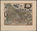
Blaeu 1645 - Novus XVII Inferioris Germaniæ Provinciarum typus.jpg 3,614 × 3,040; 1.97 MB
-
Carte Pays-bas espagnol-es.svg 509 × 708; 132 KB
-
Carte Pays-bas espagnol.svg 509 × 708; 81 KB
-
Descriptio Germaniae inferioris Nederlanden 1573.png 1,778 × 1,352; 7.32 MB
-
Descriptio Germaniae Inferioris Nederlanden Map by Abraham Ortelius 1573.jpg 6,817 × 5,153; 15.69 MB
-
Die Niederland Nach denen XVII Provincien Eingetheilet (11170024).jpg 8,211 × 4,777; 18.75 MB
-
Die Niederland Nach denen XVII Provincien Eingetheilet (11170024).png 8,211 × 4,777; 56.91 MB
-
Habsburgse Nederlanden 1555-2-es.svg 1,651 × 2,162; 3.06 MB
-
Habsburgse Nederlanden 1555-Simple-es.svg 1,651 × 2,162; 920 KB
-
Habsburgse Nederlanden 1555.svg 1,651 × 2,162; 871 KB
-
Inferioris Germaniae Provinciarum Nova Descriptio 1604 Blaeu.jpg 3,197 × 2,368; 7.67 MB
-
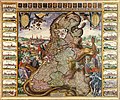
Leo Belgicus (1609) - Visscher.jpg 717 × 600; 122 KB
-
Leo belgicus.png 3,326 × 2,742; 23.28 MB
-
Map Burgundian Netherlands 1477-en.png 1,123 × 1,249; 825 KB
-
Map Burgundian Netherlands 1477-es.svg 737 × 850; 345 KB
-
Map Burgundian Netherlands 1477-fr.svg 748 × 858; 126 KB
-
Map Burgundian Netherlands 1477-hu.png 555 × 637; 170 KB
-
Map of Seventeen Provinces of Low Germanie (Zeventien Provincien der Nederlanden) 1626.jpg 10,000 × 7,836; 20.09 MB
-
Map of the Habsburg Netherlands by Alexis-Marie Gochet-es.svg 1,651 × 2,162; 1.79 MB
-
Netherlands 1559-1608.jpg 1,320 × 1,919; 569 KB
-
Political map of the Low Countries (1350)-es.svg 2,818 × 3,608; 1.95 MB
-
Political map of the Low Countries (1350)-hu.svg 2,818 × 3,608; 850 KB
-
Political map of the Low Countries (1350)-NL.svg 2,818 × 3,608; 886 KB
-
Sitting Leo Belgicus - Visscher.jpg 3,500 × 2,886; 3.36 MB
-
Willem-jansz-blaeu niederlande.jpg 4,268 × 3,368; 4.32 MB
-
Zeventien provincien.jpg 800 × 630; 231 KB
-
ZXVII Speed K.jpg 867 × 620; 904 KB


